This post is based primarily on
Don's notes, occasionally supplemented with MT's notes from our Camino in 2016.
When information from other sources is added—for further explanation to readers
or to satisfy our own curiosity—that is set off in a text box (as this one).
Most of the photos that accompany
this post are from Don’s camera (with a caption indicating the time it was
taken); those from MT’s iPhone are indicated by “MT” placed at the beginning of
the photo caption. Photos from any other source (such as the public domain
Wikimedia Commons) indicate that source in the caption.
MT
woke at 5:30 am, Don at 6:00 am. At 7 am, we ate breakfast buffet (included) at
Hotel Avenida restaurant. We saved
apples and cupcake-like pastry for later.

Friday, September 23, 2016, 6:50 AM – Pontevedra: Hotel Avenida – menu in
elevator with 3 choices for Menú del Día (Menu of the Day) with same prices but
different dishes than we had the day before.
We
departed at 7:40 am in the dark with heavy fog. Don had planned to take a photo
of the hotel exterior in the morning sun, but it was too dark. (The fog lasted
until around 10:30, when the sun broke through).
As
we walked through the Pontevedra city center, the streets and sidewalks were
being washed and cleaned by machines. Along the Camino route, besides the
normal arrows and scallop shell signs, there were tiny blue lights down the
center of the pavement.

7:54 AM – Pontevedra: pilgrim on route
through city center on wet pavement with street lights in fog.
On
the way out of the city of Pontevedra, we passed over the Ponte do Burgo bridge into the neighborhood of O Burgo.

7:58 AM – Pontevedra: Ponte do Burgo, viewed
from south end, with street lights in fog.
Pontevedra is a city that has a
number of neighborhoods. Historically, the best known is O Burgo, famous for its bridge over the Río Lérez.
In 1169, King Fernando
(Ferdinand) II of León granted a royal charter to the parish of “Burgo de
Pontevedra” (fortified town of Pontevedra), indicating that already in the 12th
century the city had a defensive wall. At first, the term Burgo referred to the
primitive town of Pontevedra and not to the town across the bridge, which did
not yet exist. Once the new (medieval) bridge was built, what we now know as O
Burgo appeared at the other end of the bridge. Already in a document of 1170,
the new Burgo is spoken of, as opposed to the “Burgo Vello” (Old Burgo). In a
document of 1290, there is mention of a “burgo parvo que stat prope ponte
vocitur de Ponteveteri” (little town that stands near the bridge called of
Pontevedra). Another document, when referring to the pilgrimage church
Santiaguiño do Burgo, called it “eccleasie Sancti Jacobi de burgo parvo” (church
of St. James of the little town). Thus, the “burgo parvo” (little town) on the
north end of the bridge was distinguished from the large town of Pontevedra on
the south end, which ceased to be called Burgo de Pontevedra.
Officially the parish of Santiago
Peregrino do Burgo was created in 1996 by breaking it away from Santa Maria la
Mayor and from Divino Salvador de Lérez. It began with the expropriation of the
small Capela de Santiaguiño (Chapel of Little Santiago), built in honor of the
Apostle as part of the Camiño Portugués. According to tradition, the Apostle
Santiago visited here during his evangelization journey.
The bridge, now called Ponte do Burgo, is the oldest of all bridges
in the capital of Pontevedra. It is one of the symbols of the city and appears
in the coat of arms of the Municipality of Pontevedra.
Recent studies link the
foundation of Pontevedra with the settlement of Turoqua, a mansion on the Via
Romana XIX, founded on the south bank of the Río Lérez in the vicinity of which
the Romans would build a bridge. (Excavations in 1988 found a Roman milestone
at the south end of the bridge, dedicated in the year 134 AD to Emperor
Hadrian.) The exact location of the first Roman bridge cannot be determined,
but it is estimated that it would have been upstream from the current bridge
and at a lower level, since the river bed was much narrower in Roman times.
A document of 1141 attests to the
existence of a place called Pontus Veteri (Old Bridge), alluding to the old
Roman bridge, which was in disuse because of its ruin. After Fernando
(Ferdinand) II of León granted a charter to the Burgo de Pontevedra in 1169,
the city was revitalized thanks to the restoration of roads and bridges.
Because of the state of the Roman bridge that had given name and origin to the
city, it was replaced by a medieval one near the same site (which can now be
seen, with certain modifications). All visible traces of the Roman bridge then
disappeared. The first references to the medieval bridge date from 1165, when
the kings Fernando II of León and Galicia and Afonso of Portugal signed a “paz
super flumen Lerice in vetula ponte” (peace treaty over the river Lérez on the
old bridge), referring to the old Roman bridge [in] waters below it.

Pontevedra: Ponte do Burgo
in 18th century, view from north showing a Platforma de acceso á ponte
(platform for access to bridge) and twin towers of Casteliño do Burgo (Little
Castle of Burgo) on the near (north) end, and Porta da Ponte (Gate of the
Bridge) on the far (south) end (https://gl.wikipedia.org/wiki/Ponte_do_Burgo#/media/File:Pontevedra_49-01r.JPG).
The Ponte do Burgo (Galego) or Puente del Burgo (Castilian Spanish), as it exists
today, is of medieval origin. At the time of its construction, it had a total
of 15 half-pointed arches, with large cutwaters between the arches, in addition
to two important estribos (abutments,
buttresses, supports) at the headwaters, and the roadway was less than 3 meters
wide. Still in the 17th and 18th centuries, drawings of the bridge show a
“Platforma de acceso á ponte” (platform for access to bridge) on the north end;
the twin towers of the “Casteliño do Burgo” (Little Castle of Burgo), which
welcomed visitors on the north bank in the neighborhood of O Burgo; and the “Porta da Ponte”
(Gate of the Bridge), one of the gates of the walled city of Pontevedra, on the
south end of the bridge.
The English invasion of 1719
caused the destruction of the Casteliño. The medieval bridge also had a tower
that was destroyed by the English in 1719; it was rebuilt, but disappeared
permanently in 1805.
Over the years, it underwent
improvements, extensions, and various reforms, so that today it has a width of
about 9 meters and only 11 of its arches can still be seen. The rest of the
arches, as well as the original estribos,
are buried under successive fillings made on its margins. Around 1890, the old
stone parapets were replaced by a new metal railing. However, the most
important reform was carried out in 1953-1954, with the aim of reinforcing the
structure and extending the width of the roadway with the execution of new
arches supported by the cutwaters. The widening allowed two lanes of traffic
and sidewalks for pedestrians.

Pontevedra: Ponte do Burgo,
view from south end in 2009, on a sunny morning (commons.wikimedia.org from www.panoramio.com/photo/23001652 Author:
tiago186703274).
At 8:20, just after leaving Pontevedra, Don made an emergency stop in a cornfield.
The
Camino route followed the route of the old Via Romana XIX. We began on a paved
road that soon passed under a railroad bridge. Most of this day’s route ran
parallel to the rail line.

8:34 AM – After Pontevedra: two signs for Variante
Espiritual (Spiritual Variant) of Camino Portugués (to the left); MT on road in
background.
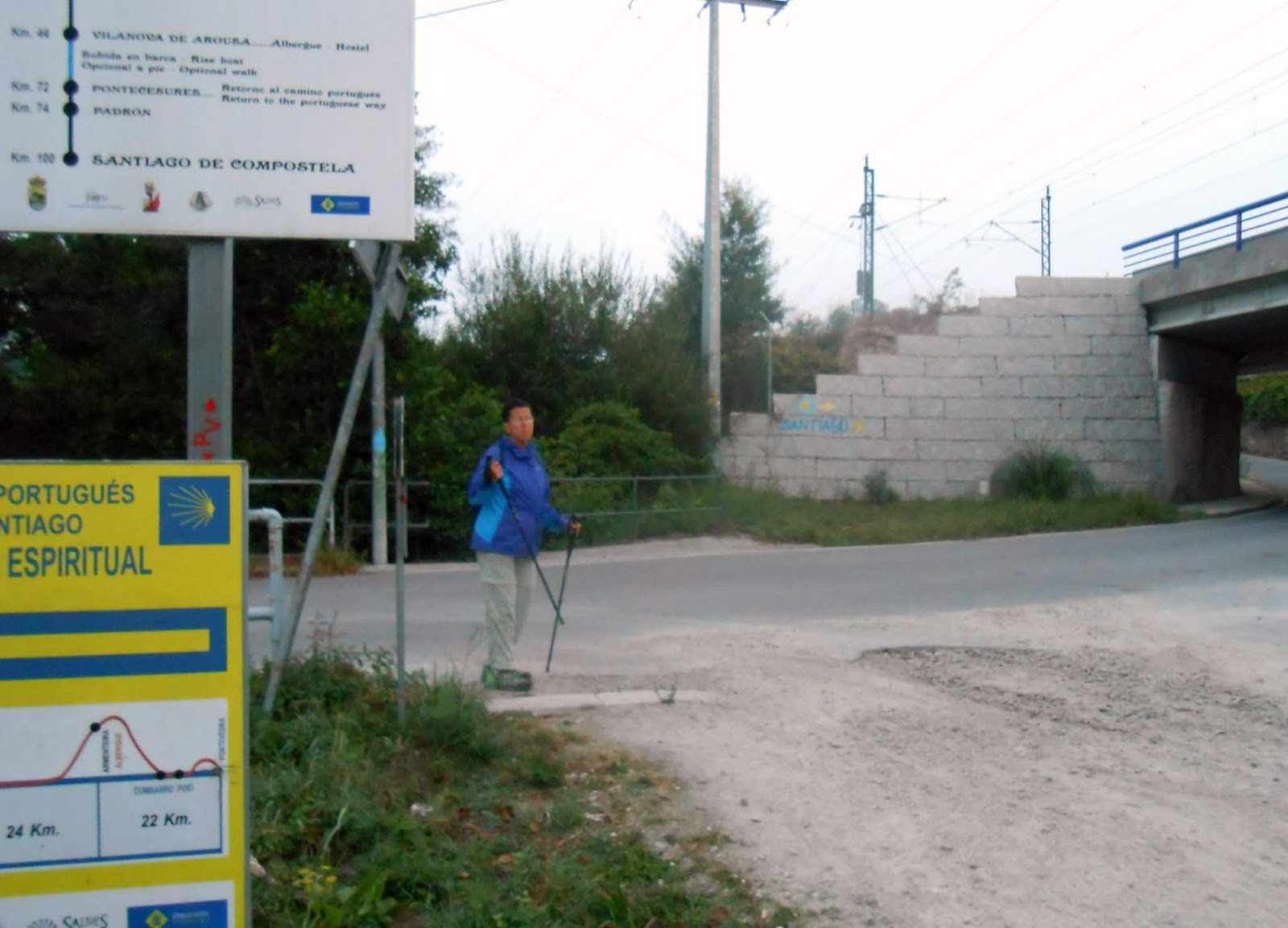
8:34 AM – After Pontevedra: MT near those
signs for Variante Espiritual (Spiritual Variant) of Camino Portugués (to the
left) and two yellow arrows pointing (right) to “Santiago” painted on railroad bridge
abutment on road we took.

8:34 AM (Cropped) – After Pontevedra: two
yellow arrows pointing (right) to “Santiago” painted on railroad bridge
abutment on road we took.

8:36 AM – Alba: sign (in Castilian Spanish)
for Iglesia de Alba, still ahead.
We
came into the village of Alba.
Alba (meaning
sunrise or daybreak) is a village in a rural parish (pop. 825) of the same name
in the municipality of Pontevedra. In Alba, a miliary stone (Roman milestone)
was discovered, dedicated to the Emperor Caracalla, evidence that the Via Romana
XIX passed through here. Alba hosts numerous cruceiros. One of those cruceiros
and a monument to the Pilgrim are next to the Iglesia de Santa María de Alba
(Church of St. Mary of Alba), which was begun in Romanesque style in the early
12th century and rebuilt in the 18th century, in a combination of Neoclassical
and Baroque styles.

8:43 AM – Alba: stone hórreo (with vertical vents on sides and pinnacle and cross finials
on roof) with tower of Iglesia de Santa María de Alba in fog in background.

8:43 AM – Alba: cruceiro near iglesia de Santa María – side with Crucified Christ
at top and figure of Santiago Peregrino on shaft.

Alba: figure of Santiago Peregrino on shaft of cruceiro near Iglesia de Santa María (commons.wikimedia.org).
Perhaps because of this figure of
Santiago on its shaft, this cruceiro
is sometimes misidentified as the Cruceiro de Amonisa, which is actually near
the village of Valbón (much farther down the Camino route, in the next
municipality).

8:43 AM – Alba: cruceiro – other side with unidentified figure at top.
Many
of the villages we passed were identified by a sign on the road, which did not
actually pass through the population center.
The
next village we came to was San Caetano,
still in the parish of Alba.

8:51 AM – San Caetano: sign for entering village
of San Caetano in the parish of Alba (telephoto 156 mm).
San
Caetano
(pop. 81) is a village in the parish of Alba in the municipality of Pontevedra.

8:58 AM – After San Caetano: stone marker for
Via Romana XIX and Camino marker stone for P.K. 58.738.
Next,
we came to the village of Leborei in
the parish of Cerponzóns.

8:58 AM – Leborei: sign for entering village
of Leborei in the parish of Cerponzóns.
Cerponzóns (in Galego,
officially Cerponzones in Castilian Spanish) is a parish (pop. 773) in the
municipality of Pontevedra. One of the villages in the parish is Leborei (in
Galego, or Liborey in Castilian Spanish).
Next,
we came to the village of O Castrado,
still in the parish of Cerponzóns.

9:05 AM – O Castrado: sign for entering village
of O Castrado in the parish of Cerponzóns, with two pilgrims on road (a couple
we followed for a long time), still in fog.
The village of O Castrado (meaning the castrated one) is
still in the parish of Cerponzóns in the municipality of Pontevedra. Its name
is due to the act of clearing, “castrating,” or breaking a piece of ground and
then burning it in order to grow crops. (The Spanish verb castrar can mean castrate, but also to prune [a plant].)

9:08 AM – Near O Castrado: wooden hórreo on stone legs, with no finals on
roof, next to vineyard (still in fog).

9:09 AM – Near O Castrado: other end of same
wooden hórreo on stone legs, with no
finals on roof, next to vineyard (still in fog).

9:24 AM – After O Castrado: MT following couple
on wooded path (still in fog).

9:35 AM – After O Castrado: MT with other pilgrims
(including Mr. and Mrs. Williams, whom we had met in Tui) at small stone bridge
in woods.
Next,
we approached the village of San Amaro.
Before reaching the actual village, we stopped at the café/bar A Pousada do Peregrino (Inn of the
Pilgrim).

9:54 AM – Near San Amaro: entrance to courtyard
of Café Bar A Pousada do Peregrino; large chalkboard near barrel with “Café
Bar” lists establishment’s name “A Pousada do Peregrino” at top and then a list
of foods offered: Cafés (coffees), Zumo Natural (natural juice), Croissant,
Tostadas (toast), Bocadillos (sandwiches), Refrescos (refreshments), Cervesas
(beers), Tapas, and Ensalada (salad); smaller chalkboard advertises Sello
(stamp), WiFi, and Docha (shower); beyond the entrance is an hórreo.

9:53 AM – Near San Amaro: stone hórreo with vertical vents and
basketball goal on side, door on side, and no finials of roof - in courtyard of
Café Bar A Pousada do Peregrino.
Ge
got sellos at the bar.

Near San Amaro: sello from “A Pousada de Peregrino [The Inn of the Pilgrim), Lugar [Village)
of] San Mauro [an alternate spelling of the saint’s name], 39 Portela, 36692
Barro Pontevedra, Telefono: 986…7.”
This sello was our first indication that we had departed the municipality of Pontevedra and entered the municipality of Barro (but still in the province of Pontevedra).

9:54 AM – Near San Amaro: sign, near Café Bar A
Pousada do Peregrino, advertising Café Bar Mesón Don Pulpo 100 m ahead, listing
offerings in Spanish, English, and French, as well as the oldest (stamp for )
credential on this stage of the Camino.
We
would stop there for this sello.

San Amaro: sello for “San Amaro de Portela” with picture of the saint, from
Café Bar Mesón Don Pulpo.
San
Amaro
is a village (pop. 199) in the parish of Portela in the municipality of Barro,
in the comarca (province) of
Pontevedra.
Barro (meaning mud, pop.
3,746) is a concello (municipality)
in the comarca (province) of
Pontevedra. The first human remains date from the castro (hill fortress) culture. With the Romanization, the area
began to gain importance, being crossed from north to south by the Via Romana
XIX. That route is parallel or similar to the route of the Camino Portugués and
the N-550 highway.

10:02 AM – Near San Amaro: Camino marker post
for P.K. 54.760 and another stone marker for Via Romana XIX.
NOTE:
In Spain, they are much better about having the rays of the scallop shell on
marker posts pointing the direction to go. (There have been no exceptions yet.)

10:04 AM – San Amaro: sign for entering village
of San Amaro in parish of Portela in municipality of Barro, still in fog (mild
telephoto 63 mm).

10:04 AM – San Amaro: cruceiro – side with Crucified Christ at top and figure of Santiago
Peregrino on shaft (inscription on base: “Granitos Fontan Año 2001,” still in
fog (mild telephoto 44 mm).
10:04 AM – San Amaro: cruceiro – other side with Virgin and Child at top, still in fog
(mild telephoto 44 mm).

10:04 AM – San Amaro: outdoor laundry pool,
still in fog (mild telephoto 44 mm).

10:05 AM – San Amaro: sign about Via Romana XIX
and how a Roman road was constructed (mild telephoto 44 mm); text in Galego
(partly obscured).

10:05 AM – San Amaro: sign with map of Via
Romana XIX with red arrow and circle at current location (mild telephoto 44
mm).

10:16 AM – After San Amaro: MT approaching
another cruceiro – side with pieta at
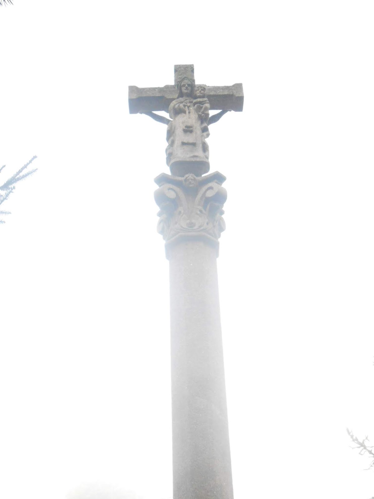
top (mild telephoto 44 mm).

10:16 AM – After San Amaro: pieta at top of
that cruceiro, in heavy fog
(telephoto 156 mm).
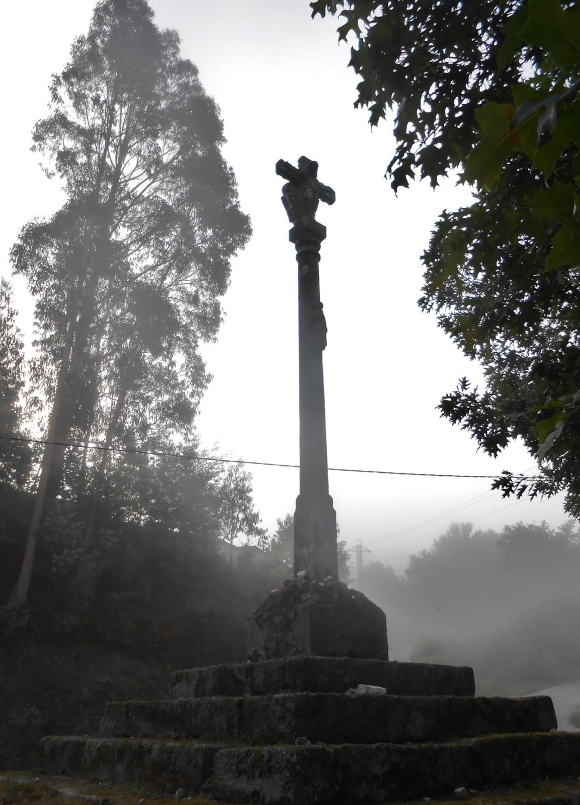
10:16 AM – After San Amaro: cruceiro- other side, probably with
Crucified Christ at top, backlit in heavy fog (telephoto 105 mm).
Next,
we came to the village of A Cancela.

10:21 AM – A Cancela: sign for entering village
of A Cancela in parish of Portela in municipality of Barro. in heavy fog.
A
Cancela
is a village (pop. 59) in the parish of Portela in the municipality of Barro,
in the comarca (province) of
Pontevedra.
Around
10:30 am, the sun finally came out.
At
this point, we were probably at the village of Valbón.

10:38 AM – Valbón: long, wooden hórreo on 8 stone pillars with no
finials on corrugated tin roof (mild telephoto 49 mm).
Valbón is a village in
the parish of Agudelo (pop. 453) in the municipality of Barro.

10:40 AM – Valbón: long, stone hórreo with vertical vents on sides and
pinnacle and cross finials on roof (mild telephoto 38 mm).

10:42 AM – Valbón: cruceiro – side with Crucified Christ at top; two figures on sides
of shaft (the one on the right seems to be Santiago Peregrino with his staff
and gourd; the one on the left appears to be a woman); building with statue of
Santiago Peregrino in background.
This is probably the Cruceiro de Amonisa. Brierley’s
guidebook says that just past the village of Barro, the Camino route “continues
past the ancient Cruceiro de Amonisa set at a jaunty angle with St. James
replete with staff looking towards Compostela. Veer < left by granite blocks
….” Brierley shows a photo of the figure of Santiago Peregrino on one side of
the shaft and another figure around on the other side. Various other sources agree that Santiago's staff is pointed north, toward Santiago de Compostela.

10:42 AM – Valbón: cruceiro – side with pieta at top; two unidentified figures on
sides of shaft (the one on the left seems to be Santiago Peregrino).

Valbón: cruceiro – side with Crucified
Christ at top and unidentified (probably female) figure on this side of shaft; yellow
arrow points to left past granite blocks, in the same direction the figure of
Santiago on the other side of the shaft would be pointing
(commons.wikimedia.org, which identifies the location as “Barro, Agudelo,
Valbón”).

10:42 AM – Valbón: statue of Santiago Peregrino
near that cruceiro (telephoto 156
mm).

10:42 AM – Valbón: Camino marker post for P.K.
52.024, with pilgrim resting on short wall.

MT 10:50 AM – After Valbón: our shadows on
paved path.

10:52 AM – After Valbón: approaching another cruceiro by cornfield on paved road.
This cruceiro is often misidentified as the Cruceiro de Amonisa, which
is actually in the village of Valbón. Unlike descriptions of the Cruceiro de
Amonisa in Brierley’s guidebook and various Internet sources, this one has no
figures (including that of Santiago Peregrino) on the sides of its shaft,
although it does lean at “a jaunty angle.”

10:53 AM – After Valbón: that leaning cruceiro by cornfield – side with
Crucified Christ at top, backlit (mild telephoto 63 mm).

10:53 AM – After Valbón: other side of that cruceiro, with figure of Virgin Mary at
top, facing sun; MT in background on the trail.

11:01 AM – After Valbón: Camino marker post for
P.K. 50.201 (mild telephoto 81 mm).

11:22 AM – After Valbón: Camino marker post for
P.K. 49.121 (Don’s walking poles in foreground).
It
was about this time that Don noticed that one of the rubber tips on his walking
poles was missing (see photo above). These were left over from the Camino
Francés in 2014, but fortunately he had brought the worn ones from the Camino
Francés in 2013 as backup.

11:37 AM – After Valbón: Camino marker post for
P.K. 48.148 (mild telephoto 49 mm).

11:37 AM – After Valbón: highway sign on
highway N-550, at same intersection, showing 40 km to Santiago de Compostela
(telephoto 156 mm).

11:44 AM – After Valbón: vineyard with people
picking grapes.

11:51 AM – Briallos: sign for Briallos on
highway N-550, just before we turned off left on gravel path; vineyard on right
(telephoto 187 mm).
Briallos is a village in
a parish of the same name (pop. 422) in the municipality of Portas.
Portas is a municipality
(pop. 3,016) in the province of Pontevedra. The Camino route passes through
Portas on the way up from the municipality of Pontevedra toward the
municipality of Caldas de Reis.
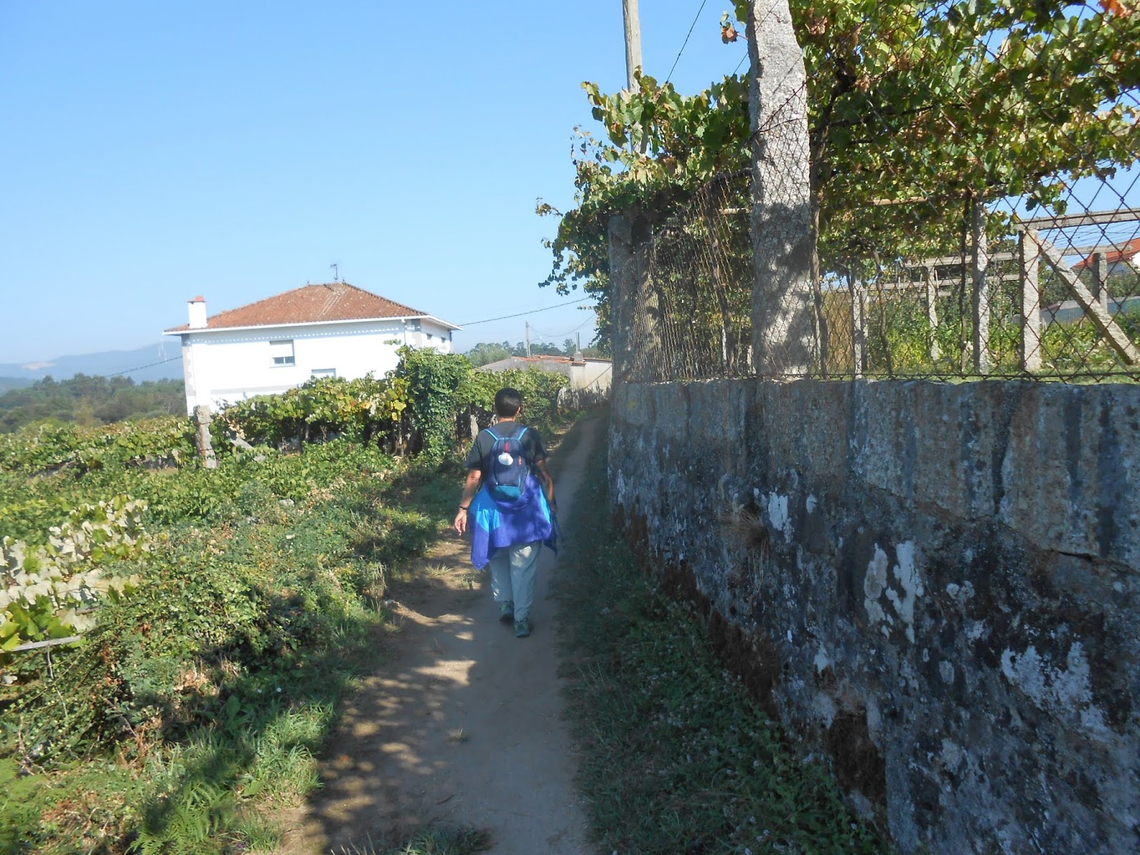
11:55 AM – Briallos: MT on path by vineyards.

12:05 PM – After Briallos: grapes ready for
picking (MT picked some sweet ones).

MT 12:05 PM – After Briallos: MT with grapes
she picked.

12:07 PM – After Briallos: more vineyards near
fork in path (we would follow paved path to left); red flowers at left.

12:07 PM – After Briallos: red flowers in
vineyard.

12:12 PM – After Briallos: MT looking at sign
by Capela de Santa Lucía (mild telephoto 49 mm).
The Capela de Santa Lucía, located in the parish of Arcos da Condesa,
is about 6.4 km before the city of Caldas de Reis.
Arcos
da Condesa
(Arches of the Countess) or Santa Mariña de Arcos da Condesa is a parish (pop.
439) located in the south of the municipality of Caldas de Reis. Its name may
come from the Condesa Munia, daughter of Froila Vermúdez (a Galician nobleman
who fourht against the Arabs in the 11th century), who lived in the village of
Marán, which is now located in this parish.

After Briallos: Capela de Santa Lucía (gl.wikipedia.org).

12:12 PM – After Briallos: sign for Capela de
Santa Lucía – in Concello de Caldas de Reis, posted by the Camino de Santiago
Foundation and the Government of the Province of Pontevedra (mild telephoto 49
mm).
This
was our first indication that we had passed from the municipality of Portas
into the municipality of Caldas de Reis.
Caldas
de Reis (in
Galego and officially) or Caldas de Reyes (in Castilian Spanish) is a
municipality (pop. 9,430) in the northwest of the province of Pontevedra. It is
located between the Umia and Bermaña rivers.

Coat of Arms of
Municipality of Caldas de Reis (en.wikipedia.org or By Susana Freixeiro - Own
work, CC BY-SA 3.0, https://commons.wikimedia.org/w/index.php?curid=17906217).
The municipality is composed of 9
parishes, two of which are
Caldas de Reis (Sam Tomé and Santa María) and Caldas de Reis (Santa María).
Santa María de Caldas de Reis is a parish (pop. 436) located in the south of the municipality of Caldas de Reis. (The gl.wikipedia.org page for this parish lists 8 villages, including Tivo, in this parish and includes a photo of “Portada da Igrexa de Santa María de Caldas de Reis and another of the Agnus Dei on the tympanum of that church, as well as the story of the Baldaquino de Santa María de Caldas de Reis, explaining that, on the wall of the interior of that church, there are two panels of a baldachin that is supposed to be the first graphic depiction, in the late 15th century, of the discovery of America, also known as Baldaquino de Colón (Baldachin of Columbus).
Caldas de Reis (San Tomé and Santa Maria), or San Tomé e Santa María de Caldas de Reis is a parish (pop. 4,501) located in the south of the municipality of Caldas de Reis. (The gl.wikipedia.org page for this latter parish lists only the city of Caldas de Reis under “Lugares da parroquia de San Tomé e Santa María de Caldas de Reis and includes [erroneously?] a photo of the Igrexa de Santa María.)

12:23 PM – After Briallos: pilgrim mural at
snack spot on path with vending machines.

12:30 PM – After Briallos: stone hórreo above garage with picnic table –
end with horizontal vents and cross finial on roof (mild telephoto 81 mm).

12:30 PM – After Briallos: same stone hórreo above garage with picnic table –
end with horizontal vents, side with vertical vents, and pinnacle and cross
finials on roof.

12:30 PM – After Briallos: same stone hórreo above garage with picnic table –
other end with open door, side with vertical vents, and pinnacle and cross
finials on roof.
Soon
we came to the village of Tivo.

12:42 PM – Tivo: cruceiro by vineyard – side with Crucified Christ at top and small
figure on (right) side of shaft.
The peaceful village of Tivo (Tíbo) is in the parish of Santa María
de Caldas de Reis in the municipality of Caldas de Reis, about 1 km from city
of Caldas de Reis. It includes a stone cruceiro
from 1654, fountain (Fonte dos
Catro Canos [Galego for Fountain of the Four Pipes]), and public washing
place.

12:42 PM – Tivo: cruceiro by vineyard – side with pieta at top and small figure on (left)
side of shaft.

12:42 PM – Tivo: cruceiro by vineyard –small figure (probably John the Baptist) on
side of shaft (mild telephoto 56 mm).

12:43 PM – Tivo: Albergue Catro Canos (pilgrim hostel
in brown building), with yellow sign by its gate: “Se Sellan Credenciales aqui”
(Credentials are stamped here), just below it another yellow sign for Albergue
Catro Canos, saying Benvides (Welcome) and listing foods and WiFi offered; at
right is chalkboard with arrows pointing to the albergue and offering Pilgrim
Breakfast: Large Coffee and Toast or Croissant for 2.50€.
We
stopped and got sellos at Albergue Catro Canos (Galego for Hostel of the Four
Pipes) in Tivo.

Tivo: Sello from “Albergue Catro Canos, Tivo, 58 – [municipality of]
Caldas de Reis, Telf.: 696 582 014 – 600 345 181, alberguecatrocanos@gmail.com” showing
the local fountain above the scallop shell.

12:43 PM – Tivo: stone hórreo (over garage) with vertical vents on end and no finial of
roof.

12:43 PM – Tivo: sunny side of same stone hórreo (over garage) with vertical vents
on end and side and no finials of roof (mild telephoto 72 mm).

12:43 PM – Tivo: bikers at drinking fountain (Fonte
dos Catro Canos [Galego for Fountain of the Four Pipes]); the name apparently comes from the pipes from which water flows from each of the four sides (mild telephoto 72
mm).
Then
we entered the outskirts of the city of
Caldas de Reis.
Caldas
de Reis
(in Galego and officially) or Caldas de Reyes (in Castilian Spanish) is a city
(pop. 7,000) in a municipality of the same name (pop. 9,430) in the northwest
of the province of Pontevedra. Until the mid-19th century, it was called just
Caldas, and from 1877-1981 it was officially called Caldas de Reyes. It is
located on the banks of the Río Umia.
Sometimes still called just
Caldas (meaning hot springs), its history is inextricably linked to its thermal
waters. There has been human presence here since prehistoric times. The first
settlers of which we have certain knowledge were the Cilenos, a pre-Roman castro (hill fortress) people who
occupied the territory between the Ulla and Lérez rivers. In Roman times it
became a major spa, called Aquae Calidae (Warm Water) or Aquae Celenae (town of
the Cilenas Waters), on the Via Romana XIX. In Christian times, in the late 4th
century, it became the bishopric of Celenis (in the 6th century, the bishop’s
seat was transferred to Iria Flavia, and today Caldas de Reyes is listed by the
Catholic Church as a titular see). During the Reconquista (Reconquest), it was transformed into Rex Calda (King
Hot Spring). In 1105, Alfonso de Borgoña (also known as Alfonso Raimundez in
the House of Burgundy) was born in this town; he was grandson of King Alfonso
VI of León and Castile and son of Count Raymond of Burgundy (known in Spanish
as Raimundo de Borgoña) and Queen Urraca I of León and Castile, and would be
crowned King (and Emperor) of León as Alfonso VII in 1126. Due to the birth of
Alfonso VII and the predilection that the Castilian royal house always showed
for Caldas and its thermal waters, with monarchs spending several long seasons
here, the nickname “de Reyes” (Reis in Galego) was added to the original place
name of Caldas. This is why it is called Caldas de Reis (Hot Springs of the
Kings).
Caldas was always an obligatory
point of transit for Portuguese pilgrims and foreigners who entered Galicia
through Tui or through the ports of Vigo and Pontevedra, and then making their
way to Santiago along the route marked by the two Roman roads XIX and XX, which
crossed the province of Pontevedra.

12:52 PM – Caldas de Reis: trailer with picked
grapes (at least 3 different kinds of different colors) by vineyard.

1:01 PM – Caldas de Reis: Iglesia de Santa María
– bell tower and apse; west façade at right.
The Igrexa de Santa María de Caldas (Church of St. Mary of Caldas) is
an important example of medieval art of the 12th century. The construction of
the church was motivated by the promotion of Santiago and the pilgrimage routes
by the crown of Castile and León. There are traces of influence by the Porta de
la Gloria of the Cathedral in Santiago. Although it has undergone several
modifications throughout its history, the oldest parts preserved in Romanesque
style from the 12th century include the apse and the west façade. The apse is
conserved, with lateral buttresses. The western door is under a modern portico
that supports a Baroque bell tower. The door has two half-pointed archivolts
and a tympanum, flanked by pairs of columns. On the tympanum atop the western door is a
sculpture of Agnus Dei (Lamb of God). Inside are the remains of a Gothic
altarpiece.

Caldas de Reis: Igrexa de
Santa María – bell tower, west façade (with door under portico), and apse at
right (gl.wikipedia.org).

Caldas de Reis: Igrexa de
Santa María – western door (gl.wikipedia.org).

Caldas de Reis: Igrexa de
Santa María – tympanum of western door (gl.wikipedia.org).

1:02 PM – Caldas de Reis: Igrexa de Santa María
– bell tower and other side, with mausoleum (right).
As
we entered the town center, we came to the Igrexa
de Santo Tomé, which we would visit later.

1:10 PM – Caldas de Reis: Iglesia de Santo Tomé
– bell tower and façade.
The Igrexa de Santo Tomé (Church of St. Thomas) was built in 1890 by
popular subscription. It was erected with the stones of the old Torre de Dola
Urraca (Tower of [Queen] Doña Urraca), the residence of the archbishops of
Compostela since 1228, conserving two windows much older than the rest of the
complex. Also preserved from the tower are the parapets embedded in the walls
of the apse. The church is dedicated to St. Thomas of Canterbury (St. Thomas
Becket, 1118-1170), who made a visit to the village in 1167, on his way to
Santiago de Compostela as a pilgrim.
We
arrived at Hotel O Cruceiro (Hotel of the Crucifix) around
1:30 pm, after either getting bad directions or misunderstanding them, several
times before someone got us on the right track. MT’s iPhone couldn’t take any
more photos because the memory was full. We wanted to buy a flash drive and
find a computer at the hotel or the library in order to transfer her photos to
it. The hotel desk clerk drew on a map how to get to the library (back near
where we had entered town) but said it would be closed until 5 pm. However, he
said there was a “Chinese store” down the street that was open until 2 pm,
where she thought we could get a flash drive. She suggested that we go right
away, even before going to our room. She also said we could eat (lunch rather
than dinner on our voucher) at any time before 3:30.
We
found the Yixin China store and
bought what they called a “pen drive” (16 GB) at 1:40 for €9.95.
Then
we went back to Hotel O Cruceiro,
where we got sellos and went to their
comedor (dining room) for lunch.

Caldas de Reis: Sello from “Hotel ‘O Cruceiro’ - Caldas de Reis, www.hotelcruceiro.com“ with cartoon
pilgrim on scallop shell.
The hotel dining room had no written menu, but the waiter gave us a choice for first course of “fried fish” (not further identified) or potato salad. We asked for a mixed salad and got very large and good ones: we later saw that a man at the next table got for his first course what looked like potatoes, peas, and carrots, and it looked good. Our choices for the second course were either “chop pork” or spaghetti bolognese; we chose the latter, as did practically everyone else eating there, including a group of 11 Spanish men, among whom was our Camino friend Ciprian. (We had met Ciprian again on the trail at a place where he said there was a detour [8 minutes each way] to a fantastic waterfall—but we didn’t go.) For dessert, MT had an ice cream cone (packaged but good), and Don had “chocolate cake” (layers with whipped cream and chocolate mousse).

2:24 PM – Caldas de Reis: Hotel O Cruceiro restaurant
– Don’s mixed salad, including tuna and white asparagus.

2:59 PM – Caldas de Reis: Hotel O Cruceiro
restaurant – empty bottle from our red wine (it had no real label, but only a
small one that said “Selección”); also bottle of water and basket of bread that
came with the meal.

3:04 PM – Caldas de Reis: Hotel O Cruceiro
restaurant – Don’s “chocolate cake.”
After
this late lunch, we showered, washed clothes, and hung them on the window to
dry.
At
5:15, we set out for the library (the Turismo office nextdoor was closed),
where the librarian showed us to a computer and later spent some time helping
us try to copy MT’s iPhone photos to the flash drive, but still unsuccessfully.

5:15 PM – Caldas de Reis: mixed hórreo (with cross and pinnacle finials
on roof) across street from Hotel O Cruceiro (telephoto 156 mm).
After that, we went to the nearby Igrexa de San Tomé to check on mass times.

6:48 PM – Caldas de Reis: Igrexa de San Tomé –
main (west) façade and bell tower.
We
arrived just as many people were coming out, like a mass was just over. A sign
said there would be a pilgrim mass at 8 pm, but MT was too tired to wait around
for that. We stayed long enough to look around the interior of the church and
take a few photos.
The Igrexa de Santo Tomé (Church of St. Thomas), also known as Igrexa
de Santo Tomás de Caldas de Reis, was built starting in 1890 by popular subscription
and was completed in 1894. The neo-medieval was erected with the stones of the
old Torre de Dola Urraca (Tower of [Queen] Doña Urraca), the residence of the
archbishops of Compostela since 1228. From a chronological point of view, however,
the tower could hardly have been the dwelling of Queen Urraca of León, Castile,
and Galicia (1079-1126), since it is in Gothic style after the 17th century. It
was also said that Urraca’s son, the future King Alfonso VII of León, was born
in the tower.
The church has a single nave and
a smaller apse. It conserves two windows much older than the rest of the
complex. Also preserved from the tower are the parapets embedded in the walls
of the apse. The church is dedicated to St. Thomas of Canterbury (St. Thomas Becket,
1118-1170), who made a visit to the village in 1167, on his way to Santiago de
Compostela as a pilgrim.

6:39 PM – Caldas de Reis: Igrexa de San Tomé –
view from rear of nave to main altar in apse (with people leaving); (main)
pulpit at left (with staircase); main altar in apse (flanked by two [minor]
pulpits); side altar on right.

6:42 PM – Caldas de Reis: Igrexa de San Tomé –
(minor) pulpit and main altar, both in carved wood (mild telephoto 56 mm).

6:42 PM – Caldas de Reis: Igrexa de San Tomé –
side altar on right with statue of San Roque.
San
Roque
is the patron saint of Caldas de Reis.
One
lady seemed to be waiting for us to leave the church, and we asked her if they
had a sello. She took our credenciales to the front of the church
(sacristy) and brought them back stamped.

Caldas de Reis: Sello from Igrexa de San Tomé for “Santo Tomás – Caldas de Reyes.”

6:46 PM – Caldas de Reis: cruceiro in front of Igrexa de San Tomé – side with Crucified
Christ at top; on shaft is an unidentified monk above figures of Adam and Eve.

6:46 PM – Caldas de Reis: cruceiro in front of Igrexa de San Tomé – figures of Adam and Eve
(with fig leaves) under a tree, with a head (probably of the serpent) peering
out over Eve’s head (mild telephoto 49 mm).

6:47 PM – Caldas de Reis: MT and cruceiro in front of Igrexa de San Tomé
– other side with Virgin Mary at top and unidentified figure on shaft.
We
had a bit of trouble getting to the Calle Real, on which we had come from the
hotel. When we asked a lady (walking with her daughter and dog), she said that
pilgrims get lost on Calle Real and that she would show us a shorter way; she
took us to where we could see the hotel (probably via Calle Carlos Garcia Bayón,
which we later saw on the map from the hotel was indeed shorter).
Back
at Hotel O Cruceiro, we asked in the
cafetería (coffee shop/bar) if they
had sangria, and lady said no but she made us something similar. Something like
the tinto de verano we had had in
Muxía on a previous Camino, the wine had orange slices in it, and she brought
us four empenadas to go with it.

7:08 PM – Caldas de Reis: Hotel O Cruceiro
cafetería - MT (right) with our wines and empenadas.

7:19 PM – Caldas de Reis: Hotel O Cruceiro exterior.
No comments:
Post a Comment