This post is based primarily on
Don's notes, occasionally supplemented with MT's notes from our Camino in 2016.
When information from other sources is added—for further explanation to readers
or to satisfy our own curiosity—that is set off in a text box (as this one).
Most of the photos that accompany
this post are from Don’s camera (with a caption indicating the time it was
taken); those from MT’s iPhone are indicated by “MT” placed at the beginning of
the photo caption. Photos from any other source (such as the public domain
Wikimedia Commons) indicate that source in the caption.

MT Thursday, September 22, 2016, 8:10 AM – Arcade: Hotel Duarte – sunrise
from hotel.

MT 8:18 AM – Arcade: Hotel Duarte – sunrise from hotel.
We departed the hotel at 9 am.


9:03 AM – Arcade: Hotel Duarte – exterior
front, with private albergue next
door at left.

9:04 AM – Arcade: Albergue Lameiriñas (at
left) adjoining Hotel Duarte (at right).

9:04 AM – Arcade: view, from Hotel Duarte, toward Ensenada de San Simón (Cove of St. Simon).

9:16 AM – Arcade: old-looking stone hórreo with vertical and horizontal
vents and no finials on roof – end view (telephoto 93 mm).

9:16 AM – Arcade: old-looking stone hórreo with vertical and horizontal vents and no finials on roof – side view (not so old-looking) (no telephoto).

9:18 AM – Arcade: view of Ensenada de San
Simón (Cove of St. Simon) where it joins the Río Verdugo river (off screen to
right).
The Ensenada de San Simón (Cove of St. Simon) is an inlet at the far
north end of Ría de Vigo (Estuary of Vigo). It connects the Ría de Vigo with
the mouth of the Río Verdugo at Arcade. The Isla de San Simón (Island of St.
Simon) is located in the middle of the cove.

9:20 AM – Arcade: MT on street leading to
Ponte Sampaio stone bridge over the Río Verdugo river where it flows into Ensenada
de San (to left of bridge).
The Ponte Sampaio (or Pontesampaio) is a handsome stone bridge over the
Rio Verdugo built in 1795 over two earlier foundations, from Roman and medieval
times. The Camino Portugués crosses this bridge of 10 semicircular arches,
situated between angled cutwaters, that joins the town and parish of Arcade
with the neighboring municipality of Pontevedra. It was here that the local
militia (a body largely of peasants under the command of a Spanish colonel) inflicted
a significant rout of Napoleon’s troops during the War of Independence.
The Battle of Puente Sanpayo or Battle of San Payo (Ponte Sampaio in
Galego) took place between 7 and 9 June 1809 in the Spanish War of Independence
during the Peninsular War. The Spanish forces defeated the French forces,
forcing then to retreat and causing the failure of the French offensive to recapture
the cities of Vigo and Pontevedra. The battle marked the final evacuation of
the French army from Galicia, ending 5 months of French occupation.
Halfway across the bridge, the
Camino route enters the Municipality of Pontevedra.

9:21 AM – Arcade: Ponte Sampaio stone bridge
over the Río Verdugo river where it flows into Ensenada de San (to left of
bridge); village of Ponte Sampaio on far side.
On
the far side of the bridge, we would go through the village of Ponte Sampaio
and continue along old cobbled streets, with stretches of the Roman road Via
XIX, such as the ascent via Brea Vella da Canicouva.
Ponte
Sampaio
(in Galego and officially Santa María de Ponte Sampaio, but Puente Sampayo in
Castilian Spanish) is a village in a parroquia
civil (civil parish, pop. 1,185) in the concello
(municipality) of Pontevedra. It takes its name from the bridge that linked it
to the old province of Tuy by way of the parish of Arcade.

9:24 AM – Ponte Sampaio: MT on path leading
uphill into village, with hórreo
(with vertical and horizontal vents on stone end wall and no finials on roof);
white sign at top of this incline for “Camiño Xacobeo Portugués” pointing to
right.

9:25 AM – Ponte Sampaio: side of that long,
mixed hórreo (with door in this side
but no third gable above it, vertical and horizontal vents in stone parts
separating sections of wood-slat sides, and no finials on roof).

9:26 AM – Ponte Sampaio: another sign (posted by Concello de Pontevedra) for
“Camiño Xacobeo Portugués” (this time pointing to left); mixed hórreo (with vertical and horizontal
vents and ornamental gable on stone near end, wood-slat sides with door on left
side, and pinnacle finial on near end of roof), guarded by a white ceramic
rooster.

9:26 AM – Ponte Sampaio: stone and brick hórreo (with vertical vents in stone
ends and stone parts separating brick sections of sides, and cross finials on
left end of roof.

9:32 AM – After Ponte Sampaio: stone hórreo (with vertical and horizontal
vents and cross and pinnacle finials on roof); wooden door on this end
(telephoto 156 mm).

9:32 AM – After Ponte Sampaio: view from
other end of same stone hórreo (with
vertical and horizontal vents and cross and pinnacle finials on roof) (no
telephoto).

9:33 AM – Acevedo: cruceiro (A Cruz) – side with Crucified Christ at top.
Acevedo is a village in
the parish of Ponte Sampaio. Located there is a cruceiro (A Cruz) built on an ancient petroglyph that serves as a
base and thus Christianizing the site.

9:37 AM – After Acevedo: Camino marker post
P.K. 74.434.

9:37 AM – After Acevedo: MT on what we first thought was the “ancient stone paved pilgrim way” but were just modern paving stones.
We soon came to an old-looking stone bridge that we mistook for the Ponte Nova. According to Brierley’s guidebook, we would “cross the Río Ulló by the remains of the medieval bridge A Ponte Nova (built on Roman remains as this was part of the calzada Romana XIX.”

9:39 AM – After Acevedo: primitive-looking
stone low-water bridge.
The Ponte Nova (New Bridge) was an arched medieval bridge built on
Roman remains that were part of the Via Romana XIX. However, the medieval
bridge was shattered (collapsed) in 2006 by a flood of the Río Ulló. The Camino
route was diverted, and in October 2010 a new bridge was inaugurated, although
now of steel and concrete. After Ponte Sampaio, the Camino route passes through
the Ponte Nova, a bridge of new construction (2010).
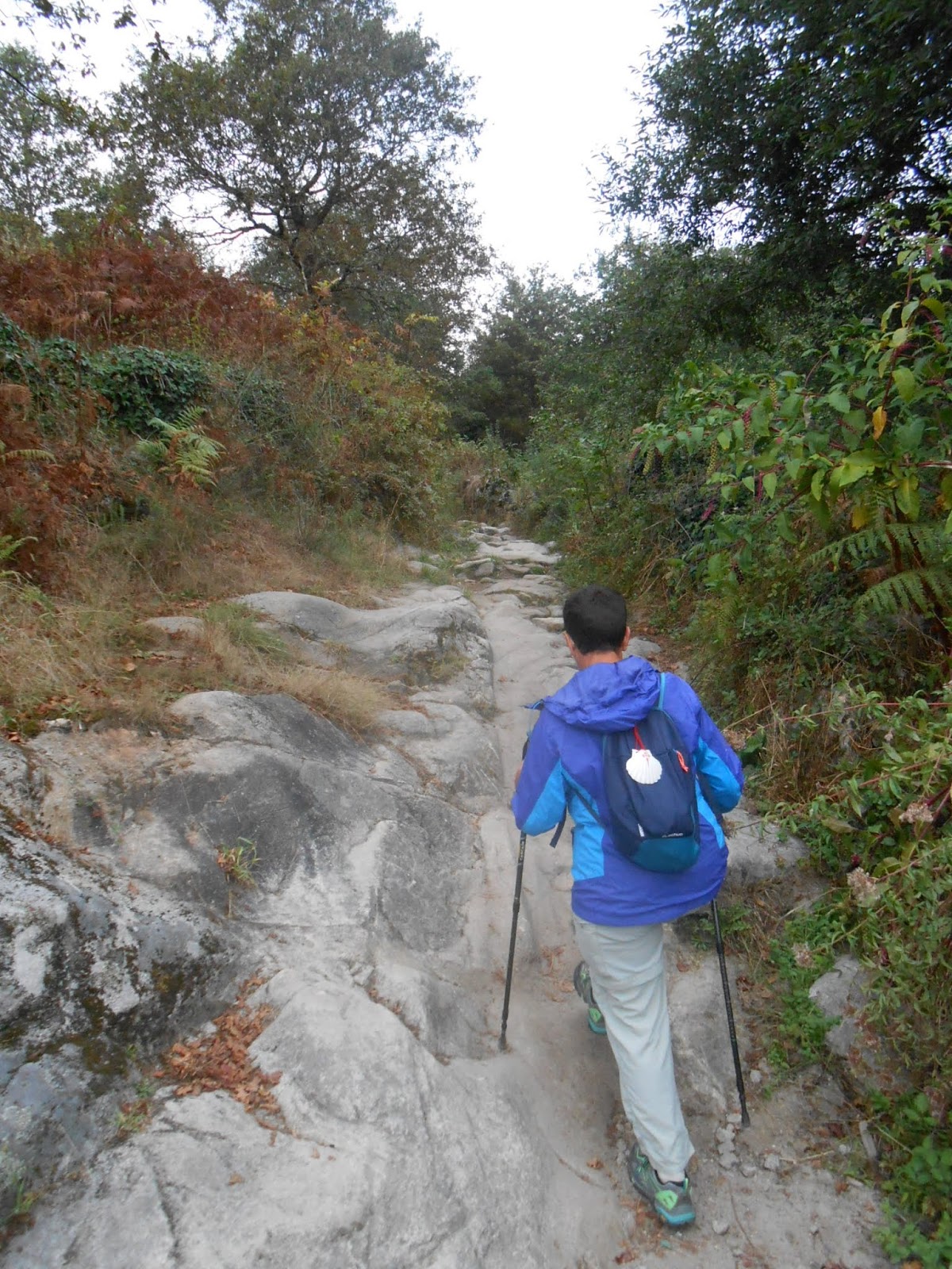
Then we began a rather steep climb on the ancient stone-paved pilgrim way Brea Vella da Canicouva up to the next high point, the Alto da Canicouva (Height of Canicouva)).

9:41 AM – Brea Vella da Canicouva: MT on
start of the actual Brea Vella da Canicouva, which just looked like a bunch of
rocks.
After the Ponte Nova, the Camino
route goes onto the Brea Vella da
Canicouva (aka Vrea Vella da Canicouva), a path of great stone slabs that
runs along the route of the Via Romana XIX. The ascent of Brea Vella alternates
between stretches of irregular stones and others of dirt and gravel or
sometimes modern paving stones.
A
Canicouva
is a town (pop. 165) in a parish (pop. 254) of the same name in the
municipality of Pontevedra. Until 1960, it was part of the parish of Ponte
Sampaio.

9:41 AM – Brea Vella da Canicouva: MT on
start of the actual Brea Vella da Canicouva, approaching the first thing that
could be called a “stone slab” among a bunch of smaller rocks.

9:46 AM – Brea Vella da Canicouva: more
modern paving stones, on steep ascent.
9:47 AM – Brea Vella da Canicouva: MT more
rough stones (here part of a large stone formation).

9:47 AM – Brea Vella da Canicouva: MT
continuing up those rough stones.

9:49 AM – Brea Vella da Canicouva: MT more
rough stones (here again more regularly sized and spaced).

9:51 AM – Brea Vella da Canicouva: now a
gravel path through woods.

9:53 AM – Brea Vella da Canicouva: MT again on rough stone path.
The ancient stone path finally led us to a paved road.

10:10 AM – After Brea Vella da Canicouva: intersection
of paved roads with sign for “Canicouva” (the parish, in blue at top) and “Cacheiro”
(the village).
The Camino route reaches the Alto da Canicouva around the crossroads
and wayside cross Cruceiro Cacheiro
before finally descending into the provincial capital of Pontevedra.
The village of Cacheiro (pop.78) is in the parish of Canicouva.

10:10 AM – After Brea Vella da Canicouva: MT
paved road, with Camino marker stone (with no distance on it) on other side of
road.

10:15 AM – After Brea Vella da Canicouva (near Cacheiro): young man with guitar and drinks (in cooler) at intersection on wooded paths; his sign said: “Bebidas – Drinks 1 [euro] – Agua Aquarius – Water, Refrescos – Soft Drinks, Cerveza – Beer.”

10:21 AM – After Brea Vella da Canicouva: Camino
marker stone for P.K. 71.687 (with yellow arrow on side and rays of scallop shell
indicating the route straight on to the right, but a faint blue arrow on the
front pointing left) in an area cleared of trees.

10:30 AM – After Brea Vella da Canicouva: Camino
marker stone for P.K. 70.955 with vineyard in background along paved road.
Along the road, near P.K.69, we came to a makeshift outdoor “café” run by a German man. We stopped there 10:45-11:00 am.

10:46 AM – Near P.K.69: sign, in German, for
“café” with “Getränke, Obst, Stärkung, Kleine Häppchen” [Drinks, Fruit,
Refreshment(s), Small Morsels].

10:46 AM – Near P.K.69: German outdoor “café”
(in front of house by vineyard along road).

10:46 AM – Near P.K.69: German “café” – food
and hats offered included tomatoes and onions for 2.90€ or a plate of cheese
and cold cuts for 4.00€; our walking poles and MT’s daypack at table in
background (seating on logs around a cable spool).

10:47 AM – Near P.K.69: German outdoor
“café” – MT and owner by our table (seating on logs around a cable spool) with
our tomatoes and onions on table.

10:47 AM – Near P.K.69: German outdoor
“café” – our tomatoes and onions in olive oil, which came with bread.

11:01 AM – After P.K.69: modern-looking
mixed hórreo (although vents in sides
might be painted to look like wood) with bulbous finials on both ends of rood
and door on side (with steps leading almost up to it, but no third gable over
it) (telephoto 105 mm).

11:15 AM – After P.K.69: stone hórreo with vertical and horizontal vents and no finials on roof (telephoto 105 mm).

11:16 AM – Near Capela de Santa Marta: Camino marker P.K. 68.577.
Then, after crossing the parish of Figueirido (in the municipality of Vilaboa), we arrived at the Capela de Santa Marta (in the municipality of Santa Comba de Bértola). The chapel was open, allowing us to visit the simple interior and get self-service sellos.

11:18 AM – Capela de Santa Marta: MT and
other pilgrims arriving at chapel.

11:18 AM (Cropped) – Capela de Santa Marta: MT and other pilgrims arriving at chapel; “Capela da Santa Marta” engraved in stone just to right of door, sign at far right: “Camiño de Santiago – Concello de Vilaboa – Capela de Santa Marta – [Federación?] Camiño de Santiago – [Deputación?] Provincial de Pontevedra.”

11:18 AM – Capela de Santa Marta: MT
entering chapel.
The Capela da Santa Marta (Chapel of St. Martha, Castilian Spanish:
Capilla de Santa Marta) dates from 1617. It is a small stone structure with a
recently restored wooden ceiling inside.

Capela da Santa Marta:
interior (es.wikiloc.com).
It is located in the village of Santa Marta in the parish of Santa Comba de Bértola in the municipality of Vilaboa, bordering on the municipality of Pontevedra. It marks the end of the section of the Camino route in the municipality of Vilaboa.

Sello
from “Capela Santa Marta Bértola.”

MT 11:24 AM – Capela de Santa Marta: Don and MT in front of chapel door.

11:19 AM – Capela de Santa Marta: signs
posted in glassed-in frame to left of door (exterior): poster for “Santa Marta
2016” Festival of Santa Marta that takes place on July 29, starting at noon; a
business card for Pensión Santa Clara in Pontevedra, and a notice in Spanish,
Galego, and English that “There is a stamp inside.”
Across from the front door of Capela da Santa Marta was a cruceiro.

“Chapel
of Santa Marta
“Dated
from the year 1617.
“In
front of the chapel [Galego: capéliña;
Castilian: capilla] of Santa Marta,
which dates from the year 1617. It lacks steps. It has a prismatic base with
the lower edges reduced and cylindrical vane, striated and woody, with the
image of Santa Marta in front. Simple capital, with four straight sides that
gives way to a square cross, with the edges reduced and with reinforced ends,
from which a three-nailed Christ stands out, under INRI, with closed hands, the
cloth knot on his left and the right foot covering the left. It has no image on
the back.”
The cruceiro is of later date than the chapel.

11:20 AM – Capela de Santa Marta: cruceiro in front of chapel.

11:21 AM – Capela de Santa Marta: façade with no pilgrims outside.

11:23 AM – Just past Capela de Santa Marta:
road sign for leaving the municipality of Vilaboa and entering the municipality
of Pontevedra, on the road EP-0002 (Network of Streets - Deputación de [Council
of] Pontevedra); yellow arrow on utility pole points to Camino route straight
ahead, after turning corner to left (telephoto 250 mm).

11:23 AM – Just past Capela de Santa Marta:
road sign (posted by Network of Streets - Deputación de [Council of]
Pontevedra) for leaving the municipality of Vilaboa and entering the
municipality of Pontevedra on road EP-0002; both yellow arrow on the sign post
and yellow arrow on utility pole point to Camino route straight ahead
(telephoto 156 mm, but closer up).
Pontevedra is a province
(pop. 950,919) along the Spain’s Atlantic coast. It forms the southwestern part
of the comunidad autónomia (autonomous
community) of Galicia. Some 11.5 % of the province’s population lives in the
capital, the city of Pontevedra, and around 30 % in Vigo.

Coat of Arms of Province of
Pontevedra (en.wikipedia.org).
The official languages of the
province are Spanish and Galician (Galego). According to the 2001 census, 29.6
% of the population have Galician as their mother tongue, whereas 32.1 % speak
it “often.” The remaining 38.3 % speak Spanish as their native language or
speak mostly in Spanish.
The Concello de Pontevedra or Municipio de Pontevedra (both meaning the
municipality) is in charge of governing the city and municipality of Pontevedra.

Map of Municipality of
Pontevedra, showing its parishes and the surrounding municipalities
(es.wikipedia.org).
The Municipality of Pontevedra consists of its urban center (city of Pontevedra) and 15 rural parishes.
Since entering the Municipality of Pontevedra, we had passed through the parishes of Puente Sampayo and A Canicouva and were now entering the parish of Tomeza. Beyond the city of Pontevedra, we would pass through the parishes of O Burgo, Alba, and Cerponzones before leaving this municipality.

11:24 AM – Tomeza: sign entering Tomeza in
Concello de Pontevedra (telephoto 250 mm).
San
Pedro de Tomeza
is a parish (pop. 1082) in the municipality of Pontevedra. It is situated to
the southwest of the city of Pontevedra. This parish is known for its long
tradition of stonemasons, who with their work gave the name to Tomeza. Villages
in the parish include O Pobo, O Casal do Rio, Lusquiños, and O Marco. Within
the parish, the Río do Pobo flows into the Río Tomeza.

11:24 AM – O Pobo: sign (posted by Network
of Streets - Deputación de [Council of] Pontevedra) entering O Pobo in Concello
de Pontevedra (telephoto 381 mm).
O
Pobo
(meaning The People) is a village (pop. 148) in the parish of Tomeza in the
municipality of Pontevedra.

11:34 AM – Casal del Rio: sign (posted by
Network of Streets - Deputación de [Council of] Pontevedra) entering Casal del
Rio in Concello de Pontevedra; yellow arrow in post points to Camino route
straight ahead (telephoto 250 mm).
O Casal
del Río
is a village (pop. 77) in the parish of Tomeza in the municipality of Pontevedra.

11:35 AM – Casal del Rio: strange modern cruceiro – side with Crucified Christ at
top, with pilgrim hat on top of cross, pilgrim body (from head down) with
scallop shells on column, statue of Santiago Peregrino and inscription “Os Peregrinos”
[The Pilgrims] at bottom of column, and four-pointed base with (partially
visible) inscription “A Cultural Amigos … Tomeza.”

11:36 AM – Casal del Rio: strange modern cruceiro – back side with what looked
like Santiago Peregrino at top, with pilgrim hat on top of cross, pilgrim body
(from head down) on column; MT in background.

11:36 AM (Cropped) – Casal del Rio: back
side of cruceiro – back side with figure
of what looked like Santiago Peregrino at top, but on closer inspection was
actually La Peregrina or La Virxe Peregrina (The [female] Pilgrim or The Virgin
Pilgrim) representing the Virgin Mary in pilgrim cloak and hat, carrying a walking
staff with gourd attached in one hand and carrying the Child Jesus on her other
arm – this form of the Virgin is the patron saint of the the city and province of Pontevedra.

11:36 AM – Casal del Rio: another pillar, on
the same parking lot, with scallop shell and cross of Santiago.

11:36 AM – Casal del Rio: another pillar, on
the same parking lot, with what we first thought was like a frieze on a church,
but was actually a small replica of the silver reliquary purported to contain
the remains of St. James in the crypt of the Cathedral in Santiago; sign at
right (posted by Concello de Pontevedra) for “Zone Reserved for Parking and Bus.”

11:40 AM – Lusquiños: sign for entering Lusquiños
in parish of Tomeza (telephoto 156 mm).
Lusquiños is a village
(pop. 457) in the parish of Tomeza in the municipality of Pontevedra.

11:44 AM – Lusquiños: remains of two stone hórreos with pile of other rescued
stonework (telephoto 93 mm).

11:55 AM – O Marco: sign (posted by Network
of Streets - Deputación de [Council of] Pontevedra) for entering O Marco in
municipality of Pontevedra (telephoto 187 mm).
O Marco is a village
(pop. 35) in the parish of Tomeza in the municipality of Pontevedra.

11:58 AM – O Marco: MT and other pilgrims (including two Frenchmen from Normandy) in front of Camiño
Portugués mural on front of Casa Pepe.
Bar
Tapería Casa Pepe,
established in 2013, in the village of O Marco on the outskirts of the city of
Pontevedra, is known for its great meals, tapas, and wines. It is located in a
traditional Galician stone house and has an outdoor terrace.

11:59 AM – O Marco: MT in front of Casa Pepe (mild telephoto 81 mm).

MT 12:05 PM – O Marco: fresh bread hanging
on house door.

12:12 PM – After O Marco: wooden statue of
pilgrim with large backpack, in front of a pensión.
Finally,
we came into the city of Pontevedra.
The city of Pontevedra is the capital of both the Comarca (County) and Province of Pontevedra and of the Rias Baixas
(Low Bays) in Galicia. It is also the capital of its own municipality (Concello
de Pontevedra) which is, in fact, often considered as an extension of the
actual city. The municipality (pop. 82,946) is composed of the city of
Pontevedra and 15 rural parishes in close proximity.
A local legend relates the
founding of Pontevedra to Teucer (Teukro), a Greek hero of the Trojan War, who founded
a settlement here and called it Helenos. This legend was reinforced with the
suspicion that Greek traders might have arrived in the Rias Baixas area in
ancient times. However, most historians and archaeologists agree that the
initial settlement was probably formed during the integration of Gallaecia (old
Galicia) into the Roman Empire (ca. 1st century BC). Prior to the arrival of
the Romans, there had been Celtic castro
(hill fortress) settlements in the area. Two of these castros were located where the churches of Santa María and San
Francisco now stand. Recent studies link the foundation of Pontevedra with the
settlement of Turoqua, a mansion on the Via Romana XIX, founded on the south
bank of the Río Lérez in the vicinity of which the Romans would build a bridge.
The current name of the city is a
Latin composite, derived from Pons/Pontis
(bridge) and Veteris/Vetera (old),
hence Ponte(m) Verata(m) and thence Ponte-Vedra in the Galician (Galego)
language. The name Pontis Veteris may
have first appeared in documents in 1103, referring to the “old bridge” built
by the Romans across the Río Lérez, as part of Via Romana XIX.
Well-connected since Roman times,
Pontevedra consolidated itself as an intermediate town during the Suebic period
(ca. 5th-6th century AD). In the 4th century, the Suevi (Swabians) conquered
this area, and the city became the capital of the Kingdom of Rekiamundo and
also the episcopal headquarters of the Suevi. In the 8th century, invading
Arabs devastated the city; it was liberated in 739 by King Alfonso I, restoring
the episcopal seat.
In 1169, King Fernando
(Ferdinand) II of León granted a charter to the parish of “Burgo de Pontevedra”
(fortified town of Pontevedra), marking the birth of the city. This charter led
to the revitalization of the city after a period of emptiness in the Early
Middle Ages.
During the 12th century,
Pontevedra rose as an important commercial center. Over the following
centuries, the city continued to grow, expanding beyond the original walled
enclosure. It reached its zenith in the 15th century as a trade and
communications hub. By the 16th century, Pontevedra was the largest Galician
port, situated on the Lérez river at its entry into the Pontevedra Estuary, an
Atlantic inlet. One of Christopher Columbus’ ships, the Santa Maria, originally
named La Gallega (The Galician), was built in Pontevedra by the Mareantes guild.
In the 16th century, Pontevedra was the largest population center in Galicia. In
the following centuries, however, sedimentation caused by the Lérez river
rendered the harbor unsuitable for large-scale navigation. Reduced port
activity, as well as political decisions and dynastic conflicts led to a
general decay in trade and a reduction of the population. By the beginning of
the 19th century, Pontevedra was little more than a backward town with the
economy based on fishing, arts, and crafts. Yet, with the establishment of new
political divisions in 1833, Pontevedra suddenly was transformed into a
provincial capital. It then grew and slowly became an administrative center.
The introduction of the railway also reconnected the city with the rest of the
country, after having lost its harbor.
We arrived at Hotel Avenida in Pontevedra at 2:30 pm, where we got sellos.

Pontevedra: Sello for “Hotel Avenida Pontevedra, Telf. 986 85 77 84” with
scallop shell.
We showered, washed clothes, and hung them in the bathroom (there was no balcony in room 704). We asked for lunch rather than dinner (included on our voucher) and went down to the hotel restaurant around 2 pm (lunch was 1-3 pm). We had seen a menu with three different menú del día (menu of the day) options for €9.50, €12, and €16. The waiter said we could order anything from the first two. We asked for red wine (got a whole bottle) and water (got a large bottle) and got bread. First course: both got Tortilla Español (Spanish omelet-like dish from the €9.50 menu); second course: Don got Bacalao a la Gallega (Cod Galician Style, in red sauce with potatoes and onions from the €9.50 menu) and MT got small lamb chops from the €12 menu; dessert: both got a cup of packaged ice cream (MT strawberry cream, Don chocolate and vanilla).

2:14 PM – Pontevedra: Hotel Avenida
restaurant – our red wine (Viña Canceleira, product of Spain), bread and water;
Dutch couple in background.

2:16 PM – Pontevedra: Hotel Avenida
restaurant – Don’s Tortilla Español.

MT 2:16 PM – Pontevedra: Hotel Avenida
restaurant – MT’s Tortilla Español,
with wine and bread.

2:16 PM – Pontevedra: Hotel Avenida
restaurant – Don’s Bacalao a la Gallega.

MT 2:31 PM – Pontevedra: Hotel Avenida
restaurant – Don with wine and his Bacalao
a la Gallega, wearing the “siguelaflecha” (follow the arrows) shirt a
friend had brought back for him from their own Camino in 2015.

2:29 PM – Pontevedra: Hotel Avenida
restaurant – MT’s lamb chops.
After lunch, we got a city map and directions from the hotel desk clerk and set out for the old town center.
Pontevedra has the second largest
“old town” in Galicia, second only
to Santiago de Compostela.
We initially followed the yellow arrows for the Camino route until we reached Capela da Peregrina. After that, we used a combination of the map from the hotel and the one in Brierley’s book to tour important places. We also found the Turismo de Pontevedra office, which was closed at the time. We came back later to this church and also to the Turismo office.

3:39 PM – Pontevedra: Capela da Peregrina –
façade and towers.
The Capela da Peregrina (Chapel of the Female Pilgrim), also known as Igrexa
da Virxe Peregrina (Church of the Pilgrim Virgin), Santuario de la Virgen
Peregrina (Sanctuary of the Virgin Pilgrim), or just La Peregrina, was built in
1778-92. It is one of the most symbolic and relevant buildings in the city. Since
the Middle Ages, Pontevedra was on the route of the Camino de Santiago, namely
its southern or “Portuguese” branch. This church, with its scallop-shaped
floorplan, is a popular destination for tourists and pilgrims. It has been a
Monumento Historico-artístico (Historical-Artistic Monument) since 1982 and a
Bien de Interés Cultural (Site of Cultural Interest) since 2011.
The work of the Portuguese
architect Antonio Souto, it is the sanctuary of the patron saint of Pontevedra.
The work was paid for by the Cofradía de Nuestra Señora del Refugio y Divina
Peregrina (Brotherhood of Our Lady of Refuge and Divine [female] Pilgrim). The
floorplan is almost round, in the shape of a scallop shell. It ends in a
crossing marked by the apse and the sacristy. The Baroque convex façade with Neoclassical
elements from the 18th century is framed by two towers. In niches on the upper
body, images of Santiago, San Roque, and La Peregrina are dressed as Jacobean
pilgrims, protectors of the faithful who went to Santiago along the Portuguese Camino
route. The Virgin Mary in the form of La Peregrina, is the patron saint of the
city and province of Pontevedra. This ornate façade is preceded by an atrium
with stairs, surrounded by a balustrade with pinnacles, Also worthy of emphasis
is the fountain at the foot of its stairs.
Inside the church, the great
altarpiece designed by Melchor de Prado at the beginning of the 19th century is
striking. The interior was completely restored in 2008.

3:39 PM (Cropped) – Pontevedra: Capela da
Peregrina –statues, on façade, of San Roque (around curve to left), La
Peregrina (center), and Santiago (right).

Pontevedra: Capela da Peregrina – statue, in niche on façade, of La Peregrina (De
Socpunk de Vigo, Spain - Flickr, CC BY 2.0, https://commons.wikimedia.org/w/index.php?curid=904005).

3:41 PM – Pontevedra: Capela da Peregrina –
statue, on façade, of Santiago Peregrino (telephoto 156 mm).

3:41 PM – Pontevedra: Capela da Peregrina –
interior, view from rear of nave to main altar in apse.

Pontevedra: Capela da Peregrina – statue of La Peregrina (Virgin Mary in
pilgrim attire, with pilgrim staff in one hand and carrying the Christ Child on
the other arm) on main altar (De GFreihalter - Trabajo propio, CC BY-SA 3.0, https://commons.wikimedia.org/w/index.php?curid=10766772).

Pontevedra: Capela da Peregrina – prayer card (scanned) with photo of statue of
La Peregrina on main altar with caption “Our Lady of Refuge – The Divine [female] Pilgrim – Pontevedra” and prayer (on back side of card) in Spanish, which translates:
“PRAYER
“Virgin
Pilgrim, Queen and Our Lady,
protection,
refuge and guide of the walker!
Look
at us with eyes of mercy
and
welcome us into your maternal lap,
instruct
us in the precepts
and
values of the Gospel,
guide
the steps of our walking through life
on
the paths of justice, love and peace,
and
grant us the grace to arrive
at
the goal of our existence
at
the hand of your Son Jesus Christ,
our
Lord, Amen.”
(Approved
and blessed by the Archbishop
of Santiago 16 July 2007)
Brotherhood
of Our Lady of Refuge
The
Divine [female] Pilgrim
The delicate wooden carving of La
Peregrina actually only shows the head and hands of the Virgin and Child. The
rest of the Virgin is covered by a dress and pilgrim cloak and hat in colors
that seem to change according to the liturgical season; the Child wears the
same colors.
The image of La Peregrina dates back to the 18th century, when, according to legend, a group of French pilgrims disembarked at Bayonne, on the
French side of the Pyrenes, to begin their journey. They carried with them a
beautiful image of the smiling Virgin with the Child Jesus in her arms, who
guided and protected them on their pilgrimage to Santiago. The French pilgrims
left in Pontevedra the Marian devotion to the Virxe Peregrina. The image was
dressed in the manner of pilgrims to Santiago, carrying a staff to aid walking
and as defense against possible enemies; from the staff hung a small gourd, in
which the pilgrim kept water or wine for the journey. She also carried a bag
for food and the omnipresent scallop shell.
However, according to the Cofradía
de la Virgen Peregrina (Brotherhood of the Virgin Pilgrim), the true origin of
the Brotherhood and the arrival of La Peregrina in Pontevedra is very different
from what the legend tells, but no less beautiful. The chronicles tell that in
1753, some children from the neighborhood of Nuestra Señora del Camino (Our
Lady of the Way) asked the Archbishop of Santiago to create a brotherhood
dedicated to “la Virgen del Camino,” headquartered in the church of the same
name. Little by little, devotion to this image increased, resulting in increased
donations, which made it possible to provide new silk dresses for the Virgin and
Child between 1758 and 1762. For some years, the image, then known as Nuestra
Señora del Refugio y Divina Peregrina (Our Lady of Refuge and Divine Pilgrim)
was venerated in the Igrexa da Nuestra Señora del Camino (now disappeared). The
fact that that church already had an image venerated as Virgen del Camino (with
its own brotherhood) led to friction and reduced donations. As a result, in
1776 the Municipal Government informed the Cofradía de Nuestra Señora del
Refugio y Divina Peregrina of the decision to move their image to a new chapel.
Construction of the Capela da Peregrina began in 1778, funded in full by its
Brotherhood.

“The
dome of the Iglesia Virgen Peregrina in Pontevedra is one of the jewels of
Baroque architecture in Spain. The church started to be built in 1778 and is
one of the most relevant of the city of Pontevedra and symbolic buildings
[Spanish: one of the most symbolic and relevant buildings of the city of
Pontevedra]. From the dome you can see the plant [Spanish planta = floorplan] in
the form of vieira [Spanish for scallop shell], symbol of the pilgrims going to
Santiago de Compostela.”

3:45 PM – Pontevedra: Capela da Peregrina –
Baroque dome, from below.

Pontevedra: Capela da Peregrina - sello from “Cofradía de Nuestra Señora
del Refugio - La Divina Peregrina – Pontevedra” (Brotherhood of Our Lady of
Refuge - the Divine [female] Pilgrim - Pontevedra), with crossed pilgrim staffs
behind two scallop shells with Pontevedra coat of arms.
The Convento de San Francisco (Convent of St. Francis) or Convento e
Igrexa de San Francisco (Convent and Church of St. Francis) was built almost
entirely in the 14th century in the late Gothic style. The convent is believed
to have been started around the time that St. Francis of Assisi came to
Santiago de Compostela in 1214. Its foundation is usually set between 1223 and
1229, although there is no documentary evidence until 1274, when the convent
received its first donation. Only the main portal and the body of the church
are preserved from the 13th century. In its current form, the church began
around 1310, with construction in the following decades, with additions extending
into the late 17th century. This convent church of the Franciscans is a
masterpiece of the art of the mendicant orders that came to the city at the time
of its first splendor. It was declared a Bien de Interés Cultural [Site of
Cultural Interest] and Historical-Artistic Monument in 1896. It is located on a
hill, initially outside the city walls.

Convento e Igrexa de San Francisco (By Cynthia - originally posted to Flickr as
Pontevedra 2007, CC BY-SA 2.0, https://commons.wikimedia.org/w/index.php?curid=4844926).
Heading a bit farther to the north, we came to the Igrexa de San Bartolomé, which was closed at this time. (We later went back there for mass.)

3:59 PM – Pontevedra: Igrexa de San
Bartolomé – façade.
The Igrexa de San Bartolomé or Bartolomeu (Church of St. Bartholomew),
at the northeastern corner of the old quarter, was built between 1696 and 1714
as a chapel for the Jesuit college in Pontevedra. This Baroque Jesuit church
follows the triumphant stylistic guidelines in Rome at that time (Italian
Baroque). Built in the Baroque style of the Jesuits, it was acknowledged as a
classic work of its kind by the 17th century and is now viewed as a prime
example of Galician Baroque. It has a stunning main façade, which unfortunately
is hard to see in its entirety due to the proximity of buildings across the
narrow street. The main features of the façade are six towering columns, three
on each side of the recessed entrance. The columns support an ornamental
soffit, above which are perched a central rectangular window and two small bell
towers.
It was owned and worshiped in by
the Jesuits between 1650 and 1767. In 1767, the Jesuits were expelled from all
of Spain, and San Bartolomé became a parish church in the following century.
The adjoining building, known as
Edificio Sarmiento, was the headquarters of the Colegio de la Compañia de Xesús
(College of the Society of Jesus, the Jesuits) until its expulsion in 1767. It
is now part of Pontevedra’s museum complex. The cloister and, above all, the
grand staircase of 1722 are remarkable.
As we moved westward through the old quarter toward the Basilica de Santa María, we came to the Praza das Cinco Rúas, with an interesting cruceiro.
The Praza das Cinco Rúas (in Galego) or Plaza de las Cinco Calles (in
Castilian Spanish), meaning Square of the Five Streets. It is called this
because five streets converge there in the old town of Pontevedra. It is near
the house of the Ramon María del Valle-Inclán (born 1866), one of the most
important figures in the renaissance of Spanish literature.

4:13 PM – Pontevedra: Cruceiro das Cinco
Rúas – side with Crucified Christ at top.

4:13 PM (Cropped) – Pontevedra: Cruceiro das
Cinco Rúas – side with Crucified Christ at top (with a monk kneeling at the
foot of the cross); about halfway down the column is the figure holding a child
and another figure around the side; and at the lower end of the column appear
Adam and Eve (with Eve picking an apple) with the serpent’s head above Eve’s,
most of its body around the column behind her, and its tail below.
The Cruceiro das Cinco Rúas is so called because it now stands in Praza
das Cinco Rúas in the old quarter of Pontevedra. It is also known as Cruceiro
de Estribela because, when it was built in 1773, it was originally located in
the seaside village of Estribela in the western part of the Municipality of
Pontevedra, between the cities of Pontevedra and Marin. In 1939, the
Falangeists, who were celebrating their victory in the Spanish Civil War, attached
cables to the cruceiro in order to
hang garlands and banners and broke it into pieces. After that, it was kept in
an hórreo in Estribela. Thus it was not
until it was taken to the Museum of Pontevedra in 1962, that it was restored.
However, it never returned to Estribela, but, once restored, it was placed in
the Praza das Cinco Rúas. Decades later, in 1999, following the petitions of
the Asociación de Vecinos San Andrés de Estribela (Association of Residents of
San Andrés of Estribela), the City Council of Pontevedra placed a replica in
Estribela that can now be seen there. The residents of Estribela consider the cruceiro the emblem of their (religious)
parish of San Andrés in the civil parish of Lourizán.
The interesting sculptural group at
the bottom of the column was originally polychrome but now only preserves the
red pigmentation of the primer that was applied before painting. It consists of
an octagonal base with three stairs. On this is based a pedestal with diverse
moldings and an inscription that crosses its four faces and includes the date
of construction: 1773. The shaft is quadrangular in its lower section, and then
of hexagonal with the faces slightly convex.

Pontevedra: Cruceiro das Cinco Rúas – lower part of (front) side (By José Luis
Filpo Cabana - Own work, CC BY 3.0, https://commons.wikimedia.org/w/index.php?curid=46082626, cropped).
Around the column on the other (left)
side there are two small figures of souls in the midst of the flames; above
them can be seen a relief with the instruments of the Passion. On the back of
the column, there is an inscription that asks for a prayer for the souls of
penitents in purgatory.
Above this sculptural group, straight
above Adam and Eve, is St. Anthony of Padua carrying the Child Jesus. A bit
higher up on the shaft, but around to the right, there is another small figure
identified as San Andrés (St. Andrew), the patron saint of Estribela.

Pontevedra: Cruceiro das Cinco Rúas – upper part of (front) side with Crucified
Christ (By José Luis Filpo Cabana - Own work, CC BY 3.0, https://commons.wikimedia.org/w/index.php?curid=46082626,
cropped).
The capital presents a
geometrical and simplified version of acanthus leaves and scrolls with an angel
between each pair of scrolls. Atop this is a plinth on which a simple cross of beveled
corners is erected. On the cross at the top of this side is the Crucified
Christ accompanied by a kneeling monk.
When Roman polytheists were in Galicia,
they used to build altars at crossroads. In Christian times, the Franciscan
order had 10,000 crosses erected where pagan rites had been performed
previously. This may explain the presence of the Franciscan St. Anthony on the
column and an unidentified monk kneeling at the foot of the cross at the top.

4:13 PM – Pontevedra: Cruceiro das Cinco
Rúas – other side with Virgin Mary holding the Child at the top and no other
figures on this (back) side.

4:13 PM (Cropped) – Pontevedra: Cruceiro das
Cinco Rúas – other (back) side with Virgin Mary holding the Child at the top.
On the top of the other side is
the Virgin Mary carrying the Child Jesus. There two cherubs lying on the
crossbar above the Virgin’s head and possibly a dragon (or serpent) beneath her
feet. Again, the figure around the side of the column (to the left here) is identified
as San Andrés (St. Andrew).
Continuing westward, we came to the Basilica de Santa María.

4:16 PM – Pontevedra: Basilica de Santa
María – approaching from east (apse) end.

4:17 PM – Pontevedra: Basilica de Santa
María – cruceiro in front of main
(west) façade – side with Crucified Christ at top and small figure on column
below.

4:31 PM – Pontevedra: Basilica de Santa
María – cruceiro in front of main
(west) façade – (back) side with pieta at top (mild telephoto 63 mm).

4:18 PM – Pontevedra: Basilica de Santa
María – main (west) façade and bell tower; steps to entrance blocked by iron
fence and gate.
The parish of Santa María has
existed since at least 1163, with the earliest reference to an Iglesia de Santa
María in 1172. The Basilica de Santa
María (Basilica of St. Mary) was built over a small old Romanesque church
dedicated to Santa María that was demolished at the end of the 15th century. It
is undoubtedly the best example of religious architecture in the entire city.
The Real Basílica de Santa María A Maior (Galego: Royal Basilica of St. Mary
Major) or Real Basilica Menor de Santa María la Mayor (Spanish: Royal Minor Basilica
of St. Mary Major), also called Santa María A Grande (Galego), began in the
16th century as an initiative of the Gremio de Mareantes (guild of navigating
sailors), inhabitants of la Moureira, an active and thriving maritime
neighborhood at the foot of the Basilica. Declared a Historical-Artistic
Monument in 1931 and later a Bien de Interés Cultural (Site of Cultural
Interest), Santa María perfectly combines late Gothic with influences of
Manueline and Renaissance style.
The highest ranking church in the
city, Igrexa de Santa María Mayor (Church of St. Mary Major), was neither a
cathedral nor a cocathedral, despite the importance of the city, which belongs
to the Diocese of Santiago. It had to wait until 1962 to obtain the rank of
Basilica. The church also has the distinction of Santuario Real (Royal
Sanctuary).

4:20 PM – Pontevedra: Basilica de Santa María – altarpiece-like
entrance in main (west) façade.

Pontevedra: Basilica de
Santa María – close-up of main door (commons.wikimedia.org).
Above the door is a relief of the Dormition of the Blessed Virgin; above that, the decoration includes medallions in the form of scallop shells, as well as sculptures of saints (including two Evangelists) and other biblical and even historical figures; and above that is a rose window that gives light to the central body. The façade is crowned by a Calvary (Crucifixion scene) and a cresting of elaborate stone lace, of the Portuguese Manueline style. This entrance is accessed by a great, wide staircase. The construction of the bell tower started in 1552.

Pontevedra: Basilica de
Santa María – image of San Xerome (St. Jerome) with eyeglasses on main (west)
façade (De Usuario:Lameiro - Fotografía propia (self-made), Dominio público, https://gl.wikipedia.org/w/index.php?curid=167947).
Since the steps leading to the door on the main (west) façade were closed off by an iron fence and gate, we had to go around to the south façade to enter the church. Outside the south façade, in the Praza de Alonso de Fonseca was another cruceiro.
The southern façade is located on the Praza de Alonso de Fonseca or
Praza del Arzobispo Fonseca (Square of [the Archbishop] Fonseca).* That façade
contains a semicircular arch, bordered by a stone jamb and Baroque ornaments.
*Alonso
de Fonseca y Ulloa
(1475-1534) was Archbishop of Santiago de Compostela (1507-1523), after which
he became Archbishop of Toledo.

Pontevedra: Basilica de
Santa María – south façade; the south side entrance is around a corner directly
behind the cruceiro; pavement in the
square was under construction at the time of this photo (gl.wikipedia.org).

4:21 PM – Pontevedra: Basilica de Santa
María – MT at side door, on south façade, where we entered.

Pontevedra: Basilica de Santa María – sculptures over door on south façade (De
Iago Pillado - Trabajo propio, CC BY 3.0, https://commons.wikimedia.org/w/index.php?curid=14797355).
When we entered the church through the south door, Don didn’t see the sign about no photos being allowed until after he had already taken a few photos of the interior. Since the tower was closed, the desk at the entrance was unmanned.

4:22 PM – Pontevedra: Basilica de Santa
María – interior, view from rear of central nave to main altar in apse; MT
standing at right (horizontal).

4:22 PM – Pontevedra: Basilica de Santa
María – interior, view from rear of central nave to main altar in apse, MT
coming back up aisle at right (vertical).
The interior, has three naves. The central one is predominantly of
Renaissance style, while the other two, like the side chapels, are influenced
by the Late Gothic style. Some of the side chapels have altars in the Baroque
style. The ceilings of all three naves, as well as the main chapel in the apse
and side chapels, are executed with surprising ribbed vaults. One can see the
Cristo del Desenclavo (Christ of the Unnailing, 16th century) and the Cristo de
los Mariñeros (Christ of the Mariners, 18th century).
The main altarpiece is from the late 19th and early 20th centuries, dedicated
to the Queen of Angels, and made of chestnut and walnut wood, the work of the
Galician sculptor Máximino Margariños Rodríguez de Bendaña (1869-1927), the
creator of the school of carving in Santiago. He is also the author of the
precious pulpit carved in those same
woods, from the same period.

Pontevedra: Basilica de
Santa María – pulpit and main altarpiece (By Luis Fernández García - Own work,
CC BY-SA 3.0, https://commons.wikimedia.org/w/index.php?curid=5686027,
Cropped).

4:24 PM – Pontevedra: Basilica de Santa
María – baptismal font; to left behind it is window with statue of John the
Baptist.

4:26 PM – Pontevedra: Basilica de Santa
María – statue of John the Baptist silhouetted in window of thick wall behind
baptismal font.
As we exited the south side door, we again say the cruceiro in Praza de Alonso de Fonseca.

Pontevedra: Praza de Alonso de Fonseca - cruceiro
and Casa Rectoral (Rector’s House, Rectory) across the square from south façade
(commons.wikimedia.org).

4:28 PM – Pontevedra: Praza de Alonso de
Fonseca - cruceiro (side with [very
thin] Virgin Mary and Child above Santiago Peregrino at top, Fonseca coat of
arms and crossed anchors on capital, and “Vuelto a su lugar” and “Año Santo
Mariano” on two sides of quadrangular base) and Casa Rectoral (Rector’s House,
Rectory) behind it at left.
The Cruceiro de Santa María (Cross of St. Mary), also known as Cruceiro
do Burgo (Cross of O Burgo), is from the Late Middle Ages. The origin of this cruceiro is unknown, but it is possible
that it was originally located next to the Capela de Santiaguiño do Burgo in
the O Burgo neighborhood of Pontevedra. The Archaeological Society moved it to
the Ruins of Santo Domingo, then to the garden of the Castro Monteagudo
building, where it remained until its final placement, since 1954, in front of
the south façade of the Basilica de Santa María on the Praza de Alonso de
Fonseca in Pontevedra.
The old cross of Plateresque
style is on modern capital, shaft, and stairs from the year 1949. It represents
a detailed work of flowery style and very elaborated with a tendency to
geometry. The arms are decorated with waves along a central nerve and finished at
the ends with a flower of four petals with a prominent central button. At the
top of one side is a small Crucified Christ and beneath that a bishop with a
walking stick; on the other side is the Virgin Mary with the Child Jesus in her
arms and below that Santiago Peregrino. Next to the figures of the bishop and
Santiago, there are two other figures that seem to be monks. On the four faces
of the modern capital are the coat of arms of the city of Pontevedra (below the
Crucified Christ), a scallop shell over crossed pilgrim staffs with gourds, two
crossed anchors, and the coat of arms of Fonseca (below the Virgin Mary). The
shaft of the cruceiro rests on a quadrangular
base on which inscriptions on the sides read: “Año Santo Jacobeo / Vuelto a su
lugar / Año Santo Mariano / Santa Misión MCMLIV” (Year of St. James / Return to
His/Your Place / Marian Holy Year / Holy Mission MCMLIV [1954[).

4:27 PM – Pontevedra: Praza de Alonso de
Fonseca - cruceiro (side with
Crucified Christ above figure of bishop at top, Pontevedra coat of arms on
capital, and “Santa Misión MCMLIV” on quadrangular base), and rear of south
side of Basilica de Santa María behind it.

4:27 PM (Cropped) – Pontevedra: Praza de
Alonso de Fonseca - cruceiro (side
with Crucified Christ above figure of bishop at top, Pontevedra coat of arms on
capital).
Then
we went back to the Turismo office
on Praza de Verdugo, which had been closed earlier, and this time we got sellos.

Pontevedra: Sello for “visit Pontevedra, Turismo de
Pontevedra S.A., C.I.F. [Certificado de Identificación Fiscal = tax
identification certificate or VAT (Value Added Tax) number, for companies]: A-94000783, Plaza de la Verdura, s/n
[without number], 36003 Pontevedra.” With scallop shell overlapping from
Confradia de N.S. del Refugio.

5:11 PM – Pontevedra: MT in front of H&M
store on Rúa Benito Corbal, where she went in to look.
Then
we stopped at Supermercados Froiz on
Rúa Benito Corbal to look for fruit. We bought 2 bananas (€0.22) and a 1-liter
carton of “Gazpacho Alvalle suave (sem pepino [without cucumber])” soup (€3.39)
for a total of €3.61.

5:39 PM – Pontevedra: Supermercados Froiz –
fish counter.

5:39 PM – Pontevedra: Supermercados Froiz –
fish counter; fish include Rapante
(Four-spot megrim), Filete de bacalao
(filet of cod), [sign hidden behind it, but visible in previous photo] Lomo de bacalao (loin of cod), Langostino cocido grande (Large cooked
prawn), and Mendo limón (Lemon sole);
each sign listing scientific name, method of production, type of fish, zone of
capture, caliber, expiration date, and price.
Then
we went to a park in Praza de Barcelos
and ate our two bananas.
Then we decided to go to the 6:30 pm mass at Igrexa de San Bartolomé.

Pontevedra: Igrexa de San Bartolomé – façade (commons.wikimedia.org).
However, local ladies in the pew ahead of us finally told us that there was no mass, because no priest was available. At least we were able to see the interior of the church, which had been closed earlier.

6:10 PM – Pontevedra: Igrexa de San
Bartolomé – view from rear of nave to main altar in apse.
The Igrexa de San Bartolomé was built between 1696 and 1714. Inside,
there is an extraordinary collection of altarpieces and sculptures, attributed
to artists of the Compostela and Castilian schools.

6:28 PM – Pontevedra: Igrexa de San
Bartolomé – statue of Santiago Peregrino.
The carving of Santiago Peregrino
(St. James Pilgrim) is attributed to José Gambino of the Compostela school of
the 18th century.

6:29 PM – Pontevedra: Igrexa de San
Bartolomé – statue of John the Baptist in Capela de San Juan Bautista (Chapel
of St. John the Baptist) in right rear corner of nave.
Then we headed back toward Hotel Avenida.

MT 6:48 PM – Pontevedra: modern fountain on
the way to Hotel Avenida.

Parguayos (De Daum - Trabajo propio,
CC BY-SA 3.0, https://commons.wikimedia.org/w/index.php?curid=4451785
).
No comments:
Post a Comment