This post is based primarily on
Don's notes, occasionally supplemented with MT's notes from our Camino in 2016.
When information from other sources is added—for further explanation to readers
or to satisfy our own curiosity—that is set off in a text box (as this one).
Most of the photos that accompany
this post are from Don’s camera (with a caption indicating the time it was
taken); those from MT’s iPhone are indicated by “MT” placed at the beginning of
the photo caption. Photos from any other source (such as the public domain
Wikimedia Commons) indicate that source in the caption.
We
went to the buffet breakfast at Hotel
Suave Mar at 7:30.
We
departed at 8:25.
We
met several pilgrims this day: 2 men
from the Netherlands, young people from Brazil we walked with for some time
(they had done the Caminho do Sol in Brazil), and a couple from Germany who
decided early on not to follow the arrows but wanted to go along the beach.
(The marked Camino route did not go right along the coast.)
We
started out along the Promenade Marginal
de Esposende (Riverside Promenade of Esposende) that begins in front of
Hotel Suave Mar.
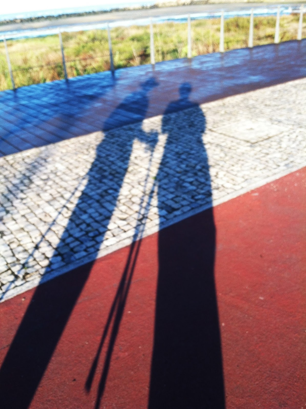
MT Friday, September 16, 2016, 8:28 (8:21) AM – Esposende: Don’s and MT’s
long shadows on promenade (part boardwalk and part paved at this point).
The
promenade led to the fortress and lighthouse and then to the seaside.

8:23 AM – Esposende: fortress and lighthouse from
platform near ocean, in morning sun; the boardwalk we were on curved around
left past the base of the fortress (mild telephoto 90 mm).
The
first village we came to was Marinhas.

8:53 AM – Marinhas: small Capela São
Sebastião (Chapel of St. Sebastian).
Marinhas (pop 6,193) is a
locality in the União des Freguesias de Esposende, Marinhas e Gandra (Union of
the Civil Parishes of Esposende, Marinhas and Gandra) since that merger of
parishes occurred in 2013, in the municipality of Esposende (2 km from the city
of Esposende). The origin of the name Marinhas (which could be translated as
marines or seafood) can be found in the common Portuguese noun marinha (navy, from Latin marina); it is closely associated with
the extraction of salt from the sea, which was done here at least in medieval
times. The patron saint of Marinhas is São Miguel (St. Michael).

8:56 AM – Marinhas: Albergue São Miguel
(Hostel of St. Michael).

9:01 AM – Marinhas: MT approaching south side
of Igreja Matriz.
The Igreja Matriz (Mother Church) of Marinhas has a mixture of styles
and reconstructions. The oldest part is located on the north façade. Looking up
at the eaves, one can see the Romanesque cachorrada*
from the late Middle Ages or 16th century. The Igreja Matriz is the church of
the Paróquia de Miguel das Marinhas ([Religious] Parish of St. Michael of
Marinhas), which was mentioned in a document of 1220 as “São Miguel de Zopães
da Terra do Neiva” (St. Michael of Zopães of the Land of Neiva).
*In architecture, a cacharro
(dog) or misula (shell) is an exposed
element that supports the eaves of a roof or any other projecting body of a
building (arches, architraves, and cornices) and at the same time can have a
decorative character. It can be made of wood or stone. A row or set of cacharros is called a cachorrada
(pack of dogs).

Cacharros in cachorrada
on exterior of Domus Municipalis (Municipal Hall) of Bragança, Portugal

9:04 AM – Marinhas: Igreja Matriz – view from
rear of nave to main altar in apse.
We
asked an old lady saying her rosary at the front left of the nave about carimbos, and she told us to find the
large house next door. All we found was a building with public toilets behind
the church. However, we also found what looked like old stone sarcophagi, but may
have been just water troughs, behind the church.

9:06 AM – Marinhas: Igreja Matriz – stone
water troughs behind church.

9:18 AM – Marinhas: cruzeiro (cross, crucifix) with “S. João do Monte 1997” (St. John
of the Mountain 1997) on base; Capela de São João do Monte (Chapel of St. John
of the Mountain) in background.
The Capela de São João do Monte (Chapel of St. John of the Mountain)
was built around 1914. Around 1952, it was moved back about 40 m when the
present churchyard was added.

9:32 AM – Marinhas: hedge with arches over
gates.

9:35 AM – Marinhas: our first (only brief)
glimpse of sea since Esposende.

9:37 AM – Marinhas: slightly better glimpse
of sea.

9:41 AM – After Marinhas: sign (for roads)
pointing back (right) to Marinhas and ahead (left) to Belinho; small sign of
stone wall for “Rua Estrada Real” (Street [of the] Royal Road).
Next
we came to the village of Belinho.
Belinho is a village
(pop. 2,000) in the freguesia (civil
parish) of the same name in the municipality of Esposende, 7 km north of the
city of Esposende. The patron saint, São Pedro (St. Peter), is venerated in the
church and in the village. The name Belinho comes from the genitive Belini, of
the Roman proper name Belinus. This leads to the supposition that the Romans had
populated this site. The antiquity of Belinho is attested in a document from
1135, in which Dom Afonso Henriques (soon to become King Afonso I of Portugal)
donated to the Archbishop of Braga the “Igrepa de S. Felix de Belínio” and all
rights pertaining to it. Documents mention the “freguesia de Sanfins de Belio”
in 1220, “Ecclesia Sancti Felicis de Belin” in 1320, “San Fizz de Belinho” in
1400, and “S. Finz de Velinho” in 1528. In 1749, it appears with the current
patron saint and name “S. Pedro Fins de Belinho.” Thus, the patron saint seems
to have originally been S. Felíx, a name that was later corrupted and renamed
S. Fins and then S. Pedro Fins.

9:57 AM – Belinho: first view of Igreja de
São Pedro Fins bell tower with onion-shaped dome; on hill in background is
Capela de Nossa Senhora da Guia (telephoto 156 mm).
The Santuário da Senhora da Guia
(Shrine of Our Lady of the Guide) consists of the Capela de Nossa Senhora da Guia (Chapel of Our Lady of the Guide),
surrounded by several terraces. It is located on the Monte da Senhora da Guia,
is on the Miradouro da Senhora da Guia (Scenic Overlook of Our Lady of the
Guide) with a view of the coast from S. Bartolomeu do Mar in the south to Viana
do Castelo in the north. The current chapel inaugurated in 1974. It replaced an
earlier, smaller chapel (17th century) that stood slightly to the right of the
present one, where remnants of its foundations are still visible.

Capela de Nossa Senhora da
Guia on scenic overlook
The front of the chapel has an
arched door, flanked by two rectangular windows with diamond stained glass. It
has a small central oculus quadrilobado
(four-lobed circular window). At the top, in the center is a simple cross on a
plinth with volutes. Four pinnacles decorate the corners of the roof.
Oral tradition attributes two
legends to the Monte da Senhora da Guia. One explains the existence of pictures
of the saint. During the invasions of Barbarians and later of Muslims, this
land was a refuge of the population who brought for their protection the image
of the saint, which would have been protected in one of the niches of the fragas … the current chapel was created
in the mid-1970s, creating better worshiping conditions. The other legend is
about a monk who inhabited a cave at Monte Jóia (Mount Joy), also known as
Monte Cabreiro, in the 19th century. The monk, known as the Monge da Guia (Monk
of Guide), remained in the cave during the summer and travelled to Lisbon
during the winter to sell lottery tickets … the cave is a natural cavity,
carved in the rock, whose narrow entrance is next to a large boulder near the
chapel. In the interior of the cave, one can observe three images of Nossa
Senhora.

9:59 AM – Belinho: view through gate of
courtyard of Igreja de São Pedro Fins bell tower with cruzeiro in foreground.
The parish church, Igreja de São Pedro Fins (Church of St.
Peter in Chains), also known as Igreja Matriz de Belinho (Mother Church of
Belinho) or Igreja Paroquial de Belinho (Parish Church of Belinho), is located
in a square with a granite cruzeiro
(cross) at the entrance. The church was built in 1897, but underwent various
remodelings in 1922 and 1925. It replaced an older building that rose to the
east, at the foot of the hill (Penteado Neiva). There, one can see a
sarcophagus, externally sub-rectangular in shape and with the interior bearing
some traces of anthropomorphism (human shape).
It is a large, beautiful building
with a bell tower attached to the north. The tower has three floors marked
outwardly by protruding estribos [literally
stirrups, possibly cornices]; the roof has an onion-shaped bulbous stone dome, adorned
at the base with a balustrade and erected fogeréus
[possibly pinnacles?] on the four corners. The façade has a rectangular portico
with a curved lintel. It is surmounted by a huge window of the same shape,
whose stone frame, profusely decorated with lacy stonework, houses a colorful
stained glass window. In the multi-curved pediment of the gable is a niche
containing the stone image of the patron saint. The main façade has the date
1897 engraved on it.

MT 10:06 (9:59) AM – Belinho: view across courtyard
of Igreja de São Pedro Fins, with steps of cruzeiro
in left foreground.

9:59 AM (Cropped) – Belinho: Igreja de São
Pedro Fins.

9:59 AM – Belinho: cruzeiro (with “1677” on plinth at base) in courtyard of Igreja de
São Pedro Fins with church in background.
In the churchyard stands a cruzeiro (cross) set on a parallelpiped*
plinth with steps, smooth cylindrical shaft, and capital, in the Corinthian
style, supporting a simple cross. The date 1677 is engraved on the granite
plinth.
*In geometry, a parallelpiped is a three-dimensional
solid body of which each face is a parallelogram and parallel to the opposite
side. A cuboid (6 rectangular faces), a cube (6 square faces), and a
rhombohedron (6 rhombus sides) are all specific types of parallelepiped.
In Belinho, we got self-service carimbo stamps at what appeared to be a
bar, but the carimbo identified it as “María-Gabríela Gonçalves-Enes Mercearia”
(mercearia = grocery store).


Belinho: carimbo stamp from “María-Gabríela Gonçalves-Enes, Mercearia, Rua
Pedro Avelino A. Sampaio, 29, 4740-163 Belinho – ESP, Portugal, Telefono 00351
253 871 170, NIF: 163 085 552” (María-Gabríela Gonçalves-Enes, Grocery Store, Rua
Pedro Avelino A. Sampaio, 29, 4740-163 Belinho – ESP[OSENDE], Portugal, Telephone
00351 253 871 170, NIF [Número Identificação Fiscal = tax identification
number]: 163 085 552).

10:03 AM – Belinho: MT on street passing sign
for Casas de Belinho (condominiums).

10:31 AM – After Belinho: another cruzeiro with date 18[56?] on plinth, and
flowering tree over a gate that said “Casa do Cruzeiro.”

10:39 AM – After Belinho: dirt and stone path
through woods.

10:42 AM – Near Antas: just onto dirt and
stone path through woods – fork in path, with stone marker.

10:42 AM – Near Antas: just onto dirt and
stone path through woods – stone marker, with Camino scallop and cross of
Santiago at top, read “Antas Esposende 2010.” Three yellow arrows at base of
marker pointed to left fork.
Antas is town in a freguesia (civil parish, pop. 2,221) of
the same name at the northern end of the municipality of Esposende and of the
District of Braga. Its patron saint is São Paio. The Rio Neiva, which runs on
the northern border of this parish is the boundary between the District of
Braga and the District of Viana do Castelo.
The name Antas (meaning Menhirs*)
results from a millenniums-old civilization that left evidence of itself here
in the form of small megaliths. One is known as the Menhir de São Paio de Antas
(Menhir of St. Paio of Antas), which is a National Monument. [These megaliths
must be common in this region, since the name of the town is plural, and there
is also another village and freguesia
called Antas in the municipality of Vila Nova de Famalicão farther north in the
District of Braga.]

Antas: Menhir de São Paio
de Antas
#/media/File:MENIR_ANTAS_1.JPG))
The Menhir de São Paio de Antas, also known as Menir de Pedra a Pé, is
a megalithic monument implanted on the small knoll overlooking the parish
church of São Paio de Antas, about 200 m away. Its dating is suggested as
around 3000 to 2000 BC. It was first discovered in 1976. The granite stone is
in a phallic configuration common in this area, with a slight slope to the
south. A Bronze-Age necropolis (cemetery) is nearby. The menhir is 1.65 m in
height and is buried about 30 cm deep. It has been classified as a Property of
Public Interest since 1992.
*A menhir or menir (also known as standing stone, orthostat, lith, or
masseba/matseva) is a large, upright standing stone, usually rough. Menhirs may
be found solely as monoliths (standing alone), or as part of a group of similar
stones. Their size can vary considerably, but their shape is generally uneven
and squared, often tapering toward the top. Menhirs are widely distributed
across Europe, Africa, and Asia; however, they are most numerous in Western
Europe, particularly in Ireland, Great Britain, and Brittany, France. The
largest concentration on the Iberian Peninsula is in Portugal. They were
constructed during many periods across prehistoric times as part of a larger
megalithic culture. In various times and places, they are thought to have been
used for religious ceremonies (including burials), as territorial markers,
elements of a complex ideological system, or early calendars. Some menhirs in
Portugal are thought to have served as territorial markers or to define sacred
spaces.

10:43 AM – Near Antas: narrow path through
woods.

10:43 AM – Near Antas: MT on narrow path
through eucalyptus, where it became rocky.

10:45 AM – Near Antas: MT on steep, narrow,
rocky path (along a rushing stream down to right, probably the Rio Neiva).

10:48 AM – Near Antas: MT on steep, narrow,
rocky path through eucalyptus, with Don’s shadow.

10:48 AM – Near Antas: Don’s long shadow on
rocky path.

10:50 AM – Near Antas: more of narrow, rocky
path ahead, with official Camino arrow on post.

MT 11:03 (10:56) AM – After Antas: MT on narrow stone
footbridge over wider, calmer part of Rio Neiva, with buildings of next village,
Rua de Cima, on hill.
At
the time, we did not know the name of this stream or of the village near the
north bank. The Follow the Camino walking notes did mention “crossing a stone
bridge” (at “Km 12” after Esposende) but did not mention the nearby village.
The Rio Neiva is the boundary between the District of Braga and the
District of Viana do Castelo. A Google Map close-up of the satellite view of
the Rio Neiva in the area north of Belinho and Antas shows this footbridge and
the nearby waterfall between the villages of Guilheta in the District of Braga
and Rua de Cima in the District of Viana do Castelo. The “street view” confirms
that this is the spot where we crossed. As the river flows toward the Foz do
Neiva (Mouth of the Neiva) where it empties into the Atlantic, there are
several dams and waterfalls.

10:57 AM – After Antas: narrow stone
footbridge over wider, calmer part of Rio Neiva, with buildings of next village
(Rua de Cima) on hill.

10:59 AM – After Antas: MT on narrow stone
footbridge over wider, calmer part of Rio Neiva, taking photo of waterfall
upstream at left.

10:59 AM – After Antas: waterfall just
upstream from stone footbridge.

10:59 AM – After Antas: stone sign, at far
end of stone footbridge, pointing right (upstream) to Castelo do Neiva.
The
full note at Km 12 had said: “after crossing the stone bridge take a right
following the arrow into the forest track dirt track [sic!].” This must have
been the arrow in question.

MT 11:07 (11:00) AM – After Antas: Don with stone sign, at far end of stone
footbridge, pointing right (upstream) to Castelo do Neiva.

11:01 AM – After Antas: stone building and
same waterfall, after right turn at end of stone footbridge.

11:07 AM – After Antas: sheep grazing by path
near village (at least one was on a leash).
Since the Follow the Camino walking notes had mentioned “crossing a stone bridge” at Km 12, we thought we should be approaching Km 13.6, where the notes said: “If you are in good form, you can follow the arrow up to the church of St. Nicolas,” which their satellite map showed in the woods just north of a village called Santiago, but we never came to an arrow or a church.
Finally,
we came to Castelo do Neiva.

11:26 AM – Castelo do Neiva: sign with seal
of Freguesia de Castelo do Neiva and Caminho de Santiago sign.
Castelo
do Neiva
is a village and a freguesia (civil
parish, pop. 2,930) of the same name at the
southern end of the municipality of Viana do Castelo. Located
approximately 12 km from the city of Viana do Castelo, it is a traditional
nucleus of fishing, where seaweed harvesting is practiced. It was formerly
called Neiva or Castelo.
The early human occupation of this
site dates back to a prehistoric castro
(hill fortress) and a poblado castrejo
(hill fortress village) of the Iron Age atop the mountain now known as Monte do
Castelo. Excavated Roman coins from the time of Caesar Augustus suggest that
the settlement reached its apogee between the 1st century BC and 1st century
AD, although the precise date of the end of the Roman occupation is unknown. In
the Middle Ages, this was the site chosen for the installation of a stone
castle, which over time gained primacy in the region, establishing itself as
the head of the so-called Terras de Neiva (Lands of the Neiva). This was one of
the castros that swore fidelity to
Dom Afonso Henriques (1112-1185) on the eve of the Battle of São Mamede (1128),
a turning point in the struggle for Portuguese independence. The settlement,
near the right bank of the Rio Neiva, was on the old coastal road from Porto to
Viana do Castelo. Its name ranged from Santiago de Neiva in the 13th century to
Castelo do Neiva, or Neiva, nowadays. This civil parish was first called
Santiago de Neiva and later Castelo do Neiva. The religious parish is still
known as the Paróquia de São Tiago de Castelo do Neiva (Religious Parish of St.
James of Castelo do Neiva).
Documents of 1220 and 1258 mention
its having Santiago (St. James) as its patron saint. The 1220 document referred
to the dominant position of the town of Santiago de Neiva, calling it “Santo
Jacobo de juxta castellum” (St. James at the Foot of the Castle). In a document
of 1290, it appeared with the category of freguesia.
Santiago de Neiva was included in the taxation of churches by the Archbishopric
of Braga in 1320. The freguesia of
Ribeira Neiva (Riverfront of Neiva), together with that of São Romão (St.
Romain), formed the area that, in the time of King Dom João I (ruled
1385-1433), was called Terra de Aguiar de Neiva (Land of Haunt of Eagles of
Neiva).
The medieval Castelo do Neiva (Castle of the Neiva), now disappeared, was
located atop Monte de Castelo (Mountain of the Castle) in the parish of Santiago
do Castelo de Neiva. With the administrative reorganization of the Kingdom of
Portugal at the end of the 14th century, the position of this coastal castle
lost importance, and it fell into decline until its decommissioning in the
early 15th century. Since then, its stones were used in neighboring villages,
and nothing remains except for the foundation of its keep and a few pieces of
the outer wall. These remains reveal very strong Romanization of the fortress.

Castelo do Neiva: coat of arms of the freguesia
(Por
Junta de Freguesia de Castelo do Neiva - Junta de Freguesia de Castelo do
Neiva, Attribution, https://commons.wikimedia.org/w/index.php?curid=10578628).
The
coat of arms of the freguesia of Castelo do Neiva has a blue
shield with a gold castle, trimmed in black, over wavy silver and blue lines
(the river Neiva); above the castle are
two silver scallop shells, highlighted in black. Above the shield is a
silver crown with four towers; below it is a white banner with “Castelo do
Neiva” in black letters.

11:39 AM – Castelo do Neiva: statue of
Santiago Peregrino in niche in wall; we had seen a sign pointing to it (mild
telephoto 54 mm).

11:39 AM – Castelo do Neiva: statue of
Santiago Peregrino in niche in wall (telephoto 76 mm).
Soon
we came to the Igreja Paroquial de São
Tiago de Castelo do Neiva.

11:41 AM – Castelo do Neiva: MT approaching Igreja
Paroquial de São Tiago de Castelo do Neiva, with sign saying “Stamp Inside the
Church” in English, French, German, Spanish, and Portuguese.
The Igreja Paroquial de São Tiago de Castelo do Neiva is one of the
most important landmarks on the Coastal Route to Santiago. During renovation of
the church in 1931, two important archaeological artifacts were found: a votive
altar from the Roman period, dedicated to the deities of the roads and the medieval
inscription from the consecration of the primitive church to Santiago dating
from the year 862 (shortly after the discovery of the tomb of Santiago), thus
being the oldest consecration to the apostle outside the territory of Spain.
The inscription is embedded in the south wall of the church.

11:41 AM – Castelo do Neiva: Igreja Paroquial
de São Tiago de Castelo do Neiva façade and bell tower.

11:41 AM – Castelo do Neiva: Fátima monument,
with Virgin Mary and the 3 children to whom she appeared, in front of Igreja
Paroquial de São Tiago de Castelo do Neiva.

11:42 AM – Castelo do Neiva: sign for “Igreja
Paroquial de São Tiago de Castelo do Neiva (Parish Church of St. Tiago de
Castelo do Neiva” with text in Portuguese and English; English text [edited per
Portuguese]:
“This
parish church is [Portuguese: has been], for many centuries, situated on the
road to Santiago (Way of the Coast)[,] in 1931 to undertake the [Portuguese: while
undertaking the work of] restoration inside the church was found the [following]
inscription of the consecration of the primitive church dedicated to S. Tiago
the Greater in the year 862, by Bishop [D.] Nausti [who] had the title of
Bishop of Coimbra.
“This
inscription proves that devotion to S. Tiago the Greater had spread south of
the Minho now more specifically [Portuguese has instead: already in] the ninth
century [to] Castelo do Neiva, and correspond [Portuguese: besides
corresponding] to the most ancient coronation [Portuguese: consecration to] S.
Tiago known outside [the territory of] Spain. The inscription is inside the
temple behind the side altar, on the right as you enter through the main door.”
Between
the two texts is a picture of the inscription (same as on our carimbo stamps) with the bottom line
partially broken off, with the transcription: “IN DEI DOMINE SACRABIT BASELICA
SANCTI JACOBI APOSTOLI DOMINUS NAUSTI ESPICOPUS …. S ERA DCCCC” and the
Portuguese translation “Em nome do Senhor consagrou a Igreja do Apostolo S.
Tiago o Bispo Nausti ….s na era 900,” which translates in English as “In the
name of the Lord, the Bishop Nausti consecrated the Church of the Apostle St.
James …s in the era 900.”
We
got carimbo
stamps at this church in Castelo do Neiva (self-service and faint) that read
“Caminho Portugués da Costa – Castelo do Neiva” with a copy of the ancient,
crude inscription that seemed to read “IN DINE SACRABIT BASELICA SC[T]I IACOBI
AP[T]LI DMUS NAVASTI EPS [and broken part on another line that ends with] …S
ERA DCCCC.” (The transcription on the sign described above shows what some of
the abbreviated Latin forms stood for.)

Castelo do Neiva: carimbo stamp from “Caminho Portugués da
Costa [Portuguese Camino of the Coast] – Castelo do Neiva” with ancient
inscription and scallop shell.

11:43 AM – Castelo do Neiva: Igreja Paroquial
de São Tiago de Castelo do Neiva – view from rear of nave to main altar in
apse.

11:44 AM – Castelo do Neiva: Igreja Paroquial
de São Tiago de Castelo do Neiva – stained glass window of Santiago Peregrino
and balcony above main door at rear of nave (telephoto 156 mm).

11:47 AM – Castelo do Neiva: Igreja Paroquial
de São Tiago de Castelo do Neiva – exterior view of same stained glass window
of Santiago Peregrino above main door and of statue of Santiago Peregrino in
niche above window (telephoto 64 mm).

11:49 AM – Castelo do Neiva: stone marker, in
front of Igreja Paroquial de São Tiago de Castelo do Neiva, of the Caminho
route of 188 km from Castelo do Neiva on the Rio Neiva to Santiago. NOTE: It
actually shows the “cross-over” route we would take from Caminha (on the
Coastal Route) to Valença and Tui (on the Central Route), although the bottom
right says “Caminho.Portugués.Costa.”

11:50 AM – Castelo do Neiva: Igreja Paroquial
de São Tiago de Castelo do Neiva – view from church back toward the sea (quite
a distance away).
Leaving
Castelo do Neiva, we continues on dirt paths through eucalyptus forest.

11:53 AM – After Castelo do Neiva: MT on more
forest path (uphill).

12:04 PM – After Castelo do Neiva: Camino
marker in woods: “Santiago – Castelo do Neiva Deseja a Todos Bom Caminho” (Santiago
– Castelo do Neiva Wishes to All a Good Trip). Km 187 2014.

12:04 PM – After Castelo do Neiva: MT on path
in eucalyptus forest.

12:08 PM – After Castelo do Neiva: MT on
rocky path between low, rough stone wall (left) and high, mortared wall
(right).

12:23 PM – After Castelo do Neiva: more rocky
path in eucalyptus forest (uphill).

12:24 PM – After Castelo do Neiva: more rocky
path in eucalyptus forest (uphill).

12:32 PM – After Castelo do Neiva: ancient-looking
mossy stone walls on both sides of path in eucalyptus forest.

MT 12:38 (12:31) PM – After Castelo do Neiva: Don with ancient-looking mossy
stone walls on both sides of path in eucalyptus forest.

12:32 PM – São Romão de Neiva: Igreja de São Romão church (closed at
this time).
São
Romão de Neiva
(St. Romain of Neiva) is a freguesia
(civil parish, pop. 1,225) of the same name in the municipality of Viana do Castelo.
There are references to the church of São Romão in documents of the 11th and
12th centuries, in which it is referred to as being an abbey. In a document of
1258, it is referred to as a freguesia.
In a document of 1528, it is referred to as being a Benedictine monastery in
the Terra de Aguiar de Neiva (Land of Haunt of Eagles of Neiva).
The Mosteiro de São Romão de Neiva (Monastery of São Romão de Neiva)
was for male religious of the Order of St. Benedict. The monastery complex
includes the Igreja de São Romão and
the Cruzeiro de São Romão de Neiva (Cross of São Romão de Neiva).
The original primitive foundation
of a Benedictine monastery of São Romão in the Lands of the Neiva dates from
the 10th-11th centuries, and its first church was established around 1022. The
monastery was enlarged and consecrated in 1087 by the bishops of Braga and Tui.
However, in the early years of the 12th century, due to the Arab incursions in
the north of the Iberian Peninsula, this monastic house was in a ruined state,
necessitating its rebuilding after 1110. During the reign of King Afonso
Henriques (Afonso I, 1139-1185), it received a foral (charter) granting it the lands that currently form the civil
parishes of São Romão de Neiva, Alvarães, and Anha. With the reforms carried
out under the Benedictine order, the monastery decayed at the end of the 12th
century, and it was not until the 15th century that there was a revival of the
community, although the monastery was never extinguished during the intervening
3 centuries. In the second half of the 17th century, the Benedictine community
totally demolished the Romanesque building, erecting a new church and
conventual area in the Mannerist style with some Baroque features. The church
has a single nave with two lateral chapels, which give the illusion of having a
transept. The façade has a profuse decorative program of Mannerist lines, full
of scrolls, windings, and pinnacles showing Flemish inspiration. In 1834, in
the context of the “general ecclesiastical reform,” the monastery was closed,
and its assets were incorporated into the National Treasury. What remains of
the conventual area is the Tuscan cloister. In the church, there is a Mannerist
altarpiece of the 17th century; it and other interior decorations were brought
from the Monastery de São Martinho de Tibães, about 50 km away. With the
extinguishing of religious orders in 1834, that Benedictine monastery was also
closed; its contents, furniture, and buildings were sold at public auction, and
the monastery building itself was sold in 1864 and subsequently fell into
dilapidation and ruin.

12:39 PM – São Romão de Neiva: steps across
from church leading uphill with Stations of the Cross.
The monastery is located at the
foot of the Monte do Crasto (Mount
of Crasto). In front of the monastery is a granite staircase of about 150 steps leading up the mountain, with
paintings on azulejo tiles
representing the Via Sacra (Way of the Cross) mounted on posts at each level in
the first part of the staircase. At the top of the stairs is the Capela da
Senhora do Crasto (Chapel of Our Lady of Crasto). This chapel, or hermitage, is
estimated to have been founded around the 16th century, when Benedictine friars
were sent up to pray vespers and watch the sunset over the Atlantic. The
current chapel was built in 1935.

12:46 PM – São Romão de Neiva: sign by gate of
cemetery next to church, giving the hours it is open in Verão (Summer) and
Inverno (Winter), posted by the “Junta de Freguesia de São Romão de Neiva”
(Council of the Civil Parish of São Romão de Neiva) – Don took this photo just
to identify the location.

12:46 PM – São Romão de Neiva: Cruzeiro de
São Romão de Neiva.
The Cruzeiro de São Romão de Neiva (Cross of São Romão de Neiva) has a
quadrangular base with five steps, a parallelepiped plinth, and a smooth shaft
with a Tuscan capital, surmounted by a sphere and a Latin cross. Erected in
1715, a few tens of meters from the Benedictine monastery, it has been
classified as a Property of Public Interest.

12:48 PM – São Romão de Neiva: sign for going
to the Capela da Senhora do Crasto by road, to left off the Camino route (we
didn’t go there and didn’t know at the time that it was at the top of the
staircase).
Next,
we came to the village of Chafé,
where we briefly saw the church, but didn’t check it out

12:53 PM – Chafé: sign entering town, with
coat of arms of the freguesia.
Chafé is a village and
a freguesia (civil parish, pop. 2,841)
of the same name in the municipality of Viana do Castelo. The parish borders
the Atlantic coast, but the village is located a few km from the coast, 7 km
south of the city of Viana do Castelo.
The paróquia (religious parish) of São João de Ester (St. John of
Esther), belonging to the Terra de Neiva (Land of Neiva), is located in the freguesia (civil parish) of Chafé, which
is on the southern border of the municipality of Viana do Castelo. Some
confusion about the civil and ecclesiastical administrative structure has
existed since the mid-11th century. Its location was, in part, within the jurisdiction
of the Benedictine Monastery of São Romão de Neiva; however, part of the
religious parish of São João de Ester was outside the domain of the monks and
thus had to pay texts to the King, as recorded in 1220. From its foundation,
Chafé had its own church, dedicated to São João Baptista (St. John the Baptist),
located in the village of Ester, in the northern foothills of the Monte de
Castelo do Neiva. In the 12th century, the phenomenon of sand invasion began to
affect the most coastal areas of the parish of São João de Ester, and the
village of Ester was buried in the sands, the houses destroyed, among them the
church. The people had to move farther inland and reorganize.
The coat of arms of Chafé has a golden shield with three red arrows
placed in roquete and tied in black, flanked to the left by a bunch of purple grapes
with green leaves and on the right by a cob of red corn in a green husk; below
the arrows are three strips of wavy green and silver lines. Above the shield os
a soi;ver crown with three towers; below it is a white banner with “Chafgé” in
black capital letters.

1:07 PM – Chafé: Igreja de São Sebastião,
with onion-shaped dome on bell tower.
The Igreja de São Sebastião (Church of St. Sebastian), also known as Igreja
Paroquial de Chafé (Parish Church of Chafé) or Igreja Matriz de Chafé (Mother
Church of Chafé), is a small church with a single nave. Above the window on the
façade is a niche with a statue of St. Sebastian.
Next
we came to Vila Nova de Anha.

1:28 PM – Vila Nova de Anha: sign entering
the freguesia.
Vila
Nova de Anha
(New Town of Anha) or (previously) just Anha, is a town in a freguesia (civil parish, pop. 2,410) of
the same name, in the municipality of Viana do Castelo. It only received the
status of vila (town) in 1985, at
which time it changed its name. It is located about 4 km south of the city of
Viana do Castelo, on the left bank of the Rio Lima.
The parish is a very old povoação (village), whose foundation
dates back to the times of the Reconquista
(Reconquest) and appears in old documents as part of the Terras de Neiva (Lands
of Neiva). There are, however, documents from the end of the 9th century that
mention this parish, which was then called Ânia. Anha was already a paróquia (religious parish) before the construction of the
Benedictine monastery of São Romão do Neiva, whose first church is from about
1022. The first known reference to Anha was in a document of 1063. In documents
of 1220 and 1258, it is mentioned under the name of Santiago de Anha, located
in the Lands of Neiva. In 1290, it appears with the category of freguesia. The Igreja de Santiago de
Anha was taxed in 1320. A document of 1528 also mentions Santiago de Anha, in
the Land of Aguiar de Neiva.

1:40 PM – Vila Nova de Anha: Igreja Matriz da
Paróquia de São Tiago – MT in front of façade with statue of Santiago Peregrino
(St. James the Pilgrim) above stained glass
window of knight on horseback, bell tower at left; azulejo tiles on both tower and façade.
The Igreja Matriz da Paróquia de São Tiago (Mother Church of the Reilgious
Parish of St. James) is a Baroque church of the 18th century. However, the
Igreja de Santiago de Anha was listed as being taxed in 1320. It is dedicated
to the patron saint of the town, and the current church has a set of stained
glass that shows his apostolic path.
The
web site of the religious parish identifies it as “Paróquia Vila Nova de Anha” but
also more fully as “Paróquia São Tiago de Vila Nova de Anha” in the “Diocese
Viana do Castelo.” The web site of the town refers to the church as “Igreja Matriz.”
1:41 PM – Vila Nova de Anha: Igreja Matriz da
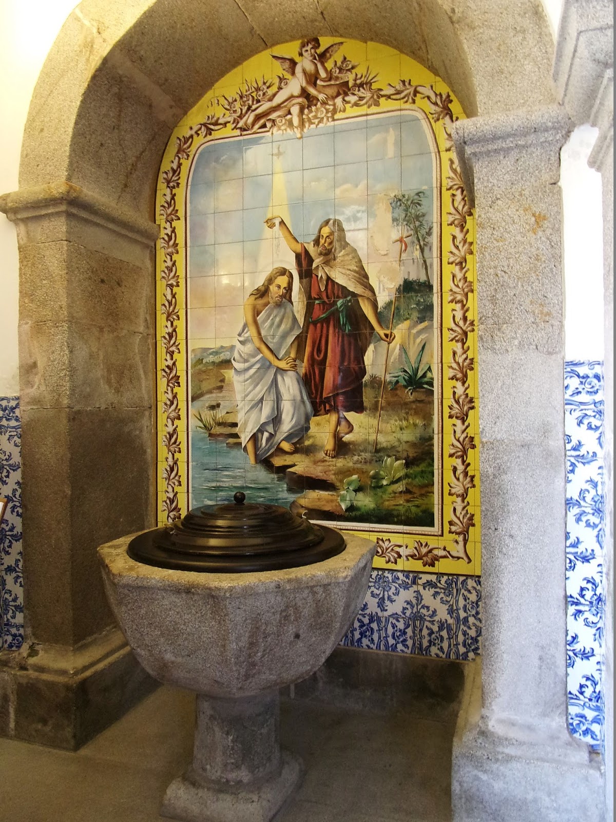
Paróquia de São Tiago – painting of Baptism of Jesus on tiles behind baptismal
font at left rear of nave, beside the guest book and self-service carimbo stamp; azulejo tiles on lower walls.

1:48 PM – Vila Nova de Anha: Igreja Matriz da
Paróquia de São Tiago – guest book for “Registro de Passagem de Peregrinos
(List passage of Pilgrims),” where we had just signed in with the comment
“Lovely,” by self-service carimbo
stamp at left rear of nave; the letterhead “Igreja Paróquial de S. Tiago, Vila Nova de Anha” at
the top, along with the carimbo, helped
identify the church for us.

Vila Nova de Anha: carimbo stamp from “S. Tiago de V. N. de
Anha – Caminho Portugués do Noroeste” (St. Tiago of V[ila] N[ova] de Anha – Portuguese
Camino of the Northwest); very faint, since ink pad for self-service was low on
ink.

1:42 PM – Vila Nova de Anha: Igreja Matriz da
Paróquia de São Tiago – view from rear of single nave, with vaulted ceiling and
azulejo tiles on walls, toward main
altar in apse.

1:42 PM – Vila Nova de Anha: Igreja Matriz da
Paróquia de São Tiago – main altar.

1:43 PM – Vila Nova de Anha: Igreja Matriz da
Paróquia de São Tiago – view from front left corner of nave toward the rear,
with a balcony and stained glass window over the main door.

1:43 PM – Vila Nova de Anha: Igreja Matriz da
Paróquia de São Tiago – stained glass window over the main door, picturing a
knight on horseback with the cross of Santiago on his shield, possibly
representing Santiago Matamoros (St. James the Moorslayer) (telephoto 360 mm).

MT 1:52 (1:45) PM – Vila Nova de Anha: Igreja
Matriz da Paróquia de São Tiago – stained glass window of Jesus on shore
directing disciples to catch fish.

1:46 PM – Vila Nova de Anha: Igreja Matriz da
Paróquia de São Tiago – statue of Santiago Apóstol (St. James the Apostle) in
niche on left side of main door interior (telephoto 90 mm).
Just
up the street from the church was a cruzeiro (cross), then an hórreo
and another cruzeiro.

1:50 PM – Vila Nova de Anha: cruzeiro.

1:58 PM – Vila Nova de Anha: hórreo (mild telephoto 64 mm).

1:58 PM – Vila Nova de Anha: same hórreo (mild telephoto 64 mm).

1:59 PM – Vila Nova de Anha: another cruzeiro; post in foreground with coat
of arms and “Paço D’Anha.”
The Quinta do Paço D’Anha (Manor House of the Palace of Anha), from the
16th century, is set in a large estate overlooking the town of Viana do
Castelo, with views of the Atlantic. The old manor has remained in the same
family for more than 400 years. It is now operated as a guest house, with four cottages
in renovated rural buildings next to the main house. The Quinta is also a
leading producer of Vinho Verde (Green Wine).

2:03 PM – After Vila Nova de Anha: outdoor
laundry with lady doing her wash; small blue signs with yellow Caminho arrow (pointing
right) and scallop shell on left.

MT 2:18 (2:11) PM – After Vila Nova de Anha: more
small blue signs with yellow Caminho arrow (pointing left) and scallop shell on
corner of another building.
Next,
we would go past the village of Darque.

2:19 PM – Between Vila Nova de Anha and
Darque: sign for Darque city limits on side of road, still in forest and not
yet in the village (looking back, on the other side of the road was a sign for
entering Vila Nova de Anha).
Darque is vila (town) in a freguesia (civil parish, pop. 7,817) of the same name in the
municipality of Viana do Castelo. The first reference to Darque dates from 895.
Documents from 1220 an 1258 mention it under the name “De Sancta Maria de
Arenis,” located in the Land of Neiva. It is mentioned in 1290 with the
category of freguesia. The taxation
of 1320 included the Igreja de Santa Maria de Areias, in the Land of Aguiar de
Neiva. A tax document of 1528 still referred to Santa María das Areias, but
after that it returned to the old place name Darque, taking São Sebastião (St.
Sebastian) as its patron saint. Darque was elevated to the status of vila (town) in 1986.

2:24 PM – Darque: first view of Viana do
Castelo in distance.

2:44 PM – Approaching Viana do Castelo, with Santuário
de Santa Luzia on hill and Eiffel bridge at right (mild telephoto 64 mm).
When
we approached the river before Viana do
Castelo, the Dutch men said they had read that there was a ferry, but we
had to cross the long metal bridge (built by Eiffel, of tower fame) over the
Rio Lima.
The Ponte Rodo-Ferroviária de Viana do Castelo (Road-Railway Bridge of Viana
do Castelo), better known as Ponte Eiffel
(Eiffel Bridge), designed by Gustave Eiffel, opened in 1878, at the height
of the Architecture of Iron. The metal bridge over the Rio Lima allows rail
traffic on its lower level and pedestrian and automobile traffic on the upper
level. Its roadways are 563 m long (total length about 645 m with ramps) and 6
m wide. It connects the freguesia
(civil parish) of Santa María Maior, in the city of Viana do Castelo, to the
village of Darque.
Originally, the crossing of the
Rio Lima was only by boat or ferry. Construction of a wooden bridge was
approved in 1807 but, because of the French invasions, work was delayed until between
1818 and 1820. This was considered a temporary solution, until it could be replaced
by a stone bridge. However, bridge tolls were only sufficient for the upkeep of
the wooden one. Finally, in 1852, the poor condition of the old bridge, and the
fact that its low structure restricted the operation of the port, led to
passing a law ordering a new one. However, much debate and several proposals
followed. Work finally began in 1877, with the company of Gustave Eiffel in
charge but with two other engineers actually directing the work, and was
completed in 1878. Eiffel always considered this bridge one of his masterpieces.
Construction of this bridge, together with the implementation of the railroad
and the extension of the port area, profoundly changed the city of Viana do
Castelo.

2:51 PM – Viana do Castelo: crossing Rio Lima
on Eiffel bridge, with Santuário de Santa Luzia on hill (mild telephoto 54 mm).

2:57 PM – Viana do Castelo: Santuário de Santa
Luzia on hill (telephoto 90 mm).

2:54 PM – Viana do Castelo: Santuário de Santa
Luzia on hill (telephoto 220 mm).
The Santuário de Santa Luzia, also known as Basilica de Santa Luzia, on
Monte Santa Luzia, was constructed in 1903, inspired by the Sacré Coeur de
Montmartre in Paris. One of the most emblematic monuments of the city, its
architecture harmonizes Neoromanesque, Neobyzantine, and Neogothic elements. From
the basilica’s mountaintop location, there are spectacular views of the city
and nearby beach. It can be reached by car via the Santa Luzia highway or by
taking the Santa Luzia Elevator.

Viana do Castelo:
Santuário de Santa Luzia – south façade
.jpg)

Viana do Castelo:
Santuário de Santa Luzia – north (back) side
.jpg))
Viana
do Castelo
is a city (pop. 36,148) and a concelho
(municipality, pop. 88,725) of the same name and also the seat of the District
of Viana do Castelo in the Norte Region of Portugal. It is located on the right
bank of the estuary of the Rio Lima, is one of the most beautiful and best
preserved historical centers in Portugal. It is highlighted by the façades of
its buildings and its azulejo tiles. The
19th-century boulevards and narrow lanes of its old quarter are crowded with
Manueline manor houses and Rococo palaces. The city is sometimes called simply
Viana.
Human settlement in the region of
Viana began during the Mesolithic era. Even around the Roman occupation, the
area was settled along the Monte de Santa Luzia. The city’s pre-Christian
origins can be seen in the remains of a Celto-Iberian castro (hill fortress), known as the Cidade Vela (Old City), near
the Basilica of Santa Luzia. The settlement of Viana da Foz do Lima (Viana of
the Mouth of the Lima), which it was called when King Afonso III granted it a foral (charter) in 1258, was a
formalization of the name Viana that the area was called already in 1253. In
the 16th century, its port gained importance as one of the entry points for
Portuguese explorers and traders in the Age of Discovery. Many of the
historical buildings date from that period. Defensive structures protected the
prosperity derived from the port, designed to repel pirates from Galicia and North
Africa. The Castelo de São Tiago da Barro, the first fortification at the mouth
of Rio Lima, had been built during the reign of King Afonso III (1248-1279); at
the end of the 16th century, it underwent restoration, taking on its present
polygonal shape. After the maritime discoveries and trade, the commercial life
of Viana reached its height during the reign of Queen María II (1834-1853), the
monarch established the Associação Comercial de Viana do Castelo (Commercial
Association of Viana do Castelo) in 1852, the fourth oldest public company of
its type. To reward the citizens for loyalty in not surrendering to the Count
of Antas, a general who had led revolutionary forces against her, the Queen had
elevated the town to the status of cidade
(city) in 1848, renaming the settlement with its current name.
Once
across the bridge, there was a traffic circle with many ways out; so we asked a
middle-aged man how to find Praça de Galiza (Square of Galicia), on which our
hotel was located, and he told us to go off to the left. After a block or so,
it didn’t look like the major street on our lodging voucher map. We asked a
white-haired man (carrying a bag of fruit, probably on his way home), and he
told us we had to go back and then under the bridge (to the east); then he said
he would just take us there, and he walked with us under the bridge and a short
way until we could see the Hotel do
Parque (3-star). At the hotel, we got our fourth carimbos of the day.

4:34 PM – Viana do Castelo: Hotel do Parque -
exterior.


Viana do Castelo: carimbo stamp from “Hotel
do Parque, Teixeira & Crispim, Lda., Praça da Galiza, 4900 Viana do Castelo.”
The Hotel do Parque had no restaurant, but when Don showed the desk clerk our voucher for dinner, she made us a reservation for 7:30 pm at Restaurante Nautico, 50 m from the hotel.
At
7 pm, we went to Restaurante Nautico,
with a card from the hotel authorizing dinner. We got: 750-ml bottle of red
wine; 0.5-liter bottle of water; starters: bread, olives, and some kind of
beans; 1st course: vegetable soup; 2nd course: grilled pescada por dois (hake
for two), with cooked potatoes, carrots, and cabbage (when MT thought the
cabbage was a salad, the waiter offered us a mixed salad, too); dessert: fruit.

7:11 PM – Viana do Castelo: Restaurante
Nautico - our pescada por dois (hake for two).
No comments:
Post a Comment