This post is based primarily on
Don's notes, occasionally supplemented with MT's notes from our Camino in 2016.
When information from other sources is added—for further explanation to readers
or to satisfy our own curiosity—that is set off in a text box (as this one).
Most of the photos that accompany
this post are from Don’s camera (with a caption indicating the time it was
taken); those from MT’s iPhone are indicated by “MT” placed at the beginning of
the photo caption. Photos from any other source (such as the public domain
Wikimedia Commons) indicate that source in the caption.
We
woke at 7 am and ate breakfast at Hotel Umu.
The
desk clerk called a taxi to take us across town to where we needed to restart
the Camino route. The taxi departed Hotel Umu at 8:28 and arrived at Portas do Sol at 8:35.
We
began the Camino route at Porta de
Santiago at 8:40. (All day long, we saw no other pilgrims, but could see
the footprints on one or sometimes two people in the dust or mud of the dirt
tracks.)

Wednesday, August 31, 2016, 8:40 AM – Santarém: Porta de Santiago with MT.

8:43 AM – Santarém: MT on her way down the steep,
rocky, wooded path.
The
rocky path down the hill led to highway N-114, where we turned left along the
highway a short distance before an asphalt path led to the right, down toward
the Igreja Santa Cruz (Church of the
Holy Cross), which we never saw. The street at the bottom was not marked; so we
asked several local people how to get to Calcada Atamarma or to Ponte Alcôrce,
shown on Brierley’s map. We finally found a crossing over the railroad tracks
that led to the medieval bridge Ponte
Alcôrce and onto a quiet country road. Brierley’s map showed a farmhouse on
the right where we were supposed to turn left, but the house was really on the
left.
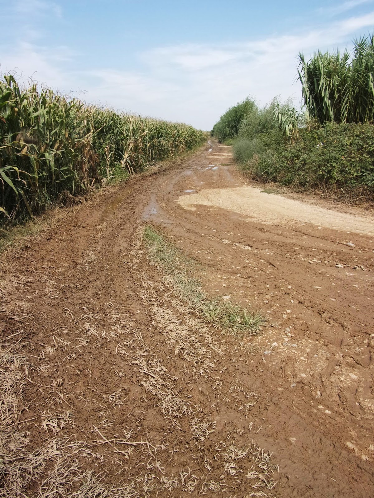
From
there, we took a series of paths and dirt roads through crop fields—mostly corn
(signs identified Pioneer and Agromais brands of seed), some sunflowers, some
vineyards with green and red grapes (the grapes tasted OK, and a few men seemed
to be checking them for harvest), lots of fields of tomatoes (some being
harvested), a few with green pumpkins, and green and red peppers (the red ones
being harvested).
We
soon got a good view of tomatoes
being harvested by combine, along the Rio Tejo.

9:19 AM – large field of red tomatoes on vines.

MT 9:42 AM – Don with grape vines.

10:07 AM – view across tomato field to where
tomatoes were being harvested by combine rear (telephoto 360 mm).

10:11 AM – Tomatoes being harvested by combine,
with conveyor shooting tomatoes into trailer behind tractor, and shooting out
vines at the rear (telephoto 156 mm).

10:12 AM – Tomatoes being harvested by combine,
shows tomatoes and vines being cut and reeled into the front of the combine,
below the operator in the cab, and a woman riding in a position to check
tomatoes before conveyor takes them up and shoots them into the trailer
(telephoto 360 mm).

10:13 AM – Tomatoes being harvested by combine,
with clearer view of woman at side; also first view of white birds following
combine (telephoto 156 mm).

10:13 AM – Tomatoes being harvested by combine;
view from other side shows size of trailer collecting tomatoes; white birds
following combine and trailer, for leftovers (telephoto 46 mm).

10:15 AM – White long-necked birds also in unpicked
part of tomato field (telephoto 220 mm).

10:33 AM – Another Zona de Caça Associativa sign
(Hunting Zone of an Association).

10:36 AM – Green pumpkins in field (telephoto 220 mm).

10:41 AM – Quinta Cruz de Légua: overgrown sign by
door (telephoto 90 mm).

10:42 AM – Quinta Cruz de Légua - exterior (ruins).
A quinta (pronounced KEEN-tah
in Portuguese or Spanish) is a large house in the country or on the outskirts
of a town—a manor house. Sometimes the term refers to the entire country estate
(manor estate), not just the house.
The term quinta originally referred to a farm or house let out for a rent of
one fifth of its produce, from (Spanish or Portuguese) quinta parte “fifth part,” in turn from Latin feminine of quintus “one-fifth.” This is why even
some small, humble properties may bear the name Quinta—a misnomer or a vain
attempt to elevate them to a higher status.
The term may also be used for an
inn, particularly one in the countryside. Nowadays, many quintas that were manor houses have been converted into inns.
However, many are now deserted.
Around
11:04 am, we entered the Freguesia de
Vale de Figueira (civil parish of Vale de Figueira).

11:04 AM – MT by sign for “Freguesia de Vale de
Figueira,” the civil parish, just before the town of the same name; the bottom
of the sign says “Saúda-vos” (Greetings to you).

11:07 AM – Back side of that sign: “Gratos pela
Visita—Bom Viagem” (Grateful for the Visit—[Have a ]Good Trip), with MT behind
sign.
We
stopped at a café in Vale de Figueira
(11:30-11:40) for a liter of water and to use the banho.
Vale
de Figueira
is a village with almost 2,000 people. Opinions differ, but most believe the origin
of the town’s name comes from the no-linger existing coating of fig trees that
used to cover the area. Still, its foundation is believed to be from the time
of the Roman Empire, and the village was also considered one of the favorite
places for Portuguese kings to visit, stay and rest.
The beautiful meadowlands (lezíria) of Vale de Figueira are bathed
by both the Tagus (Tejo) and Alviela Rivers and are famous for their beauty. It
is in a land of campinos (the
regional name given to cattle herders), horses, bulls, and nature that help
make Vale de Figueira a unique place in the Ribatejo region. The village is
rich in the production of wine and cereals. Also famous are the many quintas (manor houses) in and around the
village, some of which are very famous for their livestock (bulls, cows, and
horses).
Then
we came to a cork tree plantation.

11:49 AM – After Vale de Figueira: Entrance to cork
plantation.

11:58 AM – After Vale de Figueira: MT taking photo
of cork tree with a yellow arrow on the lower part of its trunk, which was
stripped of bark.

MT 12:05 PM – After Vale de Figueira: MT’s photo of
cork tree with a yellow arrow on the lower part of its trunk, which was
stripped of bark.
Cork
oaks
reach maturity when they are about 25 years old. Once they reach maturity, they
are harvested every 9 years, by stripping the bark from the trunk and major
branches. It doesn’t harm the tree, and the cork bark regrows. The trees live
for about 300 years. Most cork forests are in Portugal and Spain.

12:05 PM – After Vale de Figueira: sunflowers in
field.

12:48 PM – After Vale de Figueira: “sneaky” (very
hard to see) yellow arrow for right turn, over electric box.

12:48 PM – After Vale de Figueira: close-up of “sneaky”
yellow arrow for right turn (see red circle), over electric box.
We
paused (12:50-1:05) for a water break and to eat apples, from the breakfast
buffet, by a (water) tank with a nice Camino sign.

12:49 PM – After Vale de Figueira: yellow Camino
arrow on base of (water) tank; sign at right is for Casa de Azzancha between
Santarém and Golegã (it is actually a casa
rural (bed and breakfast) in the town of Azinhaga, which we would reach over
an hour later).

MT 1:01 PM – After Vale de Figueira: sign for Inn
Golegã Hostel, on tree near (water) tank, with yellow arrow and shell pointing
the way.

MT 12:59 PM – After Vale de Figueira: drawing on
tank or pilgrim Erick in trail to Santiago 31/07/2016.

12:49 PM – After Vale de Figueira: utility pole
opposite the tank, with a yellow X, meaning don’t go this way; there is also a red-and-white
sign for “Zona de Caça Municipal” (Municipal Hunting Zone, as opposed to
Associativa ones we had seen earlier).

1:17 PM – After Vale de Figueira: “Corn as high as
an elephant’s eye” on both sides of dirt road, with irrigation sprinklers on
poles (with shields to block water from getting on road—although not always
succeeding).

1:36 PM – After Vale de Figueira: Don by sign for
“Município da Golegã.” A município (municipality)
is larger than the town of the same name. The sign is by a large stand of cane,
which often grows near a river. Hard to see on post below sign is another
red-and-white sign for Zona de Caça Municipal, for that municipality.

MT 1:44 PM – After Vale de Figueira: MT by sign for
“Município da Golegã.” Hard to see on post below sign is another red-and-white
sign for Zona de Caça Municipal, for that municipality.

1:41 PM – Município da Golegã: large container full
of red peppers along dirt road.

1:42 PM – Município da Golegã: workers hand-picking
red peppers and putting them into a trailer with baskets behind the tractor.

1:42 PM – Município da Golegã: workers hand-picking
red peppers and putting them into a trailer with baskets behind the tractor
(Cropped).

1:44 PM – Município da Golegã: more red peppers on
vines.
At
2:14, we came to the town of Pombalinho.

2:14 PM – Pombalinho: signs entering town; welcome
sign on left, city limit sign on right; in the distance on the right is a sign
for “rota do vinho do Ribatejo” (route of wine of Ribatejo).
Pombalinho is a frequesia (civil parish, pop. 448) in
the concelho (county) of Golegã; it
is also the mane of the principal town in that parish. The parish was an
ancient Roman villa, under the jurisdiction of Santarém. It was originally
called Santa Cruz de Pombal (Holy Cross of the Dovecote), until the 18th
century when it became known by the current name Pombalinho to distinguish it
from other town of the same name, especially from the town of Pombal (the seat
of the municipality of the same name that included Alvaiazere and Ansião,
through which we would pass 3 days later).

2:14 PM – Pombalinho: sign “Bem-Vindos à Freguesia
de Pombalinho” (Welcome to the civil parish of Pombalinho) – “400 anos de
história” (400 years of history; the parish was founded in 1606, by King Philip
III of Spain) – “O prazer em viver no campo” (The pleasure of living in the
country). The crest of the freguesia
shows two doves (pombos in
Portuguese), which could roost in a pombalinho
(a small pombal, Portuguese for
dovecote).
We
stopped at the Pombalinho city hall
to ask if there might be a bus or taxi to take MT the rest of the way to Golegã,
since her knees were killing her. The lady who waited on us first explained
that the name Golegã was pronounced Goo-le-GAN. Then she said that there were
no more busses; so we had her call a taxi.
[The
taxi driver charged MT €14 and took her to Hotal Lusitano, rather than
Lusitanus. The problem was that Lusitanus, where we had reservations, was not a
hotel, even though Brierley lists it as one (on his map, but in the wrong
location). Instead, it is part of the Equestrian Center. Don would have the
same problem when he got to Golegã.]
With
the taxi on the way, Don departed at 2:30 to walk the rest of the way to Golegã.

2:27 PM – Pombalinho: Igreja Paróquial de Santa Cruz
– façade and tower; sign at right is for Jardim Pombalinho rest zone and public
garden, 50 m to the right on the Pilgrim’s Road to Santiago.
The Igreja Paróquial de Santa Cruz (Parish Church of the Holy Cross), in
Pombalinho, was built in the 17th century, replacing an earlier church that was
destroyed by various floods of the River Tagus (Tejo).

2:27 PM – Pombalinho: Igreja Paróquial de Santa
Cruz façade and tower, closer-up; the highway sign at the base of the tower points
LEFT to Golegã, although the Camino route went to the right.

2:30 PM – Pombalinho: sign for “Pombalinho, Terra
de Cheias” (Pombalinho, Land of Floods showing heights of flood waters in various
years: the highest in 1979, and the most recent in 2013.
This
was when Don realized that the well-marked route with blue-and-yellow square
[metal or ceramic?] signs was the “green” alternate preferred route in
Brierley, where flooding in 2012 caused the creation of a new route.

2:36 PM – Near Pombalinho: nice Camino marker,
credited to Município de Golegã | Pelouro do Turismo (Municipality of Golegã |
[Office?] of Tourism), did not bother to have the rays of the shell logo point
the same direction as the arrow (but the Portuguese in general do not follow
that Spanish norm).

2:45 PM – After Pombalinho: Dekalb sign by
cornfield.

2:46 PM – After Pombalinho: Some water from
sprinklers making dirt road muddy, but not as bad as in some places before this.
2:47 PM – After Pombalinho: road off to left (with
yellow X, meaning it was not the Camino), with more mud.

2:51 PM – After Pombalinho: tomatoes on withered
vines (Don ate one).

2:54 PM – After Pombalinho: tractor with large
trailer full of tomatoes.

3:06 PM – After Pombalinho: First sight of some
town (Golegã? – wishful thinking! – more likely Azinhaga) in distance.

3:12 PM – After Pombalinho: sprinkler on pole, with
shield.

3:13 PM – After Pombalinho: sprinklers spraying
water (telephoto 156 mm).
Around
3:15, Don reached the town of Azinhaga,
although he had not seen any city limit sign on the country road on which he
entered town.
Azinhaga, also known as
Azinhaga do Ribatejo, in a town and a freguesia
civil parish in the concelho (county)
of Golegã. The parish has a population of 1,620. The oldest known documentation
of Azinhaga is the charter granted by King Sancho II of Portugal (reigned
1223-1247); so its existence dates back at least to the early days of
Portuguese nationhood. However, evidence that its origins were prior to the
foundation of the Kingdom includes the fact that the name Azinhaga (or Azenhaga)
comes from the Arabic الزنقة az-zanqa (the term zanqa preceded by the definite article) which means narrow road,
narrow alleyway between hills, moors or hedges. The term azinhaga now means “lane” in Portuguese.
Azinhaga has a variety of cafés
and bars and connections to the original medieval pilgrim route.

3:17 PM – Azinhaga: sign for “Rota do Cavalo e do
Ribatejo” (Route of the Horse and of Ribatejo), a route by horse from
Pombalinho through Azinhaga and Golegã to São Castano, with yellow arrow on
pole above it, pointing up (straight ahead), although this pole is on a corner.

3:18 PM – Azinhaga: part of that sign showing cumulative
distances from start of route to these 4 towns (Pombalinho to Golegã = 15.5 – 4
= 11.5 km, Azinhaga to Golegã = 15.5 - 8.2 = 7.3 km).

3:19 PM – Azinhaga: Monument marker for “Obra de
Requalificação das Margens do Rio Almonda” (Work of Rehabilitation of the Banks
of the Almonda River). The
Almonda is a tributary that flows into the Rio Tejo southeast of Azinhaga,
coming from the northwest, where the Camino would cross it; the fact that this
marker is dated “Azinhaga, 30 de Abril de 2016” was Don’s first indication of
what town this was, since he hadn’t see any city limit or welcome sign.

3:27 PM – Azinhaga: Statue of novelist José
Saramago.
Nobel Laureate José Saramago was born in Azinhaga in
1922 and died in 2010. He became the first Portuguese writer to win the Nobel
Prize for literature in 1998. More than two million copies of his books have
been sold in Portugal alone, and his works have been published in over 30
languages.
Then
Don came to the Igreja Matriz de Nossa
Senhora da Conceição, on Rua do Espirito Santo.

3:30 PM – Azinhaga: Igreja Matriz de Nossa Senhora
da Conceição façade and tower; small sign for “Rua do Espírito Santo” on church
wall indicates the church faces that street; sign on corner indicates direction
to Golegã (also for Camino route).
Igreja
Matriz de Nossa Senhora da Conceição (Church of Our Lady of the Conception),
or simply Igreja Matriz, built in the 17th-19th centuries, has Mannerist and
Baroque architectural features. Probably built in the second half of the 17th
century, it was originally known as Santa María da Azinhaga and also known as
Santa María do Almonda or Santa María da Ponte de Azinhaga. The building of the
17th century had a facade distinguished by a Baroque portal framed by columns
and topped by a lacy tracery window in harmonious rendition. It was totally
destroyed by French troops during the third invasion (1810-1811). Its
reconstruction, in which it acquired a tower, ended in 1882. It was after this
reconstruction that it acquired the current name. It is the largest church in
the Ribatejo region.
Farther
along Rua do Espirito Santo, he came to the Capela do Espirito Santo.

3:32 PM – Azinhaga: Capela do Espírito Santo.
The Capela do Espírito Santo (Chapel of the Holy Spirit) was built in
the 15th or 16th century with rustic simplicity.

3:32 PM – Azinhaga: Capela do Espírito Santo; building
next to it to its right (hospital?), and then Igreja Matriz de Nossa Senhora da
Conceição at the far end of the block.
A
little farther on that street, there was a building with a nice façade, behind
which the roof was collapsing.

3:32 PM – Azinhaga: building with nice façade, but
collapsing roof behind it.

3:33 PM – Azinhaga: façade of same building, with azulejos in pediment at top, which says:
“António Caetano 18-10-1935,” probably the name of the man who had it built and
the date of construction.
In
a roundabout at the far end of Azinhaga, there was a statue, Monumento ao Campino (Monument to a Herdsman),
in honor of the campinos (herdsmen)
of the area.

3:37 PM – Azinhaga: Monumento ao Campino; inscription
on base “ C.M.G. 2005” is for Câmara Municipal da Golegã, which erected the
statue in 2005; highway sign in background points to Golegã.

3:37 PM – Azinhaga: plaque for: “Monumento ao
Campino – de autoria do escultor Rui Fernandes, sob a egide do Exmo. Presidente
da Câmara Municipal da Golegã, Dr. José Veiga Maltez, foi inaugurado a 26 de
Maio de 2005. Município de Golegã” [Monument to a Herdsman –of the authorship
of the sculptor Rui Fernandes, under the aegis of His Excellency the President
of the Council of Golegã, Dr. José Veiga Maltez, was inaugurated on May 26,
2005. Municipality of Golegã].
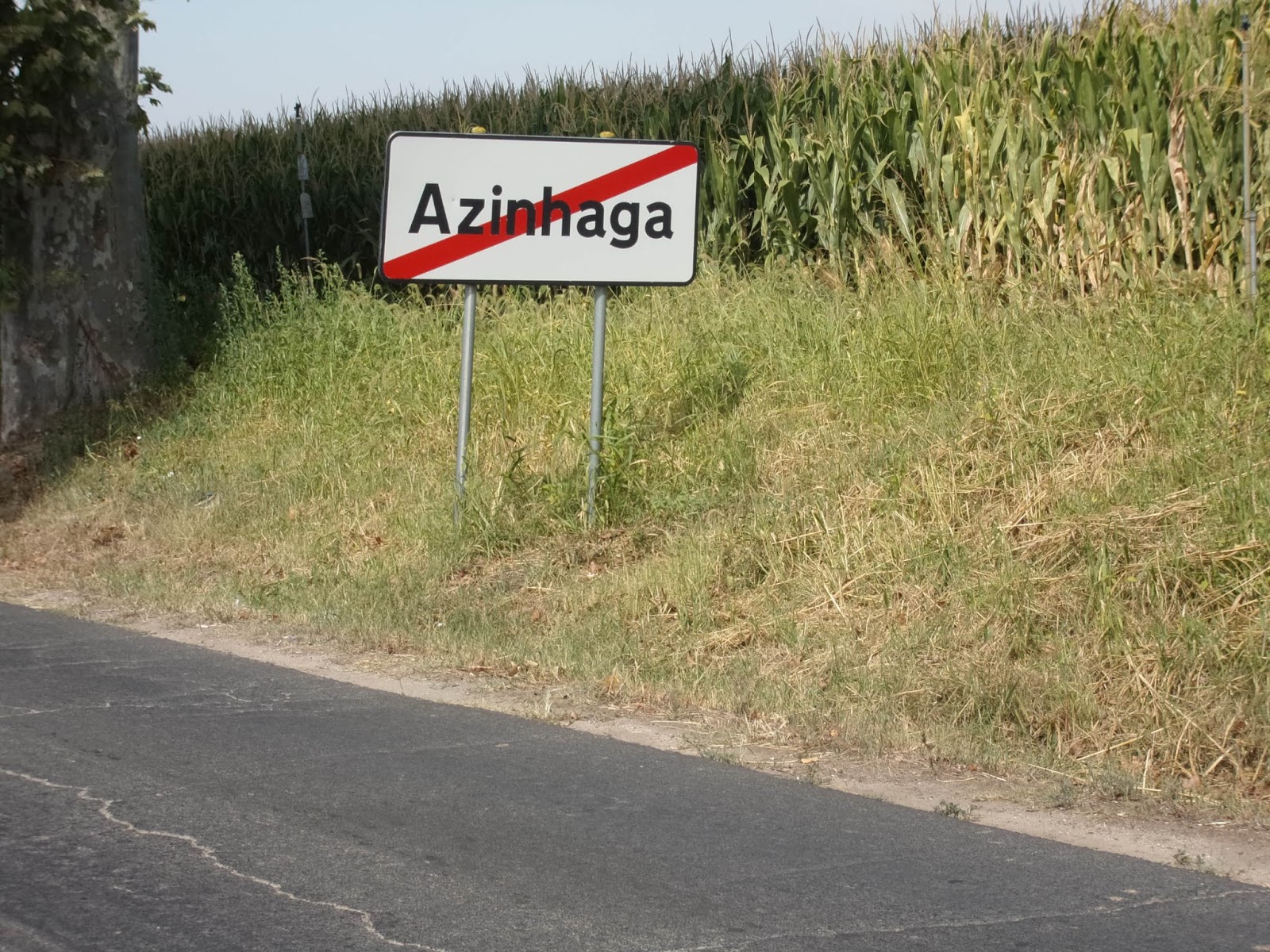
3:39 PM – Azinhaga: sign for leaving town, just
past that roundabout.
At
3:52 pm, Don came to a junction where he took the option of leaving the main
road and going toward Quinta da Brôa.

3:52 PM – After Azinhaga: junction where gravel
road to left led to Quinta da Brôa (visible in distance) and highway N-365
continued straight ahead.
Between Azinhaga and Golegã is
the majestic edifice of the Quinta da
Brôa (Manor House of the Cornbread). It was ordered to be constructed in
1831, by Rafael José da Cunha (1792-1869), called the “Principe dos Lavradores
de Portugal” (Prince of the Farmers of Portugal), since he was the son of a
family of wealthy farmers with connections to the Royal Family. He moved to
Golegã in 1817 and began cultivating cereals, vineyards, and olive groves. He
also became a huge breeder of cattle (including premier bulls for major
bullfights) and also was a pioneer in the breeding of the famous Lusitano breed
of horses. By the time he died in 1869, he had 220 permanent employees and
owned 796 head of wild cattle, 638 working oxen, 267 horses, 2,782 sheep, and
1,442 pigs.
In 1829 he leased the Quinta do
Almonda (named after the nearby river), which had belonged to the 8th Count of
Ribeira Grande, and then bought it in 1831. His prosperity attracted people of
the region begging, and broa
(cornbread) was given to them. Thus it was said that beggars should “ia à broa”
(go to the cornbread), and people began calling the place Quinta da Broa. The
main house of the manor, previously known as “Palácio Novo” (New Palace),
became known as “Palácio da Quinta da Brôa” or just “Palácio da Brôa.” The
owner also acquired the epithet “O amigo dos pobres” (the friend of the poor).
When he died, his will left money and goods to all his employees and to many
charities.
The estate is now the
headquarters of the Coudelaria de Manuel Veiga (MV) (Stud Farm of Manuel Veiga,
created by descendants of Rafael José da Cunha), which is famous for its
Lusitano horses.

3:52 PM – Quinta da Brôa: Lusitano horses, cows,
and sheep (and a few of those long-necked white birds) in pasture on left side
of gravel road (there was a large bull in another pasture across the road, but
he kept hiding from the camera).

3:54 PM – Quinta da Brôa: more Lusitano horses,
cows, and sheep in pasture on left; there was also a young lady on horseback in
equestrian attire, practicing dressage in the distant background.

3:54 PM – Quinta da Brôa: pombal (dovecote) on right side of gravel road. (Since MT had asked
what a pombal was, when we passed
through Pombalinho, Don took this to show her one, a place for doves and
pigeons to roost.)

3:56 PM – Quinta da Brôa: main house of manor
(called Palácio da Brôa), one of many buildings in the huge complex.

3:57 PM – Quinta da Brôa: gate by main house; the
wrought iron over the gate bears the initials RJC, for Rafael José da Cunha,
and the year 1831, in which he built the manor house.
Arriving
at the Quinta da Brôa main house at the end of the gravel road, Don found no
arrows for continuing on this “green” option, so he just turned right and
followed the N-365 (EN 365) highway
into Golegã.

3:59 PM – After Quinta da Brôa: EN 365 marker post.

3:59 PM – After Quinta da Brôa: same EN 365 marker
post and yellow arrow on back of road sign (unfortunately, the lighter, less-worn
part at the edge of the asphalt was the only place to walk).
The
N-365 highway had a very narrow
shoulder (1-2 ft wide and not always marked off with a white line). So Don had
to watch for oncoming traffic and be careful of vehicles coming from behind and
trying to pass someone—as one car passed two slow-moving tractors.

4:43 PM – After Quinta da Brôa: first sight of
church tower in Golegã (white, on horizon, over cornfield, in center of photo)
(telephoto 186 mm).

4:48 PM – After Quinta da Brôa: short Camino marker
(with shell and arrow) and another sign for “Rota do Cavalo e do Ribatejo” on
N-365; and glimpse of Golegã in distance (no telephoto).

4:49 PM – Near Golegã: first clear view of town,
with same church tower, of Igreja Matriz Nossa Senhora da Conceicão (telephoto
220 mm).
At
5:00 pm, Don entered Golegã.

5:00 PM – Golegã: – sign entering town.
Golegã (pronounced
Goo-le-GAN) is a lively town with around 6,000 residents, located in the plain
of Ribatejo, between the rivers Tejo and Almonda. Its roots go back to the 12th
century, when a Galician woman (from “Gallego” Golegã) set up an inn for travelers and pilgrims on the Estrada Real (Royal Way) between Lisbon
and Porto. This caused the village to become known as Venda da Golegã (Village
of the Galician Woman), which evolved into its present official name, Vila da
Golegã. The town of Golegã is the seat of the municipality of the same name, in
the Santarém District of Portugal; the municipality includes the parishes of
Golegã, Azinhaga, and Pombalinho.
Golegã is now better known as the
“Capital do Cavalo” (Horse Capital) of Portugal. It has been the site for the
gathering of breeders since at least the 18th century, and is now famous for
its national (and international) horse fair, Feira Nacional do Cavalo, held during the first two weeks of
November (St. Martin’s Day), when accommodation for miles around is booked up a
year in advance. There is also a second fair in November, the Feira Internacional do Cavalo Lusitano,
dedicated to the Lusitano breed. Apart from the equestrian events, there is
also a “running of the bulls” and bullfighting, Portuguese style.
The Lusitano, also known as Puro
Sangue Lusitano (Pure Blood Lusitano) is a Portuguese horse breed. Closely
related to the Spanish Andalusian horse. Both are sometimes called Ivberian
horses, since the breeds both developed on the Iberian Peninsula and until the
1960s were considered one breed, under the Andalusian name. Horses were known
to be present on the Peninsula as far back as 25,000 to 20,000 BC, and by 800
BC the region was renowned for its war horses. When the Muslims invaded Iberia
in 711 AD, they brought Barb (Berber) horses with them that were crossed with
the native horses, developing a horse that became useful for war, dressage, and
bullfighting. In 1966, the Portuguese and Spanish stud books split, and the
Portuguese strain was named the Lusitano, after the word Lusitania, the ancient
Roman name for Portugal.
Lusitanos are generally gray,
bay, or chestnut, although they can be any solid color, including black, dun,
and palomino. They have arched necks, powerful muscles, and a naturally high
gait. They are elegant, athletic, and hot-blooded, always seeming as if they
are about to explode into action.

5:05 PM – Golegã: – large marker stone for “Caminho
de Santiago.”
Having
arrived in Golegã, the real challenge was in finding our lodging place, which
the voucher called only “Lusitanus,” while Brierley listed it as “Lusitanus
A.N.T.E, part of the equestrian centre” and showed on his map with an H (for
hotel).
Associação Nacional de Turismo
Equestre (ANTE) has its headquarters on Largo da Imaculada Conceição in Golegã.
The company Lusitanus Turismo Equestre, S.A. owns the equestrian center and
shares facilities with the ANTE, in one of the best equestrian facilities in
Portugal, with 36 stalls for horses and 6 rooms with private bathrooms.

5:09 PM – Golegã: – intersection where Camino
turned right, as indicated on a small marker post on the right corner and also a
yellow arrow under other signs on post on that corner; also on a pedestal on
the right corner is street sign for Rua do Campo (not on maps); at right is
welcome sign for “Golegã Capital do Cavalo” (Capital of the Horse); up the
street straight ahead is Casa-Estúdio Carlos Relvas.
Once
having entered the town on N-365, Brierley’s map showed the Camino route
turning right and following Rua Dom João IV to the east, while the map from the
Follow the Camino lodging voucher showed the shortest way to “Lusitanus” was to
continue northeast on Rua Dom Afonso Henriques after a fork at which Rua José
Relvas kept going straight north. Unfortunately, there were no street signs
identifying either of those streets.
Soon,
Don passed the Casa-Estúdio Carlos
Relvas on top of a hill on what turned out to be Rua José Relvas (named for
an also famous son of Carlos).

5:13 PM – Golegã: Casa-Estúdio Carlos Relvas.
The Casa-Estúdio Carlos Relvas was built on the initiative of Carlos
Relvas (born in the Palácio do Outeiro in Golegã 1838, died 1894). He was the
son of a rich land owner, and became one of the central figures in the history
of photography in Portugal. He started out in a small photographic studio in
the garden of his farm. After achieving fame in Portugal and beyond by 1869, he
began the ambitious project of a Casa-Estúdio
(Home-Studio) specifically designed for the development of photographic art. It
was built between 1871 and 1875 and is known in Golegã as o Chalet (the chalet). It is considered one of the oldest
photography studios in the world.
The Home-Studio is in a romantic
garden, also on his Quinta do Outeiro property, with several interesting
species of trees and is a monument expressive of the architecture of iron (33
metric tons) and of revivalism of the style (Gothic as well as Moorish) that
marked the epoch. It also appears to have been inspired by the model of a
Christian church. The main façade is oriented to the west, has a portal
decorated with a bas relief representing a seahorse, and is bordered on its
sides by two “baptisteries.” This building was a pioneer of a transition
architecture that admirably joins art and technology in stone, stucco, iron,
and glass. The ornate house now serves as the Casa-Museu de Fotografia Carlos Relvas, in which his early
photographic material is displayed.
Eventually,
Don saw a sign indicating he was on Rua José Relvas and started looking for a
cross-street to get back over to the east to Rua Dom Afonso Henriques. By the
time he found one and crossed over onto Rua
Dom Afonso Henriques, signs indicated he was near the Biblioteca Municipal
(Municipal Library), too far north. So he stopped at a farmácia (where the
pharmacist lady spoke English) to ask which way to the Posto de Correios (post office), where the voucher map indicated he
could turn east toward Lusitanus. She told him to keep going south(west) a
couple of blocks. When he turned east at the post office, he could see no markings for Rua João de Deus, which
the voucher map showed going toward Lusitanus. So he asked an older local man
on a bicycle where to find that street or the Hotel Lusitanus. The man pointed
him to go back to Rua Dom Afonso Henriques and continue southwest, then turn
left. Don, who had noticed the similarly named Hotel Lusitano in Brierley,
tried to make it clear “não [not] Hotel Lusitano—Hotel Lusitanus,” but
the man was adamant that he go that way.
When
Don reached a triangle-shaped “square” Largo da Imaculada Conceicão by the Igreja Matriz, he stopped briefly to
check on mass time, but there was none that evening.

5:41 PM – Golegã: Igreja Matriz (aka Igreja da
Nossa Senhora da Conceicão) – façade and tower.
The main historical site in
Golegã is its main church, Igreja Matriz
da Golegã (aka Igreja Matriz Nossa Senhora da Conceicão or Igreja da Nossa
Senhora da Conceicão [Our Lady of the Conception]), located in the Lago da Imaculada
Conceicão (Square of the Immaculate Conception). It was built in the early 16th
century, replacing a small Gothic parish church at this site. It is one of the
most iconic and best-preserved examples of the Manueline style. (See Appendix A
of this blog for more information about the Manueline style.) The construction
was partially funded by the Crown, due to the great interest in the village
shown by King Manuel I. The remarkable main portal and the ribbed vaulted
ceiling inside the main chapel are its most important artistic features.

5:41 PM – Golegã: Igreja Matriz – main portal (Cropped).
The main portal is one of the
most characteristic of the Manueline style. It displays poly-centric arches
bordered by cairéis (borders) and
forming part of a composition framed by an alfis
(an Islamic Arab architectonic adornment consisting of a molding, usually a
rectangular panel, which encloses the outward side of an arch). The exuberant
portal is bordered on the sides by two twisted columns topped with pinnacles and
by a moldura trilobada (tri-lobed
frame [molding?]). The alfiz has two windows,
and between them in a niche is a statue of the Virgin and Child. The tympanum
is decorated with crosses of Christ, artichokes, and curled ribbon. The oculus (circular
window) over the portal is flanked by two armillary spheres (a personal symbol
of Manuel I and common in the Manueline style) and surmounted by a royal coat
of arms (curiously that of João II, predecessor of Manuel I).
The side walls of the interior
are covered with 18th-century blue and white azulejo tiles in panels representing The Washing of Feet, The Last
Supper, and The Evangelists. The lower wall is covered by an azulejo panel, also blue and white,
representing The Vision of Santa Rita. This composition resulted from the
transfer and restoration of part of a panel from the Igreja da Craça (Church of
Crace) in Santarém. (See Appendix A of this blog for more information about azulejos.)

5:40 PM – Golegã: sign for Igreja do Nossa
Senhora da Conceicão, a National Monument:
[English
translation of Portuguese text: At the end of the 15th century and beginning of
the 16th, where there once had been a parish church of Gothic style, this
church was built, financed in equal parts by the Crown and by the residents of
Golegã, its plan being attributed to Diogo Boytac. The church presents a
decoration characteristic of the Manueline style, which is considered one of
the golden ages of national history. Tradition attributes the initiative of the
undertaking to D. Manuel I “The Fortunate” (1469-1521), though some elements
suggest that its origin might date to the reign of the “Perfect Prince,” D.
João II (1455-1495).
Though
the church has been embellished with several Baroque elements, especially in
the interior, it suffered several desvirtuamentos
[diversions?] during the 17th and 18th centuries. In the year 1942, it was an
object of intervention that tried to return it to its original state. In 1998,
owing to the state of degradation it was showing, it was totally renovated
through conservation work.]
Then
Don stopped at another farmácia on that square, where the
man spoke no English but insisted that Don go by the church and turn left. This
led to the same intersection where Don had seen the “Hotel” sign pointing west
(the wrong direction) as he had entered town. Sure enough, this took him to Hotel Lusitano. (MT later explained,
from her own misadventure, that the problem was saying “Hotel,” since Lusitanus
was not a hotel but just a guest house at the equestrian center. Both Don and MT got carimbos at the hotel.)

Golegã: carimbo stamp for Hotel Lusitano.
So
Don went back to Rua Dom Afonso Henriques and found the post office again, turned right (east), then left, and then right
again on a street that led to the Feira
da Golegã equestrian stadium. Here, he found a loop-shaped street but
mistook this long one for the shorter one that led to Lusitanus on the voucher
map, and turned the wrong way. When this led nowhere, he returned to the
corner, where an old man sitting on a bench outside a bar pointed for him to go
(west) through a gate that led him into the equestrian complex, with horse
stables to the left and right.

Thursday, September 1, 2016, 8:57 AM – Golegã: front gate of Lusitanus
complex.

Thursday, September 1, 2016, 9:36 AM – Golegã: horses in stalls just inside
gate of Lusitanus complex.
Although
there were no signs outside the gate, straight ahead was a building that said Lusitanus. Before Don got to the door, a
young lady came hurrying out to meet him and said that another lady who
worked there had taken MT in her car all the way back to Pombalinho to look for
me. She called the lady’s cell phone, and I told MT that I had finally arrived
(around 6:20) after being in town since 5 pm (which was when they had got
worried and started looking for me). Then the young lady gave me a key and showed me to
our room, No. 3 “Sol" (Sun).

Thursday, September 1, 2016, 8:56 AM – Golegã: horses in stalls just inside
gate and, at far end, guest house of Lusitanus complex.

Thursday, September 1, 2016, 8:56 AM – Golegã: guest house of Lusitanus
complex; double door in middle of 3 arches (behind bush) said “Lusitanus” on
left and “ANTE” on right; our room was directly above that door.

MT Thursday, September 1, 2016, 9:54 AM – Golegã: Don, Ivana, and MT in front
of guest house of Lusitanus complex.

Golegã: carimbo stamp for “Municipio de Golegã – Capital do Cavalo”
(Municipality of Golegã – Horse Capital).
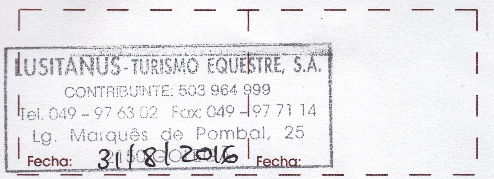
Golegã: carimbo stamp for “Lusitanus – Turismo Equestre [Equestrian
Tourism], S.A., Contribuinte [Taxpayer]: 503 964 999. Tel. 049-97 63 02 Fax:
049 – 97 71 14, Lg. [Largo = Square] Marqués de Pombal, 25, 2150 Golegã.”
When MT got back (they were back as far as Quinta da Brôa when Don called), she told Don that Ivana had showed her how to use their washing machine, on our floor, where we were their only guests. (Like every place else in town, they were booked up for the time of the horse fair in November, which was the reason for existence of this guest house.) So Don showered, and MT started the laundry.
Ivana
had given MT coupons for us to eat dinner and breakfast at the nearby Café Rédea Curta (meaning Short Rein),
to the left of the gate of the equestrian complex. Unfortunately, we did not
take an immediate left (it didn’t look like a street) but passed the same old
man on the bench in front of the bar (with a friend). Don waved at him, and we
turned left at the next corner, finding no such café. So we went back to the
corner and asked the man on the bench about the café. He pointed to go to the
complex gate and turn right (which would have been left as we came out). We
found the café (at Rua João de Jesus 17) and couldn’t understand the waitress;
so she found another waiter who spoke English. He had no menu but asked us what
we wanted to eat. We asked about fish (since we had eaten beef and veal the day
before) and he told us they had only cuttlefish (we didn’t know what that was;
despite the name, it is not a fish but rather a mollusk, related to squid and
octopus), which we ordered (not fried) and red wine (“natural” meant not
chilled).
Then
a girl (Ana Beatriz, but goes by Beatriz) from the equestrian center came into the
café for a Coke; she was 18 and volunteered at the equestrian center to be
around horses. We asked her to join us at our table and even offered to pay for
her Coke, but she insisted on paying for it (just over €1). We spoke with her a
long time, in English (she was studying tourism). The waiter came back and said
they were out of cuttlefish (we lucked out!). The salad also had goat cheese,
hard-boiled eggs, olives, tomatoes, and what MT thought were capers (but larger
and soft), with a thickened olive oil to put on it as dressing. It came with
thin toast, but the waiter had already brought a basket of bread (large rolls
and flat pieces of yellowish bread we thought could be cornbread. Beatriz said that
is was cornbread (brôa in Portuguese)
and asked the waiter to bring us more of that.

MT 8:16 PM – Golegã: Beatriz, Don, and MT
in Café Rédea Curta (Betariz took selfie).
Then
we went back to Lusitanus, where the
washing machine was still running. When it finally stopped, we hung clothes on
a portable rack and moved in in front of our door, which faced the courtyard.
No comments:
Post a Comment