This post is based primarily on
Don's notes, occasionally supplemented with MT's notes from our Camino in 2016.
When information from other sources is added—for further explanation to readers
or to satisfy our own curiosity—that is set off in a text box (as this one).
Most of the photos that accompany
this post are from Don’s camera (with a caption indicating the time it was
taken); those from MT’s iPhone are indicated by “MT” placed at the beginning of
the photo caption. Photos from any other source (such as the public domain
Wikimedia Commons) indicate that source in the caption.

Wednesday, September 21, 2016, 8:03 AM – O Porriño: Hotel Azul – breakfast for
two on table for habitación (room)
204.

8:04 AM – O Porriño: Hotel Azul – breakfast menu
(per person).
When we checked out of the hotel, we met our Spanish friend from Pontevedra at the reception desk.

8:11 AM – O Porriño: Hotel Azul – hotel
reception desk with Spanish friend from Pontevedra, MT, and Don.
We departed at 8:30.

8:44 AM
– O Porriño: MT and many pilgrims (at least 20) leaving town.
On the way out of town, we and the other pilgrims (at least 20) stopped at the Turismo office (hut) for sellos, which indicated that we were now in the Concello de Mos.

O Porriño: sello for “Camiño de
Santiago – Concello de Mos” with coat of arms of that municipality and scallop shell.
Mos is a municipio/concello (municipality, pop. 15,132) in the province of Pontevedra.
It is located in the valley of the Rio Louro and is part of the metropolitan
area of Vigo, the municipality to its west. It is bordered on the south by the
municipality of O Porriño and on the north by that of Redondela. It is divided
into 10 parroquias (parishes), one of
which is also called Mos pop. 1,585).
There is archaeological evidence of prehistoric settlements in this area, but there is no more data until the time of Romanization, when Mos was on the Roman road linking Braga with Lugo and Astorga. In the middle of the 13th century, it was known as Molis. Mos began to use the title of town in the last third of the 17th century.
There is archaeological evidence of prehistoric settlements in this area, but there is no more data until the time of Romanization, when Mos was on the Roman road linking Braga with Lugo and Astorga. In the middle of the 13th century, it was known as Molis. Mos began to use the title of town in the last third of the 17th century.

Coat of Arms of Municipality of Mos (By SanchoPanzaXXI - Own work, CC BY-SA
4.0, https://commons.wikimedia.org/w/index.php?curid=4584613;
also at https://es.wikipedia.org/wiki/Mos#/media/File:Escudo_de_Mos_(Pontevedra).svg) and De Erlenmeyer, CC BY-SA
3.0, https://commons.wikimedia.org/w/index.php?curid=38631000).
.svg))
The coat or arms of the Municipality of Mos
has a split shield, the left part gold with a red rose with green leaves and
stem; the rose symbolizes agricultural activity and ornamental cultivation linked
to the Louro river. The right part, of silver, features three checkered strips,
each with two rows of red and gold checks, separated by a black belt; this
represents the coat of arms of the noble family of Sotomayor, which since the
medieval era exerted great influence and from which descended the Marquises of
Mos. Above the shield is a royal crown.

MT 8:55 AM – O Porriño: pilgrims leaving town.

MT 8:56 AM – O Porriño: pilgrims leaving town.

MT 8:59 AM – After O Porriño: Don and other pilgrims crossing railroad tracks.

8:59 AM – After O Porriño: hórreos with wooden sides and no finials (telephoto 156 mm).

9:07 AM – After O Porriño: another hórreo with horizontal wooden sides (unusual) and no finials (telephoto 105 mm).

9:07 AM – After O Porriño: other side of same hórreo with horizontal wooden sides
(unusual) and no finials.

9:09 AM – After O Porriño: bus stop (in shape of
hórreo?) in “Concello de O" (telephoto
119 mm).

9:09 AM (Cropped) – After O Porriño: bus stop (in shape of hórreo?) in “Concello de O”; the coat of arms on the gable appears to be that of the Concello de Mos; so the “O” must have been “MOS” but lost the M and S (telephoto 119 mm).

9:09 AM – After O Porriño: bus stop (in
shape of hórreo?) in “Concello de O”
(telephoto 119 mm); only when posting this photo of this blog did we notice a
mysterious figure on the hill behind the bus stop (see red circle).

9:09 AM (Cropped) – After O Porriño: the mysterious
figure on the hill behind the bus stop appears to be a statue of a hooded woman
in black.

9:13 AM – After O Porriño: another wooden hórreo with horizontal slats on side (unusual) and no finals on roof, haze in distance.

9:27 AM – After O Porriño: small stone hórreo with vertical vents on sides and
end, cross and pinnacle finials on roof; MT on road around corner.

9:28 AM – After O Porriño: longer, ornate stone hórreo nearby, with vertical vents on sides and end, cross, horizontal vents
under eaves and gable, pinnacle finials on ends of roof and a cross on the
other side; blue and yellow Camino sign on wall apparently indicating to go in
the direction of the rays (mild telephoto 72 mm).
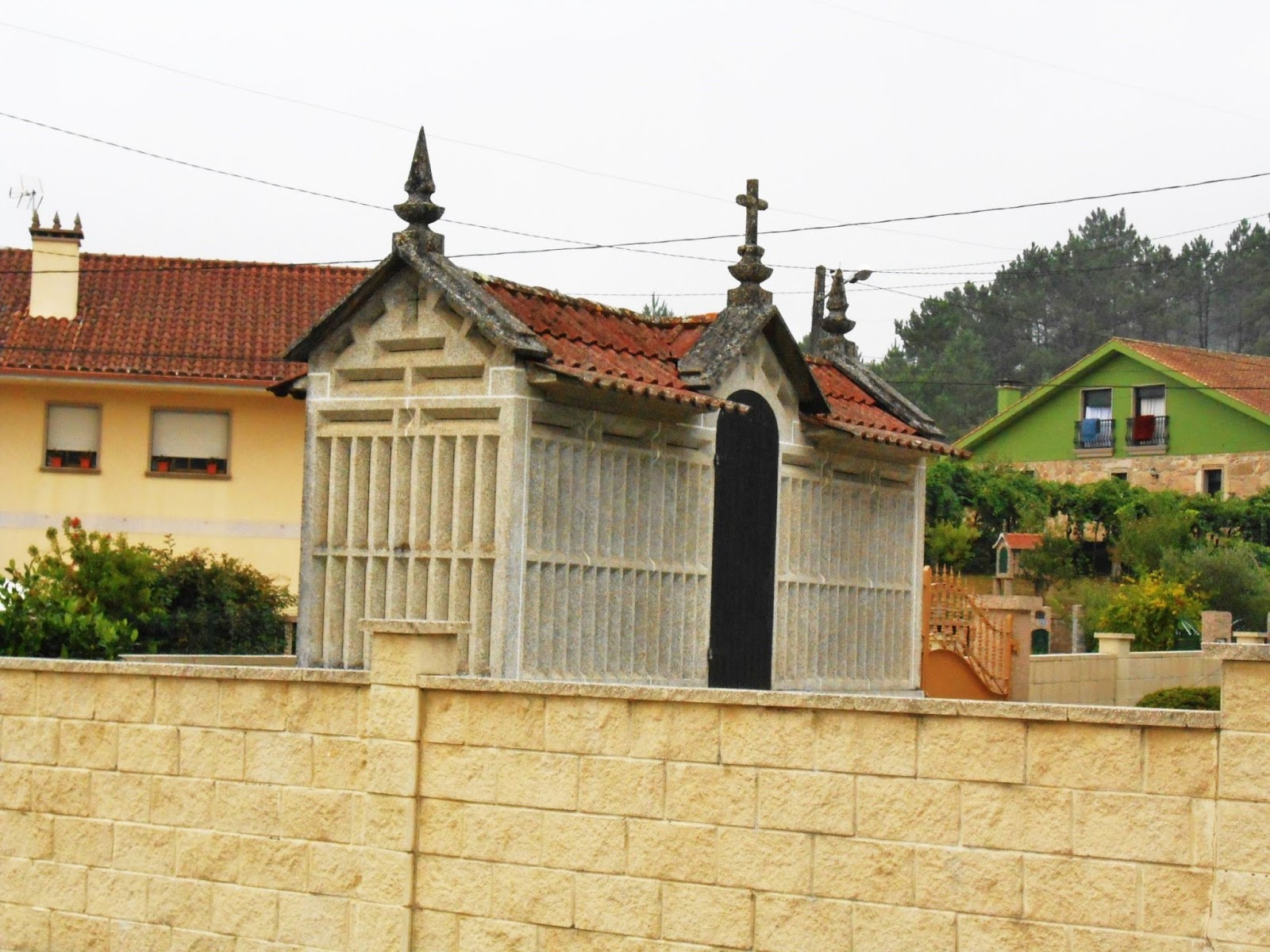
9:28 AM – After O Porriño: other side of longer, ornate stone hórreo nearby, with vertical vents on sides and end, cross, horizontal vents under eaves and gable, pinnacle finials on ends of roof and a cross above door and third gable on side; another stone hórreo in background right (mild telephoto 72 mm).

9:31 AM – After O Porriño: brick shed that may
serve hórreo-like storage function (but with no vents), even had steps on slanting concrete leading to upper level.

9:34 AM – After O Porriño: pilgrims at
intersection with blue sign for “Camiño do Ponte de Vilas”; above it another
stone hórreo with vertical and
horizontal vents and pinnacle finials on both ends of roof.

9:35 AM – After O Porriño: same stone hórreo with vertical and horizontal
vents and pinnacle finials on both ends of roof, plus cross on other side for a
third gable.

9:38 AM – After O Porriño: first stone Camino
marker post of the day: P.K. 93.471.
Apparently, we had missed the 100 km marker by taking an unmarked alternate route the day before.

9:40 AM – Mos: sign for “Pazo dos Marqueses de
Mos” and “Igrexa parroquial Santa Eulalia” (both to left) in Concello de Mos.
The Pazo dos Marqueses de Mos (Palace of the Marquises of Mos), also
known simply as Pazo de Mos, dates back to the 17th century. It is located next
to the old Roman road that joined Braga with Tui and Santiago de Compostela. In
the past, it sometimes housed the town hall; it is currently the headquarters
of the Fundación Pazo de Mos (Pazo de Mos Foundation). It is located a few
meters from the Igrexa parroquial Santa
Eulalia (Parish Church of St. Eulalia). The religious parish of Santa
Eulalia coincides with the civil parish of Mos.

9:40 AM – Mos: sign for Café-Bar-Tapería Flora
100 m ahead, opposite the Albergue, with “Official St. James Stamp of Mos.” [We
already had this official sello from
near O Porriño.]

9:41 AM – Mos: relief of Santiago Peregrino on
wall by Albergue (mild telephoto 63 mm).

9:41 AM – Mos: Igrexa Santa Eulalia – left side and façade with bell tower, near Albergue.
The Igrexa parroquial Santa Eulalia (Parish Church of St. Eulalia) is
also known as Igrexa de Santa Baia de Mos (Baia in Galego is translated as
Eulalia in Castilian Spanish and is the name of a saint of widespread devotion
throughout Galicia. (Brierley calls this church Santa Eulalia del Monte.) The
church was erected in the 16th century to one side of the Pazo de Mos. The
French set fire to the palace and the church during their invasion in the early
19th century, because the marquises of Mos refused to recognize José Bonaparte
as king of Spain.
We stopped at Bo Camiño [Good Camino, in Galego] shop, where we got sellos and used the baño; it was near the Albergue.

9:41 AM – Mos: MT taking photo of Bo Camiño,
next to GAR-VIN Estilistas (hair stylists).

MT 9:43 AM – Mos: MT taking photo of Bo Camiño.

Mos: Sello for “Bo Camiño – A tienda
do peregrino [a store for the pilgrim] Mos.”

9:42 AM – Mos: Camino marker post for P.K. 93.184 (both the rays of the scallop shell and the yellow arrow behind the post point the direction of the Camino route).

9:42 AM – Mos: sign next to that Camino marker
post with map from Ponte de Lima [back in Portugal on the inland route we
didn’t take] to Pontevedra, highlighting location of Bo Camiño in Mos (6.3 km
from O Porriño).

9:42 AM (Cropped) – Mos: top part of that map
(from Valença and Tui on border to Pontevedra, highlighting location of Bo
Camiño in Mos.

9:42 AM – Mos: near Bo Camiño – sign for Pazo de Mos, in Galego, which translates: “Donated to the Parish of Mos by D[on] Eulogio Gómez Franqueira – Reconstructed by the Community of the Dead – Inaugurated 26-9-08.” The small black-and-white sign behind it shows the hours of operation of the Cafetería (coffee shop) of the Fundación Pazo de Mos (Pazo de Mos Foundation).

9:43 AM – Mos: Cruceiro – side with Crucified Christ at top; the building in the background is known as Casa Blanca (White House).
The building known as the Casa Blanca (White House) is the
headquarters of the Asociación de Vecinos Santa Baia de Mos (Santa Baia de Mos
Neighborhood Association). It also houses the Albergue Casa Blanca (Santa Baia
de Mos pilgrim hostel).

9:43 AM – Mos: Cruceiro – other side (probably with pieta at top).
9:46 AM – Mos: brick hórreo with door on side (telephoto 93 mm).

9:46 AM – Mos: end of stone hórreo with vertical and horizontal vents, a decorative cross on
the gable and finials on roof (telephoto 119 mm).

9:50 AM – Mos: stone hórreo with vertical and horizontal vents; door and third gable on
side (telephoto 156 mm).

9:52 AM – Mos: “pan” (bread) and mail boxes by house door.

9:54 AM – Mos: blue sign (with Concello de Mos coat of arms) for “Estrada Alto de Barreiros-Santiaguiño” (Street of the Height of Barreiros-Little Santiago) and white shelter marked “Concello de Mos” with yellow arrow pointing direction of Camino route.

9:55 AM – Mos: highly decorated cruceiro – side with Crucified Christ at
top; apparently also serves as lamp post.
At the exit of the Camino route
from the municipality of Mos, pilgrims find the well-known Cruceiro dos Cabaleiros (Cross of the Knights), also known as
Cruceiro de Santisimo Cristo da Victoria (Cross of the Most Holy Christ of
Victory). Located on the Calle dos Cabaleiros street, it is a polychrome stone cross,
which on one side has the image of the Crucified Christ and on the other the
Virgin (with heads under her feet). The Cristo da Victoria (Christ of the
Victory) dates from 1612, and the first written evidence of the cruceiro is from 1673. Some
modifications continued in the 18th century.
Each of the four sides of the ionic
capital atop the column is adorned by winged cherubim (wings and faces). The
cylindrical column is striated and painted white; painted on a quadrangular
section in the lower part are various symbols of the Passion: a ladder, a swab,
and a crown of thorns. The column stands on a polychrome cubic base on which
several inscriptions have changed over the years; it currently bears the
inscription “Way to Santiago.” Below that are four steps of square section. The
cruceiro and is surrounded by an iron
fence (with flowers and a smaller wrought iron cross inside the fence). It is
peculiar, since two street lamps hang from a metal crossbar attached below the
capital. The total height of the cruceiro
is approximately 5.8 m.

10:04 AM – Mos: mixed hórreo with vents in stone end wall and stone column between
sections of wood slats on sides; pinnacle and cross finials on roof (telephoto
93 mm).
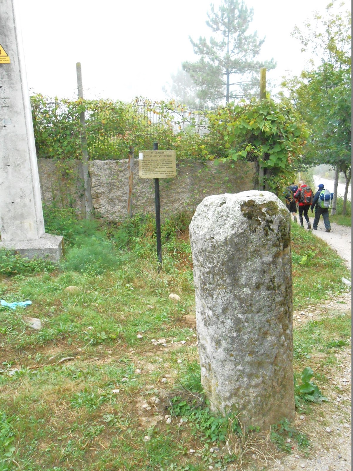
10:26 AM – After Mos: Roman milepost Marco Miliário – in background is sign
about it and pilgrims continuing on Camino path.

“Indicator
of distances employed by the Romans, which derives its name from the unit of
measure that they used: MILIA PASSUM. This milepost formed part of the VIA XIX,
which joined the cities of Braga and Astorga, passing through Lugo.
“Possibly
it was erected during the reign of Emperor Trajan, at the beginning of the 2nd
century AD.
“Alen
Nós [?]”
Near the Roman milepost was a modern Camino marker post.

10:26 AM – After Mos: Camino marker post P.K.
89.916.

10:36 AM – After Mos: mixed hórreo, empty, with door open; vertical vents on stone ends
(telephoto 93 mm).

10:36 AM – After Mos: same mixed hórreo, empty, with door open; vertical
vents on stone ends; better view of wooden slats on sides and cross and
pinnacle finials on roof (telephoto 93 mm).
Vilar
de Infesta
is a town and a parish of the same name (pop. 1,270) in the concello (municipality) of Redondela.
(Brierley’s map shows it as Vilar da Infesta, which may be the Galego version.)
It is just east of the north end of the runway of the Vigo airport.

10:39 AM – Vilar de Infesta: road sign for
highway N-550 and Os Valos to left (ahead on Camino route) and Guizán to right
(back in the direction we came from); signs at right for “Cafetería – Centro
Cultural Vilar – Área de Descanso” (Coffee House –Vilar Cultural Center – Rest
Area) just 50 m ahead and Tapería (tapas restaurant) in 1.5 km (telephoto 105
mm).
Os
Valos,
on highway N-550 is a town (pop. 168 or 361 or 485? [all according to the same
gl.wikipedia.org page for Os Valos]) in the parish of Saxamonde (pop. 778) in
the municipality of Redondela. It is east-northeast of the town of Vilar de
Infesta.
Guizán is a town in a
parish of the same name in the municipality of Mos. It is about halfway between
Mos and Vilar de Infesta, just east of the south end of the Vigo airport
runway.
Tapería
O Labrador
(Tapas restaurant – the Farmer/Peasant), although its address is in Redondela,
is 1.5 km from Redondela, on the road from O Porriño. It is in the parish of Saxamonde
in the municipality of Redondela.

10:43 AM –Vilar de Infesta: MT and pilgrim lady (who
had a bucket list) and other pilgrims.

10:43 AM – Vilar de Infesta: MT and pilgrim lady
with bucket list and other pilgrims; the left-pointing sign ahead of them is
for “Churrasqueiria Panaderia Choles.”

10:52 AM – Vilar de Infesta: Café Choles,
aka Churrasquería Panadería Choles.
Churrasqueiria
Panaderia Choles
(Steakhouse and Bread Bakery Choles) is a restaurant in Vilar de Infesta and (in
Concello de Redondela), also a bread bakery.
At first, one might assume that a
churrasqueria meant a bakery that
made churros or churros pastries. In Spanish, churras is the feminine plural of churro, which is a fried-dough pastry—a predominantly choux-based
snack.

Churros
(https://en.wikipedia.org/wiki/Churro#/media/File:Churros_Madrid.jpg By Krista -
cafe nebraska churros, CC BY 2.0, https://commons.wikimedia.org/w/index.php?curid=9818443).

Churrasco Galiza (Grilled meat Galicia) (commons.wikimedia.org).
The online menu for Churrasquería
Panadería Choles lists specialties including Churrasco de Ternera (veal) and
Churrasco de Cerdo (pork).
At Churrasqueiria Panaderia Choles, we stopped for the baño and got sellos.

Sello
from “Churrasqueiria Panaderia ‘Choles’, Jesus Martinez Bouzom, D.N.I.
36.122.402-M, Lg. [Largo = Square] Villar-Iglesia, 101, 36815 Redondela.”

10:44 AM – Vilar de Infesta: stone hórreo with brick sides and no finials
on roof; side view (telephoto 72 mm).

10:52 AM – Vilar de Infesta: same stone hórreo with brick sides and no finials
on roof; view of end with wooden door (telephoto 284 mm).

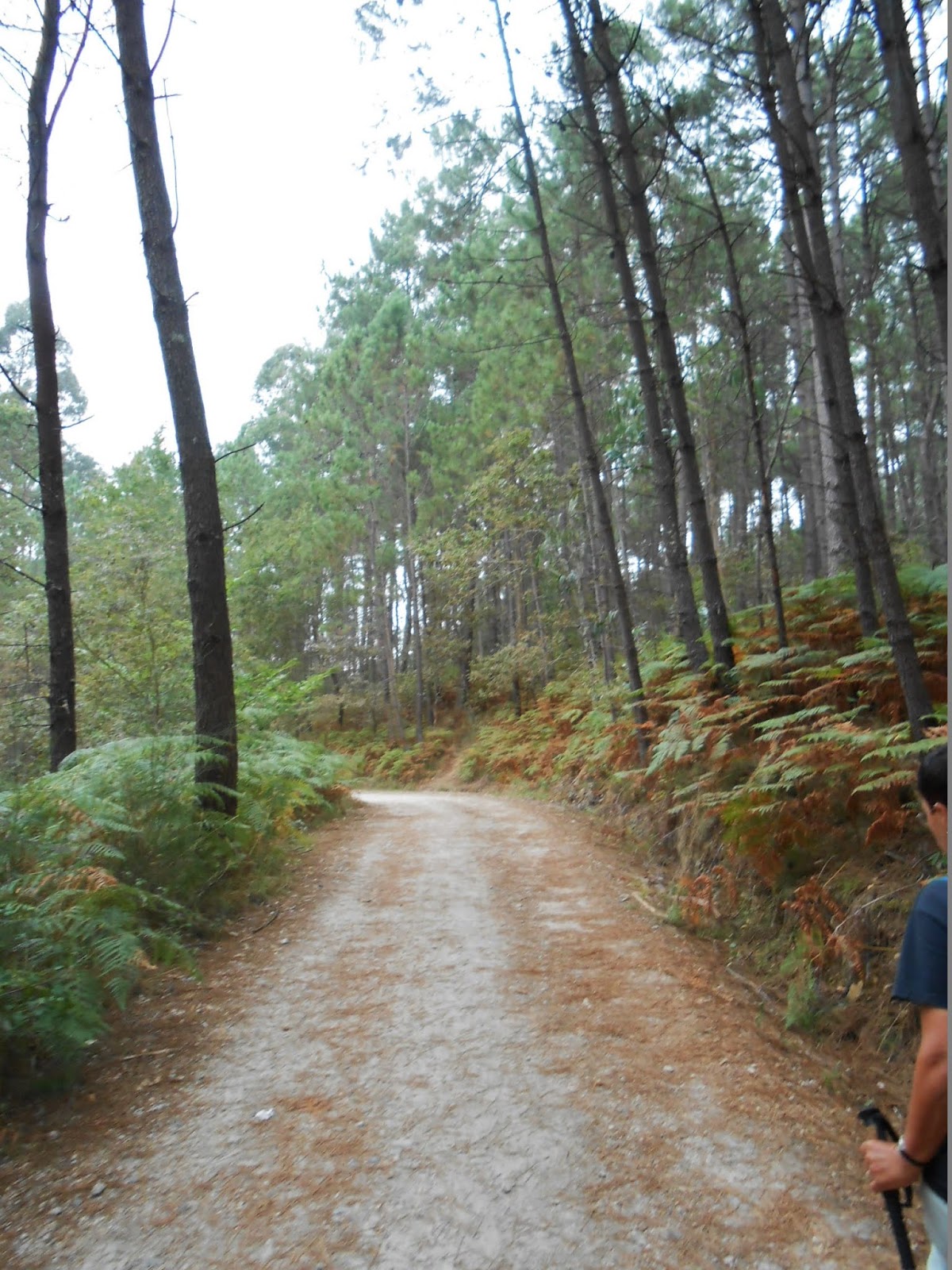
10:54 AM – After Vilar de Infesta: MT on road with
a bunch of other pilgrims (including 2 Spanish, a Brit, and 2 French) entering
pine and eucalyptus woods.

10:55 AM – After Vilar de Infesta: group of
pilgrims leaving a roadside stationary bike (last man just got off bike).

11:00 AM – After Vilar de Infesta: sign for Comunidade de Montes – Saxamonde - Chan das Pipas (telephoto 156 mm).
The Comunidade de Montes (the Galician organization of mountain
communities) has its headquarters in Vigo and has local organizations in
Saxamonde, as well as in Vilar de Infesta and other towns.
In Chan das Pipas, during the French invasion (early 19th century), a
man called Chan became famous for trying to hold the French troops back by
throwing barrels of wine on them from above (barrels are called pipas in the Galician language). The
Centro Cultural Chan das Pipas de Saxamonde honors this local hero.
We joined up with a group of men who liked to sing along the way.

11:01 AM – After Vilar de Infesta: MT with Spanish pilgrim (Ciprian) at left and one of 2 French men from Normandy.

11:01 AM – After Vilar de Infesta: MT with Brit (in foreground), Spanish pilgrim (Ciprian), and one of 2 French men from Normandy.

11:01 AM – After Vilar de Infesta: That group serenading two old women.

MT 11:07 AM – After Vilar de Infesta: Don with
Brit and Ciprian.

MT 11:07 AM – After Vilar de Infesta: Brit, Don, and Ciprian.

MT 11:09 AM – After Vilar de Infesta: woman
applauding the singing pilgrims.

11:08 AM – After Vilar de Infesta: Camino marker
post P.K. 87.089.

11:08 AM – After Vilar de Infesta: marker post for
Via Romana XIX (Roman Road 19), yellow arrow on gatepost, and sign for (left to
right) Hotel Marquiseria Santo Apóstol (Hotel Santo Apóstol in Redondela), a
photo of a Camino marker post, “Confluencia en N-550” below a yellow Camino
arrow and scallop symbol (warning that the Camino route would converge with
highway N-550), and below that “Camino portugues por la costa” (Portuguese Camino
along the coast).

11:08 AM – After Vilar de Infesta: succulents
growing in old hiking boots, blue and white flag of Galicia (Galiza in Galego),
two scallop shells, sign on utility pole for Albergue A Casa da Herba (Hostel
the House of Herba) in Redondela; French pilgrim passing on right.

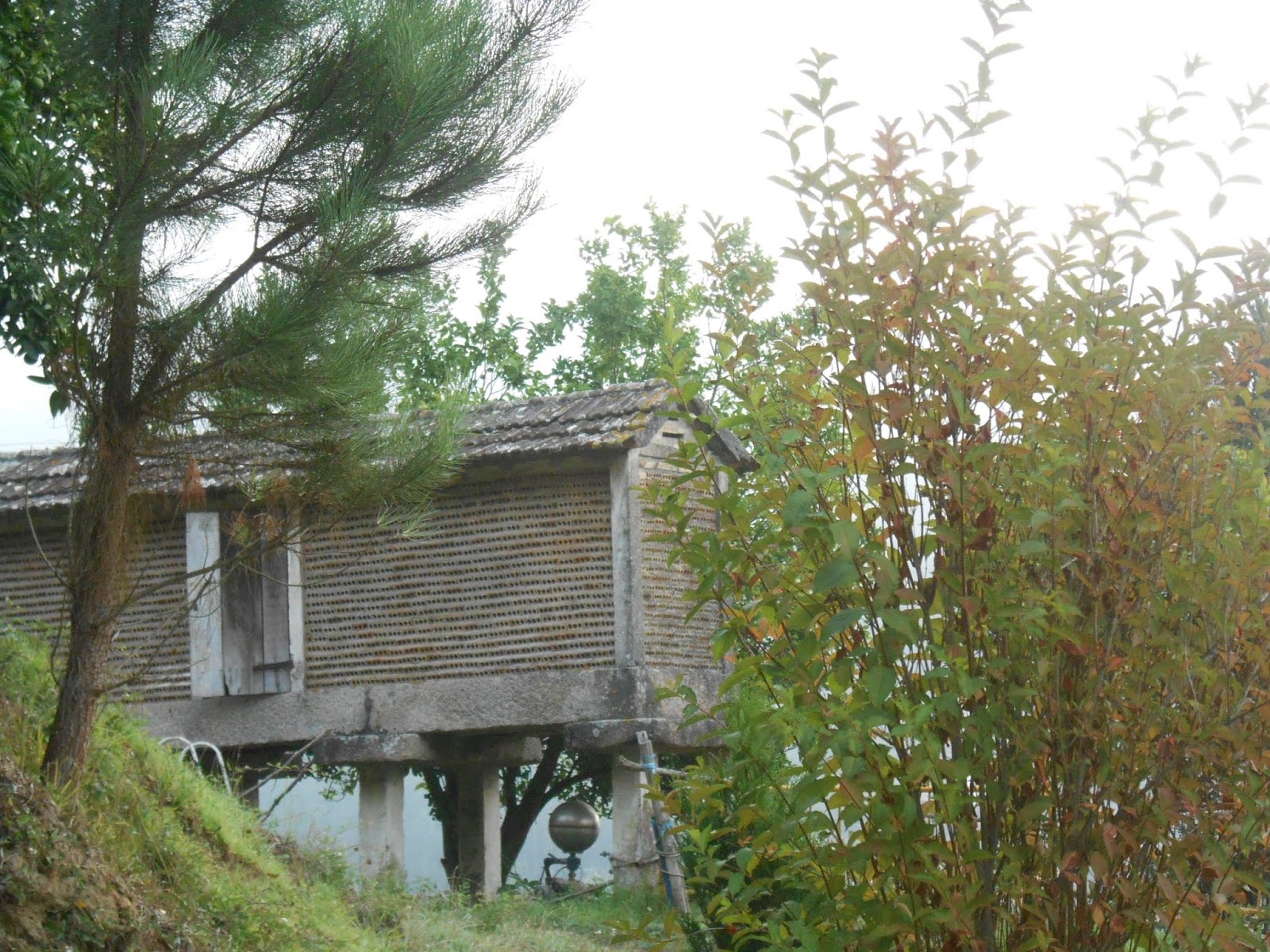
11:09 AM – After Vilar de Infesta: mixed hórreo with no finials on roof.

11:10 AM – After Vilar de Infesta: same mixed hórreo with no finials on roof; from
this angle, it is clearer that it has no floor (mild telephoto 81 mm).

11:09 AM – After Vilar de Infesta: girl on
spotted horse named Bimbo (the horse, that is), with their reflection in
traffic mirror.

MT 11:11 AM – After Vilar de Infesta: girl on
spotted horse named Bimbo (the horse, that is).

11:10 AM – After Vilar de Infesta: view across
valley with haze on hills (mild telephoto 81 mm).

MT 11:14 AM – After Vilar de Infesta: Brit, Don,
Ciprian, and MT.

11:14 AM – After Vilar de Infesta: brick hórreo with no finials on roof (telephoto 119 mm).

11:14 AM – After Vilar de Infesta: another brick hórreo with cross finial on only visible end of roof (telephoto 119 mm).

11:16 AM – After Vilar de Infesta: bus stop (shaped
like hórreo?) with coat of arms of
Concello de Redondela, yellow arrow pointing straight ahead for Camino, and
white arrow (of unknown meaning); pilgrims on road ahead, just past another
sign for (left to right) Hotel Marquiseria Santo Apóstol (Hotel Santo Apóstol
in Redondela), a photo of a Camino marker post, “Confluencia en N-550” below a
yellow Camino arrow and scallop symbol (warning that the Camino route would
converge with highway N-550), and below that “Camino portugues por la costa” (Portuguese
Camino along the coast) on utility pole.

11:16 AM – After Vilar de Infesta: bus stop
(shaped like hórreo?) with coat of
arms of Concello de Redondela, yellow arrow pointing straight ahead for Camino
route, and sign from Concello de Redondela saying that it is prohibited to
affix posters (mild telephoto 72 mm).

11:47 AM – Redondela: wall with convent in distance behind it.

11:49 AM – Redondela: sign entering town;
hand-painted “Fascista” (fascist), apparently with prefix “Anti” rubbed out.
Redondela is a town (pop.
30,000) in a parish and a concello
(municipality) of the same name, in the province of Pontevedra, Galicia. The
municipality is bordered on the north by that of Soutomaior, to the east by
Pazos de Borbén, to the south by those of Mos and Vigo, and to the west by the
Vigo Estuary

Coat of arms of Concello de
Redondela (en.wikipedia.org).
Due to its privileged location and its expanse, the region of Redondela has been inhabited since time immemorial. The Bronze Age stands out as one of the most prolific periods, as attested by numerous remains. One cannot forget the vestiges of the Celtic culture.
In the Roman period, the area
acquired special importance because Via Romana XIX (Roman Road 19), which
linked Braga (Baraca Augusta) with Astorga (Asturica Augusta), passing through
Lugo (Lucas Augusti), crossed Redondela, causing this territory to undergo
great development. The most representative testimonies of this time are the
Roman miliários (milestones), of
which the only one that is preserved in its original location is that of
Santiaguiño de Antas, also known as “El Marco” or “Anta de Maniola,” in Vilar
de Infesta. During this period, various areas of Redondela were established to
trade in salt and other agricultural products.
The Middle Ages were
characterized by the development of the town of Redondela and the splendor of
the house of Soutomaior, which played a fundamental role during conflicts
between the Church and the feudal lordship. Another factor was the development
of the Camino de Santiago following the old roman route XIX, which was a source
of many visitors, since it was a stop at the end of a stage. Archbishop
Xelmirez (of Santiago) passed through Redondela while doing the Camino
Portugués. In 1114, he temporarily established his residence here and
consecrated the Parish Church of Santiago Apostle. The town of Redondela, in
its infancy, was divided into two parts: Vilavella (Old Town) and Vilanova (New
Town), which were united by a bridge.

11:49 AM – Redondela: approaching church and another tower
behind it.

11:50 AM – Redondela: convent church and another building of Convento de Vilavella with tower and banner for “Pazo Vilavella” to right.
The Convento de Vilavella (Convent of Old Town), also known as Conxunto
de Vilavella (Ensemble of Old Town), is the name of a complex of buildings and
monuments dating from the 16th century. It consists of a convent, a church, and
a cruceiro (cross). The convent was begun
to be built in 1501 and completed in 1554. From this period, only the convent
church is preserved. In 1864, the church suffered a fire in which part of the
choir was lost, including the organ. The order of Justinian cloistered nuns left
the convent in 1931, moving to Tui, and in 1936 it agreed to cede the architectural
complex to the State, to use as a city hall. However, the transfer was never
completed due to the beginning of the Spanish Civil War. For a while after
that, it housed candy and textile factories. In 1942, the Bishop of Tui sold it
for use as a cannery. Then the convent remained empty until 2003, when it began
to function as a restaurant called Pazo Vilavella (Palace of Old Town) and hall
for weddings and banquets. In 2014, a firm in Vigo was offering to sell it for
2.5 million euros. It includes a garden with fountains and an hórreo and an interior courtyard with a
cloister.
Just across a small square from the convent was a cruceiro known as the Cruceiro de Vilavella (Cross of Old Town).

11:50 AM – Redondela: Cruceiro de Vilavella – side with Crucified Christ at top, with crucifixion scene on tablet at base.

11:50 AM – Redondela: Cruceiro de Vilavella – other side with pieta at top.

MT 12:02 PM – Redondela: MT with sign in front
of albergue with modern Camino symbol common in Galicia, inscription below:
“Camiño Portugues – Albergue de Peregrinos – Concello de Redondela.”

MT 12:04 PM – Redondela: scallop shells on doorpost; one at top says “Follow your own way” (in English), middle one says “Buen Camino” (in Castilian Spanish).
Sometime during our brief stop in Redondela, we got sellos at Anaquel Gourmet.

Redondela: sello from “Anaquel Gourmet, [unclear symbol] anaquel redondela,
[envelope symbol, for email] anaquelredondela@gmail,com, [telephone symbol] 986
40 08 02 – 667 74 66 02, C/ [Calle = Street] Padre Crespo, 46 (Redondela).”
Anaquel Gourmet (Gourmet Shelf) is a gourmet
shop and craft products in Redondela. It has a great variety of pates, wines,
preserves, cookies, chocolates, as well as a selection of Ibericos and ham cut
with a knife.
On the way through Redondela, we saw several hórreos in the city.

12:06 PM – Redondela: long, mixed hórreo with sagging roof, in city – side
view.

12:07 PM – Redondela: same long, mixed hórreo with sagging roof, in city – end
view.

12:12 PM – Redondela: stone hórreo with pinnacle and (slanting) cross finials on roof, and vertical and horizontal vents, in city –view of end and wooden door in one side (but without a third gable over that door) (telephoto 105 mm).

12:12 PM – Redondela: same stone hórreo with pinnacle and (slanting) cross finials on roof, and vertical and horizontal vents, in city –view of same end and other side with no door (mild telephoto 63 mm).

12:12 PM – Redondela: same stone hórreo with cross and pinnacle finials on roof, and vertical and horizontal vents, in city – view of side with no door.

12:27 PM – Redondela: long stone hórreo with pinnacle finial on one end
of roof, and vertical vents, in city (mild telephoto 56 mm).

12:29 PM – Redondela: mixed hórreo with cross finial on one end of roof and unclear finial on
other end, in city.

12:34 PM – Redondela: mixed (mostly wood) hórreo with no finials on roof, in city (mild telephoto 44 mm).

12:34 PM – Redondela: other end (with door) of
same mixed (mostly wood) hórreo with
no finials on roof, in city (mild telephoto 44 mm).

12:41 PM – After Redondela: two signs for Rúa
Torre de Calle (blue one with coat of arms of municipality of Redondela).

12:59 PM – After Redondela: sign along road, by
Concello de Redondela, for Parque O Loureiro (to left) and Restaurante Rural
Lume Novo (1 km to left).
Booking.com lists Restaurante Rural Lume Novo as still
being “en la ciudad de Redondela” (in the city of Redondela). We would soon
come to the Parque O Loureiro on the Camino route.

1:17 PM – After Redondela: Camino marker post
for P.K. 79.807, with yellow arrow on side.
We
stopped (1:05-1:15 pm) at the roadside park, Parque O Loureiro, with concrete
picnic tables, to eat the sandwiches we had made at breakfast.

1:18 PM – Parque O Loureiro: cruceiro – side with Crucified Christ at
top.

1:19 PM – Parque O Loureiro: cruceiro – other side with Mary at top.
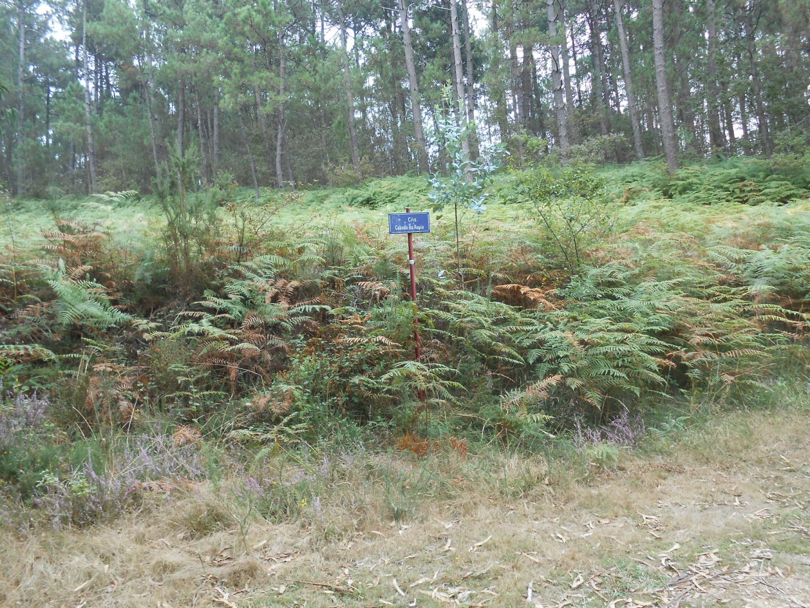
1:24 PM – After Parque O Loureiro: sign on path in middle of woods for “C[ami]ño Cabada do Rupia.”

1:24 PM – After Parque O Loureiro: sign on path in middle of woods for “C[ami]ño Cabada do Rupia, ” with coat of arms of Concello de Redondela; phone number for “Taxi” attached to post (telephoto 156 mm).
Cabada do Rupia is a calle (street) in the municipality of
Redondela.
1:25 PM – After Parque O Loureiro: MT on that
part of forest path.

1:28 PM – After Parque O Loureiro: Camino scallop shells, with names and dates, on display by path.

1:28 PM – After Parque O Loureiro: rocks stacked
to right of scallop shell display (mild telephoto 63 mm).

1:28 PM – After Parque O Loureiro: sign, across from scallop shell display, for As Chivas, pointing back uphill on paved road (telephoto 218 mm).
Tripadvisor.com lists Casa Rural As Chivas (rural bed and
breakfast) with address in Redondela, and Booking.com says it is 2.9 miles from
the center (of the town of Redondela) and shows it on a map northwest of the
town of Saramagoso (in the municipality of Redondela).
We had seen the same sign when some pilgrims went right at a fork (toward As Chivas). But we had followed fluorescent yellow-green arrows and a Camino shell direction marker to slight left/ahead and stayed on the lower, gravel path.

1:34 PM – After Parque O Loureiro: pilgrims on
gravel path with body of water (probably Ría de Vigo) ahead in distance (mild
telephoto 81 mm).

1:53 PM – Arcade: sign entering town.

1:54 PM – Arcade: MT with welcome sign (in 6 languages) entering town; behind it is a sign warning: Precaution – Concentrated Stretch of Accidents 0.5 km; MT pointing at picture on welcome sign of what our Spanish friend said were almejas (clams) (mild telephoto 63 mm).

1:54 PM – Arcade: picture on welcome sign of
what our Spanish friend (before he stopped to be picked up by his wife near Cesantes,
to go home to Pontevedra) had said were almejas
(clams), a specialty of the Arcade area; below the picture is the name and coat
of arms of the Concello de Soutomaior.
Santiago
de Arcade
is a parish (pop. 4,540) in the concello
(municipality) of Soutomaior in the province of Pontevedra, Galicia. The parish
has 5 population centers, one of which is Arcade de Arriba (Arcade from Above,
pop. 225).
Arcade is known for
its oysters (ostras), grown in the
waters of the Arcade Estuary. The “ostras de Arcade” (Arcade oysters) are a
delicious mollusk appreciated already in Roman times and currently the object
of active export.
Soutomaior is a concello (municipality) located in the
west of Galicia and the southwest of the province of Pontevedra. It is bordered
on the north by the municipalities of Pontevedra and Ponte Caldelas, on the
east by those of Ponte Caldelas and Fornelos de Montes, on the south by those
of Pazos de Borbén and Redondela, and on the west by the Vigo Estuary.

MT 1:57 PM – Arcade: Don with welcome sign.
After checking in at Hotel Duarte, we showered, washed clothes and hung them in the bathroom (there was no balcony).

Arcade: sello for “Hotel Duarte, Isaac Duarte Seoane, NIF. [Número de Identificación
Fiscal = tax identification number, for individuals]: 77.003.774-G, C/ [Calle = Street] Lameiriñas, 8,
36690 – Arcade, Telf.: 986 67 00 57.”

4:11 PM – Arcade: pastry we split at pastelería (pastry shop).

4:32 PM – Arcade: Stone hórreo with vertical and horizontal vents and pinnacle finial on
near end.

4:33 PM – Arcade: Same, long stone hórreo with vertical and horizontal vents and cross and pinnacle finials on roof.

4:33 PM – Arcade: cruceiro (side with Crucified Christ at top) and another stone hórreo with cross and pinnacle finials on roof, behind stone wall.

4:33 PM – Arcade: closer view of same cruceiro (side with Crucified Christ at top) and stone hórreo with cross and pinnacle finials on roof, behind stone wall; this view shows a rooster weather vane atop the pinnacle finial and vertical and horizontal vents in sides.

5:07 PM – Arcade: later view (on way back from
church) of same cruceiro (side with
Crucified Christ at top) and stone hórreo
with cross and pinnacle finials on roof, behind stone wall; this view shows a
rooster weather vane atop the pinnacle finial and vertical and horizontal vents
in sides (mild telephoto 72 mm).
4:34 PM – Arcade: another hórreo beyond a garden plot.

4:47 PM – Arcade: Igreja de Santiago – from street;
church on lower level.
The Iglesia de Santiago de Arcade (Church of Santiago of Arcade) was
built in the late 12th-early 13th centuries. However, a series of reforms have
ruined almost all of the original Romanesque elements. Of what remains, it is
possible to emphasize on the outside the western portal, flanked by four
columns (one of them with a shaft of helical form), and the rectangular apse. Inside,
the triumphal arch is supported by two sturdy columns with historiated capitals
that gives way to a rectangular apse covered with a stone barrel vault. New
elements have been added to the original structure, such as two insipid lateral
naves and a small baptismal chapel, decorated with mural painting with the
theme of the Baptism of Jesus, the work of a local artist. However, the most
negative element, from the aesthetic point of view, is the construction added
in the late 1960s: a cement and brick shed, conceived as a kind of “parish
hall,” that is located on the apse and completely hides it.

4:47 PM – Arcade: cruceiro (no sculpture on back side) and Igreja de Santiago (small
chapel; west façade with bell gable and main portal; and “church hall”) – from courtyard
below street level.

4:48 PM – Arcade: cruceiro in courtyard in front of Igreja de Santiago – side with Crucified Christ at top.
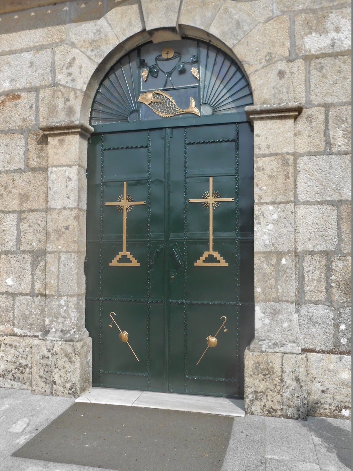
4:49 PM – Arcade: Igreja de Santiago – door of
“church hall.”

MT 4:53 PM – Arcade: Igreja de Santiago – scallop shell and pilgrim staff with gourd on door of “church hall.”

MT 4:55 PM – Arcade: Igreja de Santiago – small chapel and west façade with main portal and bell gable.

4:52 PM – Arcade: Igreja de Santiago – small chapel to left of main portal.

4:53 PM – Arcade: Igreja de Santiago – view through gate leading to lower courtyard with small chapel, west façade, and “church hall”; and view at left of town below.

MT 4:52 PM – Arcade: Igreja de Santiago – view from church courtyard of river valley.

4:50 PM – Arcade: Igreja de Santiago – wide-angle view from church courtyard of river valley (hórreo at right, far away).

4:50 PM – Arcade: Igreja de Santiago – view
from church courtyard of river valley; hórreo
at right, far away (see red circle).
Just to test the telephoto capability of his new camera, Don used it to get a close-up of that hórreo.

4:51 PM – Arcade: Igreja de Santiago – stone hórreo (with vertical vents and no
finals on roof) above river valley (telephoto 343 mm).

5:01 PM – Arcade: near Igreja de Santiago –
long stone hórreo (with vertical and
horizontal vents, cross finals on BOTH ends of roof, and door on side, but no
third gable above it) on way back from church to hotel (mild telephoto 81 mm).

5:10 PM – Arcade: near Igreja de Santiago – another long stone hórreo (with vertical and horizontal vents, cross final only on near end of roof, and door on side, but no third gable above it and no steps leading up to it).

5:12 PM – Arcade: near Igreja de Santiago – other side of that same long stone hórreo (with vertical and horizontal vents, cross final only on near end of roof, and no door on this side).

5:10 PM – Arcade: near Igreja de Santiago – yet another stone hórreo (with vertical and horizontal vents, pinnacle final only on near end of roof); in background at right is a longer stone hórreo (with no finial on its left end).

5:12 PM – Arcade: near Igreja de Santiago – that same stone hórreo (with vertical vents [and possibly horizontal vents under eaves], pinnacle final only on right end of roof, but stub of another finial on other end); in background at right is a longer stone hórreo (with no finial on its left end).

8:11 PM – Arcade: Hotel Duarte restaurant – tuna
empenadas.

8:30 PM – Arcade: Hotel Duarte restaurant – vegetable
paella.

9:15 PM – Arcade: Hotel Duarte restaurant – bacalao (cod) and potatoes with paprika
and garlic sauce.
No comments:
Post a Comment